Castlegar, BC, incorporated as a city in 1974, population 7816 (2011c), 7259 (2006c). The City of Castlegar is located on the west bank of the COLUMBIA RIVER at its junction with the Kootenay River, midway between Calgary and Vancouver, and about 35 km north of the US border. In 1974 the village of Kinnaird (incorporated in 1948) and the town of Castlegar (incorporated in 1966) merged to form the City of Castlegar.
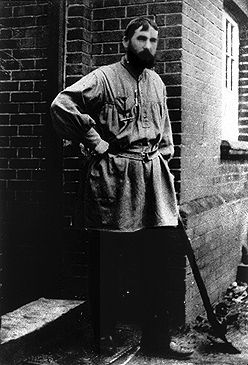
The Lakes Band of Interior SALISH dominated this vital transportation and fishing site at the confluence of the Columbia and Kootenay rivers until the mid-18th century. Edgar DEWDNEY pre-empted the site in 1865 while building the DEWDNEY TRAIL. A trail linked it with Nelson (43 km to the northeast) in 1889; the first railway followed in 1892. In 1908 DOUKHOBORS took up land in the area, and thrived until 1924 when their spiritual leader, Peter "The Lordly" VERIGIN, was assassinated.

Since the 1940s Castlegar has been a service town for Cominco (now Teck Coal Ltd) employees, a centre for dam construction workers on the Kootenay and Columbia projects and the Revelstoke Canyon Dam, and a home for mill employees. A pulp mill and Selkirk College, with a variety of university courses and technological training, are important employers. Having excellent transportation facilities, the city is a trade centre with a substantial service area.

 Share on Facebook
 Share on X
 Share by Email
 Share on Google Classroom
