Article
Golden Hinde
Golden Hinde, elevation 2200 m, is the highest mountain on Vancouver Island.
Signing up enhances your TCE experience with the ability to save items to your personal reading list, and access the interactive map.
Create Account"https://development.thecanadianencyclopedia.ca/images/tce_placeholder.jpg?v=e9dca980c9bdb3aa11e832e7ea94f5d9" // resources/views/front/categories/view.blade.phphttps://development.thecanadianencyclopedia.ca/images/tce_placeholder.jpg?v=e9dca980c9bdb3aa11e832e7ea94f5d9

Article
The water over the banks is mainly supplied by the southward-flowing cold LABRADOR CURRENT. This current splits as it approaches the Grand Banks, with one branch moving south along the coast of Newfoundland through Avalon Channel to St Pierre Bank.
"https://development.thecanadianencyclopedia.ca/images/tce_placeholder.jpg?v=e9dca980c9bdb3aa11e832e7ea94f5d9" // resources/views/front/categories/view.blade.phphttps://development.thecanadianencyclopedia.ca/images/tce_placeholder.jpg?v=e9dca980c9bdb3aa11e832e7ea94f5d9
Article
Grand Lake, 534 km2, elevation 85 m, max length 100 km, up to 300 m deep, largest lake on the Island of Newfoundland, is located on the west side of the Island, 24 km southeast of CORNER BROOK.
"https://development.thecanadianencyclopedia.ca/images/tce_placeholder.jpg?v=e9dca980c9bdb3aa11e832e7ea94f5d9" // resources/views/front/categories/view.blade.phphttps://development.thecanadianencyclopedia.ca/images/tce_placeholder.jpg?v=e9dca980c9bdb3aa11e832e7ea94f5d9
Article
With a population of about 2500 - chiefly in the villages of North Head, Grand Harbour and Seal Cove - its chief industries are scallops, herring, lobster and salmon aquaculture, dulse (seaweed) gathering and tourism.
"https://d2ttikhf7xbzbs.cloudfront.net/media/media/03d8b7c6-bc2b-4575-97ec-f3d453f5bf34.jpg" // resources/views/front/categories/view.blade.phphttps://d2ttikhf7xbzbs.cloudfront.net/media/media/03d8b7c6-bc2b-4575-97ec-f3d453f5bf34.jpg

Article
From its source just south of Georgian Bay, the Grand River winds 266 km to Lake Erie, dropping 352 m along the way. Together with its major tributaries, the Speed, Nith, Conestogo and Eramosa rivers, it drains 6200 km2, the largest watershed in southern Ontario.
"https://development.thecanadianencyclopedia.ca/images/tce_placeholder.jpg?v=e9dca980c9bdb3aa11e832e7ea94f5d9" // resources/views/front/categories/view.blade.phphttps://development.thecanadianencyclopedia.ca/images/tce_placeholder.jpg?v=e9dca980c9bdb3aa11e832e7ea94f5d9
Article
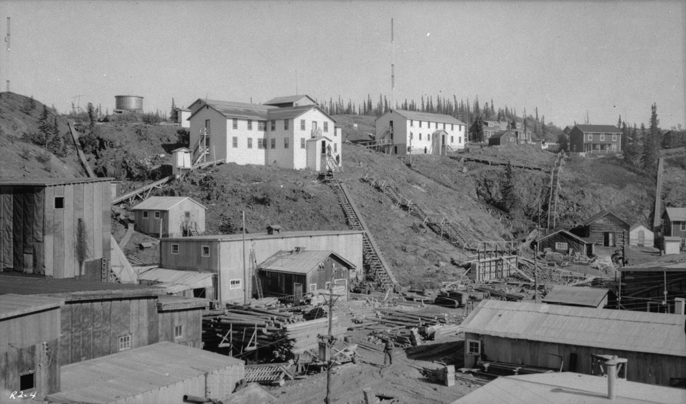
Great Bear Lake is located in the Northwest Territories. With a surface area of 31,328 km2, Great Bear Lake is the largest lake located entirely inside Canadian borders. It is also the fourth largest in North America and the eighth largest in the world. Water flows out of the lake into the Great Bear River, then into the Mackenzie River. Other rivers connected to the lake include the Dease, Camsell and Johnny Hoe. Great Bear Lake is made up of five separate arms, each with their own names: Dease, McTavish, McVicar, Keith and Smith. (See also Largest Lakes in Canada.)
"https://d2ttikhf7xbzbs.cloudfront.net/media/media/b3f3c222-8825-473d-834b-5d76b45c35df.jpg" // resources/views/front/categories/view.blade.phphttps://d2ttikhf7xbzbs.cloudfront.net/media/media/b3f3c222-8825-473d-834b-5d76b45c35df.jpg
Article
The Great Lakes are the largest group in a chain of large lakes (including Winnipeg, Athabasca, Great Slave and Great Bear) that lies along the southern boundary of the Canadian Shield. From west to east the Great Lakes comprise lakes Superior, Michigan (entirely in the US), Huron, St. Clair, Erie and Ontario. They have a total area of approximately 244,100 km 2 and drop from 183 m above sea level at Lake Superior to 74 m at Lake Ontario — the most dramatic drop occurring at Niagara Falls. Lake St Clair, while not properly a “great lake,” is considered part of this Laurentian chain.
"https://d2ttikhf7xbzbs.cloudfront.net/media/media/894ac3cf-cd0e-491f-a04f-53e7c18a4b00.jpg" // resources/views/front/categories/view.blade.phphttps://d2ttikhf7xbzbs.cloudfront.net/media/media/894ac3cf-cd0e-491f-a04f-53e7c18a4b00.jpg

Article
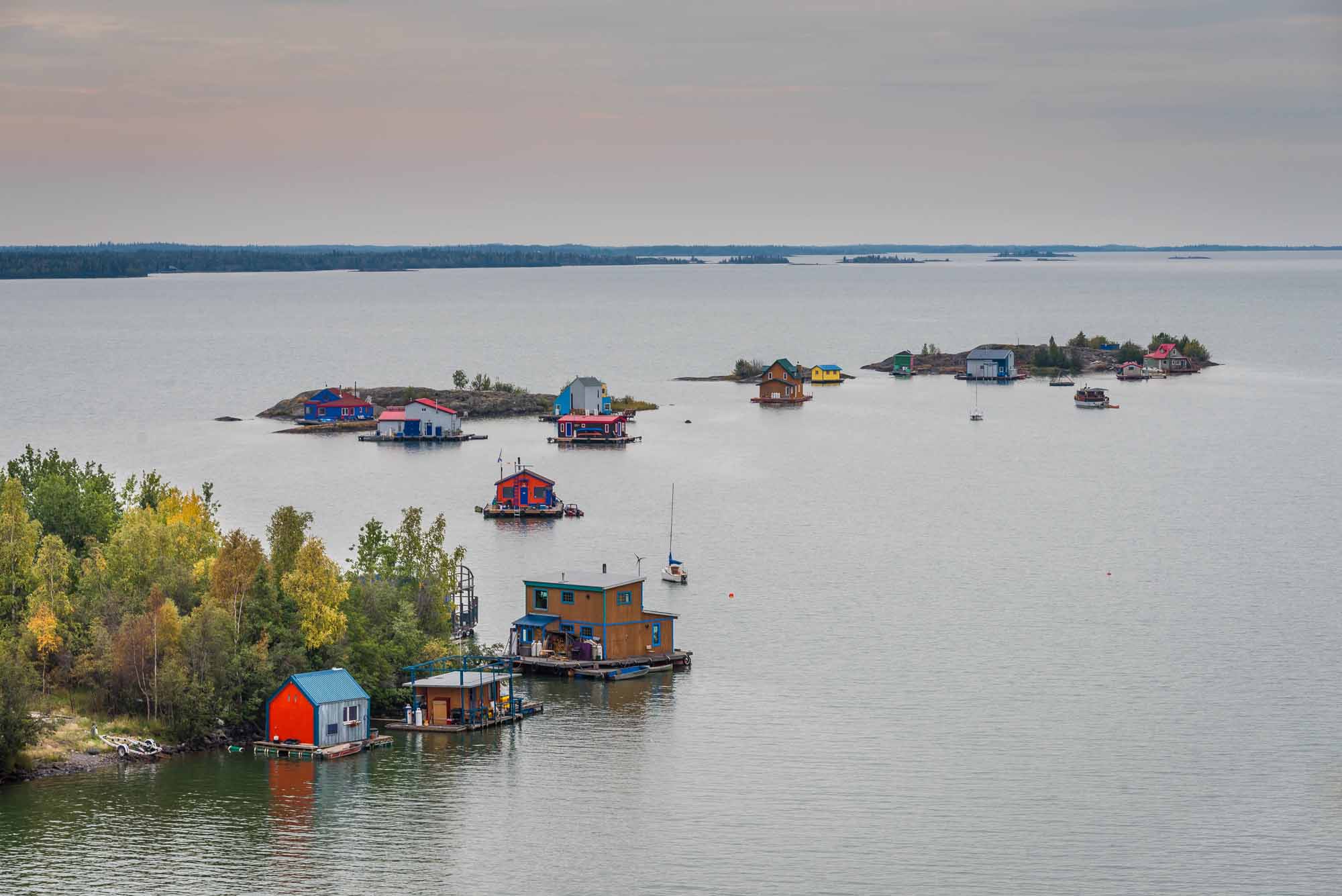
Great Slave Lake is located in the Northwest Territories. It is the second largest lake entirely within Canadian borders, the fifth largest in North America, and the tenth largest in the world.
"https://d2ttikhf7xbzbs.cloudfront.net/media/media/13ae1e1d-36ba-43cf-8b14-a08a9d6d7cfa.jpg" // resources/views/front/categories/view.blade.phphttps://d2ttikhf7xbzbs.cloudfront.net/media/media/13ae1e1d-36ba-43cf-8b14-a08a9d6d7cfa.jpg
Article
Their bucolic charm, calm waters, rich bird and marine life and mild climate, in the driest zone on Canada's Pacific coast, have attracted homesteaders and cottagers since about 1859. Stands of tall timber growing in deep soil were logged early in this century.
"https://d2ttikhf7xbzbs.cloudfront.net/media/media/2eb4a133-4037-49ab-af23-cc43cde9708f.jpg" // resources/views/front/categories/view.blade.phphttps://d2ttikhf7xbzbs.cloudfront.net/media/media/2eb4a133-4037-49ab-af23-cc43cde9708f.jpg

Article
The Gulf of Boothia is entered through Prince Regent Inlet. To the east it is bounded by the northwest coast of BAFFIN ISLAND, and to the west by the BOOTHIA PENINSULA. Depths are generally about 275 m, decreasing southward.
"https://development.thecanadianencyclopedia.ca/images/tce_placeholder.jpg?v=e9dca980c9bdb3aa11e832e7ea94f5d9" // resources/views/front/categories/view.blade.phphttps://development.thecanadianencyclopedia.ca/images/tce_placeholder.jpg?v=e9dca980c9bdb3aa11e832e7ea94f5d9
Article
Gulf of St Lawrence, a large (250 000 km2), roughly triangular inland sea receiving on average 10 100 m3/s of fresh water from the St Lawrence River at its northwest apex, is connected to the Atlantic by the Strait of Belle Isle at the northeast and Cabot Strait at the southeast corners.
"https://development.thecanadianencyclopedia.ca/images/tce_placeholder.jpg?v=e9dca980c9bdb3aa11e832e7ea94f5d9" // resources/views/front/categories/view.blade.phphttps://development.thecanadianencyclopedia.ca/images/tce_placeholder.jpg?v=e9dca980c9bdb3aa11e832e7ea94f5d9
Article
The Haida Gwaii is a group of islands off the north coast of British Columbia. The name means "Islands of the People" in the language of the Haida, who claim the archipelago as their ancestral lands. Captain George Dixon named this group of islands the Queen Charlotte Islands in 1787 after one of his ships, which in turn was named for the wife of King George III. This was its official name until 2010, when Haida Gwaii was accepted.
"https://d2ttikhf7xbzbs.cloudfront.net/media/media/440414f5-caff-4536-9eac-90dceba5603d.jpg" // resources/views/front/categories/view.blade.phphttps://d2ttikhf7xbzbs.cloudfront.net/media/media/440414f5-caff-4536-9eac-90dceba5603d.jpg

Article
Hamilton Inlet, together with Lk Melville, forms the largest estuary, over 250 km long, 40 km wide (at the western end) and 150 m deep, on the Labrador coast.
"https://development.thecanadianencyclopedia.ca/images/tce_placeholder.jpg?v=e9dca980c9bdb3aa11e832e7ea94f5d9" // resources/views/front/categories/view.blade.phphttps://development.thecanadianencyclopedia.ca/images/tce_placeholder.jpg?v=e9dca980c9bdb3aa11e832e7ea94f5d9
Article
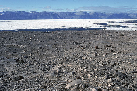
Hans Island, Nunavut, is a tiny (1.2 km2), unpopulated island south of the 81st parallel in the Kennedy Channel (the northern part of Nares Strait), almost equidistant between Ellesmere Island and Greenland. The Greenlandic word for the island is Tartupaluk. (Greenlandic is a language spoken by Greenland Inuit.) For decades, both Canada and Denmark claimed ownership of the island. On 14 June 2022, however, the two countries settled the dispute, dividing the island roughly equally between them. (See also Canadian Arctic Sovereignty.)
"https://d2ttikhf7xbzbs.cloudfront.net/media/media/951d0121-b454-4f9e-ac31-2c7aec13a96d.jpg" // resources/views/front/categories/view.blade.phphttps://d2ttikhf7xbzbs.cloudfront.net/media/media/951d0121-b454-4f9e-ac31-2c7aec13a96d.jpg
Article
Harrison River, 15 km long, flows SW from Harrison Lk to join the Fraser River about 100 km upriver from Vancouver in southern BC.
"https://development.thecanadianencyclopedia.ca/images/tce_placeholder.jpg?v=e9dca980c9bdb3aa11e832e7ea94f5d9" // resources/views/front/categories/view.blade.phphttps://development.thecanadianencyclopedia.ca/images/tce_placeholder.jpg?v=e9dca980c9bdb3aa11e832e7ea94f5d9