Browse "Parks & Nature Reserves"
-
Article
Qausuittuq National Park
Qausuittuq National Park encompasses 11,000 km2 on northern Bathurst Island and smaller surrounding islands in Nunavut. It also includes the waters of May Inlet and Young Inlet. Pronounced Kow-soo-ee-took, the name of this park translates to “the place where the sun doesn’t rise” in Inuktitut. It is bordered to the south by Polar Bear Pass National Wildlife Area, and together these two zones protect a large, ecologically intact area in the Canadian Arctic Archipelago. Qausuittuq was established on 1 September 2015 as Canada’s 45th national park. It represents the Western High Arctic Natural Region, the 38th natural region of the 39 that constitute Canada’s national parks system.
"https://d2ttikhf7xbzbs.cloudfront.net/media/media/b24f1a0a-425c-40af-87b6-16d3164c5e60.jpg" // resources/views/front/categories/view.blade.php
https://d2ttikhf7xbzbs.cloudfront.net/media/media/b24f1a0a-425c-40af-87b6-16d3164c5e60.jpg
-
Article
Quttinirpaaq National Park
Quttinirpaaq National Park (established 1988, 37 775 km2) is Canada's second-largest national park (after Wood Buffalo National Park).
"https://d2ttikhf7xbzbs.cloudfront.net/media/media/5176d9ce-bf5f-4fdf-9453-c0f71b3128e6.jpg" // resources/views/front/categories/view.blade.php
https://d2ttikhf7xbzbs.cloudfront.net/media/media/5176d9ce-bf5f-4fdf-9453-c0f71b3128e6.jpg
-
Article
Riding Mountain National Park
Natural History The park is a rolling landscape of mixed forests and grasslands dotted with lakes, streams and bogs, an "island" of green rising out of a sea of farmland.
"https://d2ttikhf7xbzbs.cloudfront.net/media/media/c9679ffa-5ed0-4a59-995b-e07de3516e05.jpg" // resources/views/front/categories/view.blade.php
https://d2ttikhf7xbzbs.cloudfront.net/media/media/c9679ffa-5ed0-4a59-995b-e07de3516e05.jpg
-
Article
Rondeau Provincial Park
Rondeau Provincial Park (established 1894, 33 km2) provides environmental protection and recreation on one of 3 peninsulas jutting south into Lake ERIE. It lies 120 km east of Windsor and 115 km southwest of London.
"https://development.thecanadianencyclopedia.ca/images/tce_placeholder.jpg?v=e9dca980c9bdb3aa11e832e7ea94f5d9" // resources/views/front/categories/view.blade.php
https://development.thecanadianencyclopedia.ca/images/tce_placeholder.jpg?v=e9dca980c9bdb3aa11e832e7ea94f5d9
-
Article
Rouge National Urban Park
Rouge National Urban Park is an ecologically protected zone in the Greater Toronto Area that encompasses much of the valleys of the Rouge River and Little Rouge Creek. A total of 79.1 km2 of land has been committed to the park, which straddles parts of the Ontario cities of Toronto, Markham, Pickering and the Township of Uxbridge. The historic area includes farmland, green space, wetlands and rivers alongside urban development, roads and highways. Established 15 May 2015 and managed by Parks Canada, Rouge is Canada’s first National Urban Park and the largest urban park in North America.
"https://d2ttikhf7xbzbs.cloudfront.net/media/media/89696c73-3105-407f-b3ce-ae56d9472b7d.jpg" // resources/views/front/categories/view.blade.php
https://d2ttikhf7xbzbs.cloudfront.net/media/media/89696c73-3105-407f-b3ce-ae56d9472b7d.jpg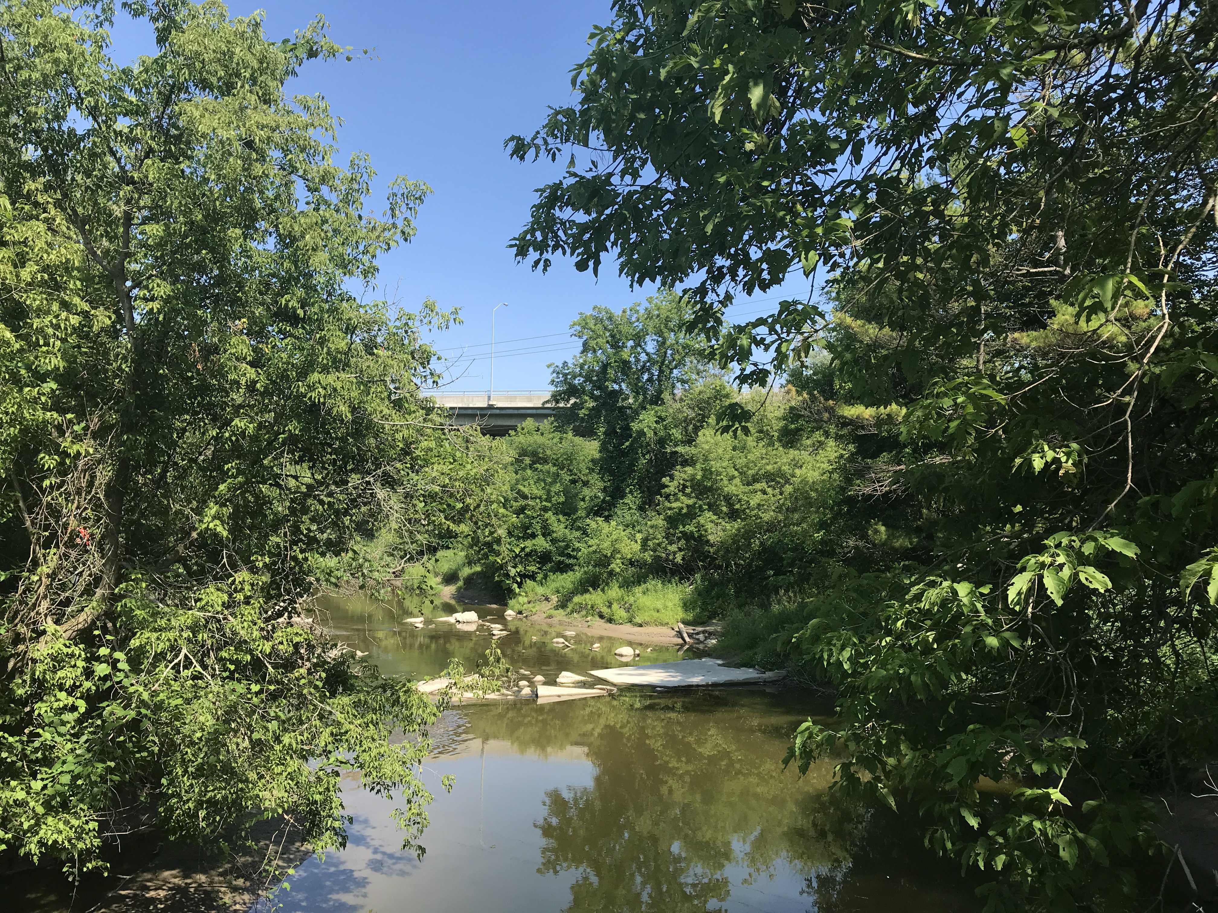
-
Article
Sirmilik National Park
Located on northern Baffin Island in Canada's High Arctic, Sirmilik National Park (agreement signed 1999; 22 250 km2) is one of Canada's isolated and most spectacular national parks. Sirmilik is an Inuktitut word that means "place of glaciers."
"https://d2ttikhf7xbzbs.cloudfront.net/media/media/99e23c81-75f9-472e-8482-f10ddb1bb260.jpg" // resources/views/front/categories/view.blade.php
https://d2ttikhf7xbzbs.cloudfront.net/media/media/99e23c81-75f9-472e-8482-f10ddb1bb260.jpg
-
Article
Thousand Islands National Park (formerly St Lawrence Islands National Park)
Most of the park islands are the summits of ancient hills of the Frontenac Axis, a strip of Precambrian granite connecting the Canadian Shield with the Adirondack Mountains in New York State.
"https://d2ttikhf7xbzbs.cloudfront.net/media/media/fad571a1-9624-4927-9403-e3b2560a4951.jpg" // resources/views/front/categories/view.blade.php
https://d2ttikhf7xbzbs.cloudfront.net/media/media/fad571a1-9624-4927-9403-e3b2560a4951.jpg
-
Article
St. Norbert Provincial Heritage Park
St. Norbert Provincial Heritage Park is located in St. Norbert, which is now a ward of Winnipeg. Designated as a park in 1985, St. Norbert Provincial Heritage Park traces the development of the area from Indigenous use to first a French-speaking Métis settlement and then a French-Canadian agricultural community of the pre-World War I period.
"https://d2ttikhf7xbzbs.cloudfront.net/media/media/e531362e-bb24-4c7f-a530-c90c224bb637.jpg" // resources/views/front/categories/view.blade.php
https://d2ttikhf7xbzbs.cloudfront.net/media/media/e531362e-bb24-4c7f-a530-c90c224bb637.jpg
-
Article
Stanley Park
Stanley Park (established 1887, 4 km2) is Vancouver’s first city park and one of the largest urban parks in Canada. It encompasses the peninsula west of downtown Vancouver and is surrounded by the waters of Burrard Inlet, Coal Harbour and English Bay. Stanley Park is located on the traditional territory of Coast Salish First Nations, including the Musqueam, Squamish and Tsleil Waututh. In 1886, the council for the City of Vancouver sent a request to the Canadian government for permission to use the military reserve to the west of the city as a public park. The Canadian government granted the city permission to create such a park in 1887. Stanley Park later opened to the public on 27 September 1888. The park is named for Governor General Frederick Arthur Stanley.
"https://d2ttikhf7xbzbs.cloudfront.net/media/media/a9ddf5c7-660a-4dd5-9d9c-6387da6a5b36.jpg" // resources/views/front/categories/view.blade.php
https://d2ttikhf7xbzbs.cloudfront.net/media/media/a9ddf5c7-660a-4dd5-9d9c-6387da6a5b36.jpg
-
Article
Strathcona Provincial Park
Strathcona Provincial Park (established 1911, 2504 km2) is a mountain wilderness in central Vancouver Island, 9 km east of Gold River and 26 km west of Campbell River.
"https://development.thecanadianencyclopedia.ca/images/tce_placeholder.jpg?v=e9dca980c9bdb3aa11e832e7ea94f5d9" // resources/views/front/categories/view.blade.php
https://development.thecanadianencyclopedia.ca/images/tce_placeholder.jpg?v=e9dca980c9bdb3aa11e832e7ea94f5d9
-
Article
Strathgartney Provincial Park
In Scots Gaelic Strath Gartney means "a valley in the hills." This description aptly fits Strathgartney Provincial Park (established 1959, 53 ha) located in the central hills of Prince Edward Island, 25 km west of CHARLOTTETOWN.
"https://development.thecanadianencyclopedia.ca/images/tce_placeholder.jpg?v=e9dca980c9bdb3aa11e832e7ea94f5d9" // resources/views/front/categories/view.blade.php
https://development.thecanadianencyclopedia.ca/images/tce_placeholder.jpg?v=e9dca980c9bdb3aa11e832e7ea94f5d9
-
Article
Terra Nova National Park
Terra Nova National Park (est 1957, 399.9 km2), Canada's most easterly national park, is located on Bonavista Bay, Nfld. Terra Nova is the Latin form of the name of the island, Newfoundland.
"https://d2ttikhf7xbzbs.cloudfront.net/media/media/47baa2cc-e48f-4b39-bfd5-4383b6cdfaa9.jpg" // resources/views/front/categories/view.blade.php
https://d2ttikhf7xbzbs.cloudfront.net/media/media/47baa2cc-e48f-4b39-bfd5-4383b6cdfaa9.jpg
-
Article
The Rocks Provincial Park
Mammoth pillars, the Rocks, rise out of the sea at Hopewell Cape on New Brunswick's southern coast. The Rocks Provincial Park (established 1958, 120 ha) is located halfway between Moncton and Fundy National Park.
"https://development.thecanadianencyclopedia.ca/images/tce_placeholder.jpg?v=e9dca980c9bdb3aa11e832e7ea94f5d9" // resources/views/front/categories/view.blade.php
https://development.thecanadianencyclopedia.ca/images/tce_placeholder.jpg?v=e9dca980c9bdb3aa11e832e7ea94f5d9
-
Article
Torngat Mountains National Park of Canada
Torngat Mountains National Park (established in 2008) encompasses 9700 km2 of Labrador north of Saglek Fiord. Torngat - in Inuktitut, Torngait - refers to one of the most powerful of Inuit spirits believed to dwell in these mountains.
"https://development.thecanadianencyclopedia.ca/images/tce_placeholder.jpg?v=e9dca980c9bdb3aa11e832e7ea94f5d9" // resources/views/front/categories/view.blade.php
https://development.thecanadianencyclopedia.ca/images/tce_placeholder.jpg?v=e9dca980c9bdb3aa11e832e7ea94f5d9
-
Article
Toronto Feature: Budapest Park
This article is from our Toronto Feature series. Features from past programs are not updated.
"https://d2ttikhf7xbzbs.cloudfront.net/media/media/63938d58-cfa6-4c57-96d9-40ba13d45fdb.jpg" // resources/views/front/categories/view.blade.php
https://d2ttikhf7xbzbs.cloudfront.net/media/media/63938d58-cfa6-4c57-96d9-40ba13d45fdb.jpg