Browse "Provinces & Territories"
-
Article
Newfoundland and Labrador and Confederation
Attempts to bring Newfoundland into Confederation in the 1860s and 1890s were met with lukewarm interest in the colony. In 1934, Newfoundland was in bankruptcy during the Great Depression. It suspended responsible government and accepted an unelected Commission Government directed by Britain. In a 1948 referendum, Newfoundlanders were given the choice to either continue with the Commission Government, join Canada, or seek a return to responsible government as an independent dominion. The independence option won the first vote. But the Confederation option won a run-off vote with 52.3 percent support. The British and Canadian parliaments approved of the union. Newfoundland became Canada’s 10th province on 31 March 1949. In 2001, the province’s name was officially changed to Newfoundland and Labrador.
"https://d2ttikhf7xbzbs.cloudfront.net/TCEImages/f6d1eaf9-8a3d-4e63-b541-3f932d9b4746.jpg" // resources/views/front/categories/view.blade.php
https://d2ttikhf7xbzbs.cloudfront.net/TCEImages/f6d1eaf9-8a3d-4e63-b541-3f932d9b4746.jpg
-
Editorial
Editorial: How the “Canadianized” Community of Newfoundland Joined Canada
The following article is an editorial written by The Canadian Encyclopedia staff. Editorials are not usually updated. When the Parliament Buildings in Ottawa were repaired after a fire during the First World War, stone plaques were erected over the entrance to the Peace Tower. There were ten of them — nine bearing the coats of arms of the provinces and one left bare, to await the day when Newfoundlandjoined Canada.
"https://development.thecanadianencyclopedia.ca/images/tce_placeholder.jpg?v=e9dca980c9bdb3aa11e832e7ea94f5d9" // resources/views/front/categories/view.blade.php
https://development.thecanadianencyclopedia.ca/images/tce_placeholder.jpg?v=e9dca980c9bdb3aa11e832e7ea94f5d9
-
Article
North-West Territories (1870–1905)
The North-West Territories was the first Canadian territory. It was Established on 15 July 1870. As a territory, the region became part of Canada. But it lacked the population, economic and infrastructure resources to attain provincial status. It thus fell under the jurisdiction of the federal government. It covered a vast area, stretching west from a disputed boundary with Labrador, across the northern portions of present-day Quebec and Ontario, through the Prairies to British Columbia, and north from the 49th parallel to the Arctic Ocean. The territory was subject to numerous boundary changes before 1905. At that time, the provinces of Saskatchewan and Alberta were carved out of the southwest portion of the region. In 1906, the remaining territory was renamed the Northwest Territories.
"https://d2ttikhf7xbzbs.cloudfront.net/media/media/1ca2e02a-e2e8-4709-acee-5581d6051d5c.jpg" // resources/views/front/categories/view.blade.php
https://d2ttikhf7xbzbs.cloudfront.net/media/media/1ca2e02a-e2e8-4709-acee-5581d6051d5c.jpg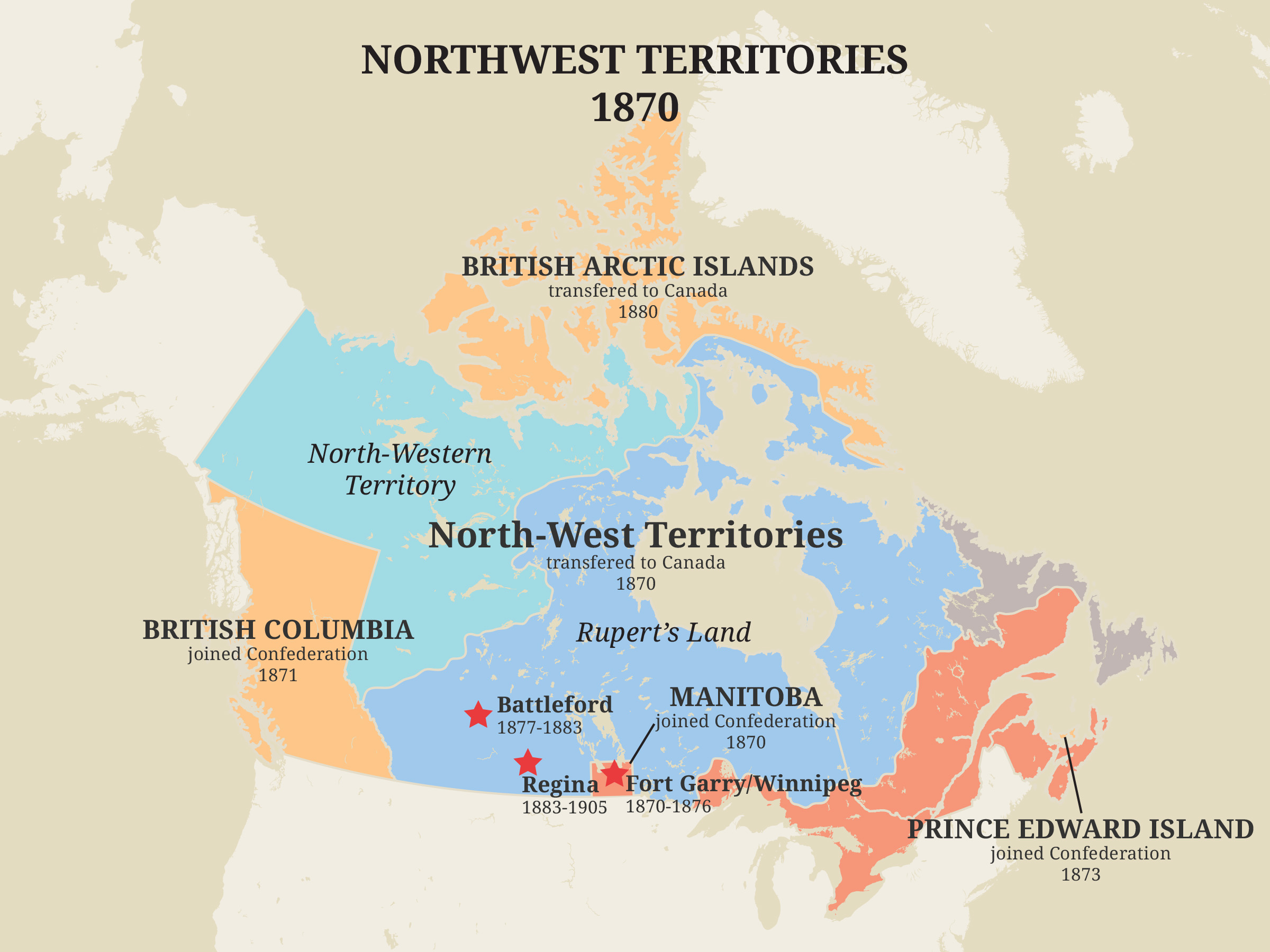
-
Article
Northwest Territories
The Northwest Territories lie northwest of central Canada, bordered to the east by Nunavut, to the west by the Yukon and to the south by the northeastern corner of British Columbia, as well as the entire northern borders of Alberta and Saskatchewan. The name was originally applied to the territory acquired in 1870 from the Hudson's Bay Company and Great Britain: Rupert’s Land and the North-Western Territory. In 1880 Great Britain also transferred to Canada the arctic islands, north of the mainland, thereby adding to the territories. The acquisition of the NWT was a major component of the Canadian government’s desire, led by Sir John A. MacDonald, to construct a British nation in North America and to guard against the potential incursion of American settlers.
"https://d2ttikhf7xbzbs.cloudfront.net/media/media/990fab4d-1900-4928-acde-c8b11f9c52dd.jpg" // resources/views/front/categories/view.blade.php
https://d2ttikhf7xbzbs.cloudfront.net/media/media/990fab4d-1900-4928-acde-c8b11f9c52dd.jpg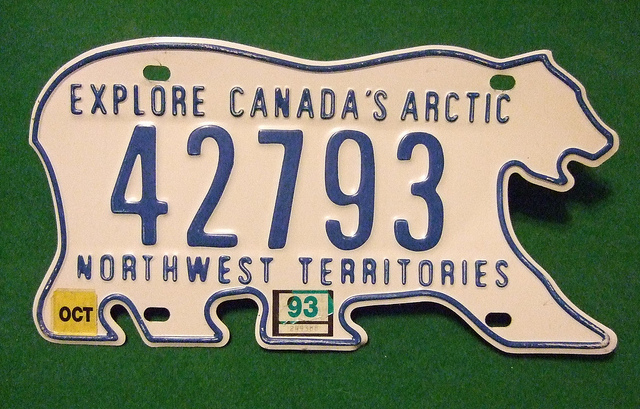
-
Timelines
Northwest Territories
The Northwest Territories lie northwest of central Canada, bordered to the east by Nunavut, to the west by the Yukon and to the south by the northeastern corner of British Columbia, as well as the entire northern borders of Alberta and Saskatchewan.
"https://d2ttikhf7xbzbs.cloudfront.net/media/media/a97bb3a4-ac75-4b97-94e5-5fcb9fe2b922.jpg" // resources/views/front/categories/view.blade.php
https://d2ttikhf7xbzbs.cloudfront.net/media/media/a97bb3a4-ac75-4b97-94e5-5fcb9fe2b922.jpg
-
Article
Northwest Territories and Confederation
The Northwest Territories (NWT) entered Confederation in 1870 after Canada acquired Rupert’s Land and the North-Western Territory from the Hudson’s Bay Company. The smaller territory now known as the NWT is what remains after the creation of several other provinces and territories out of the original 1870 lands.
"https://d2ttikhf7xbzbs.cloudfront.net/media/media/a08da9c3-b38b-4f80-a425-a29b706528af.jpg" // resources/views/front/categories/view.blade.php
https://d2ttikhf7xbzbs.cloudfront.net/media/media/a08da9c3-b38b-4f80-a425-a29b706528af.jpg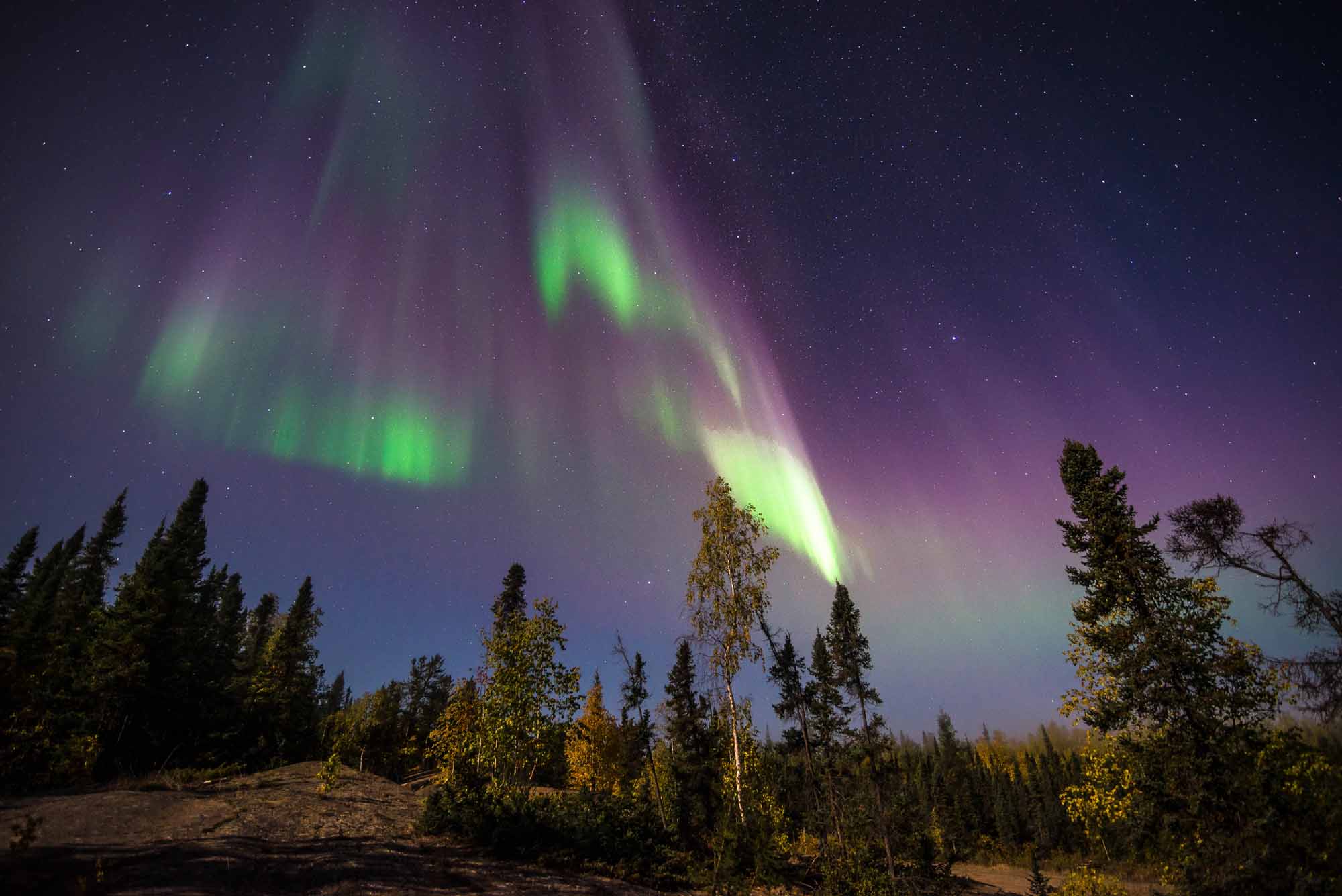
-
Article
Nova Scotia
Nova Scotia is Canada’s second-smallest province (following Prince Edward Island) and is located on the southeastern coast of the country. The province includes Cape Breton, a large island northeast of the mainland. The name Nova Scotia is Latin for “New Scotland,” reflecting the origins of some of the early settlers. Given its proximity to the Atlantic Ocean, Nova Scotia’s economy is largely influenced by the sea, and its harbours have served as military bases during many wars.
"https://d2ttikhf7xbzbs.cloudfront.net/media/media/4b77ac3b-257b-4395-b19a-b5d9fa7d020c.jpg" // resources/views/front/categories/view.blade.php
https://d2ttikhf7xbzbs.cloudfront.net/media/media/4b77ac3b-257b-4395-b19a-b5d9fa7d020c.jpg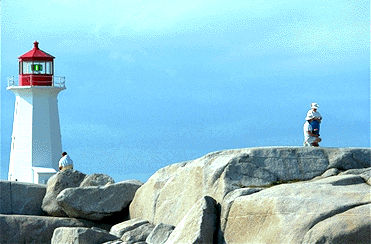
-
Timelines
Nova Scotia
Nova Scotia is Canada’s second-smallest province (following Prince Edward Island) and is located on the southeastern coast of the country. The province includes Cape Breton, a large island northeast of the mainland.
"https://d2ttikhf7xbzbs.cloudfront.net/media/media/251d5ad1-fbf2-4c53-a29e-57df6917949f.jpg" // resources/views/front/categories/view.blade.php
https://d2ttikhf7xbzbs.cloudfront.net/media/media/251d5ad1-fbf2-4c53-a29e-57df6917949f.jpg
-
Article
Nova Scotia and Confederation
Nova Scotia was one of the four founding provinces of Canada. It joined New Brunswick, Ontario and Quebec in Confederation on 1 July 1867. However, this was mainly because Confederation delivered the Intercolonial Railway to the Maritimes, and because of the efforts of Sir Charles Tupper. His government passed approval for Confederation in the colonial legislature despite popular opposition. (See Confederation’s Opponents.) Confederation was met with mass protests in the colony. Joseph Howe led a two-year effort to repeal the union. (See Repeal Movement.) But Howe finally decided he could do more to help his province by working inside the federal government. He joined the federal Cabinet in 1869.
"https://d2ttikhf7xbzbs.cloudfront.net/media/media/7b457631-bb6e-40ee-bf61-fab12a06fb6d.jpg" // resources/views/front/categories/view.blade.php
https://d2ttikhf7xbzbs.cloudfront.net/media/media/7b457631-bb6e-40ee-bf61-fab12a06fb6d.jpg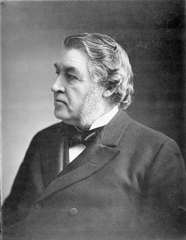
-
Article
Nunatsiavut
Nunatsiavut (meaning “our beautiful land” in Inuktitut) is the homeland of the Labrador Inuit (Labradormiut). The territory covers 72,520km2 of land and 44,030km2 of sea in the northern part of the Labrador Peninsula. On 1 December 2005, the Labrador Inuit celebrated the creation of the Nunatsiavut Government, their own regional government within the province of Newfoundland and Labrador. The Labradormiut became the first Inuit in Canada to achieve self-government. Of the approximately 6,500 beneficiaries, about 2,500 live within the settlement area in five communities: Rigolet, Postville, Makkovik, Hopedale (the legislative capital) and Nain (the administrative capital).
"https://d2ttikhf7xbzbs.cloudfront.net/media/new_article_images/Nunatsiavut/Nunatsiavut_flag.png" // resources/views/front/categories/view.blade.php
https://d2ttikhf7xbzbs.cloudfront.net/media/new_article_images/Nunatsiavut/Nunatsiavut_flag.png
-
Article
Nunavik
Nunavik, the portion of land within the province of Quebec located north of the 55th parallel, covers approximately 500,000 km2 (representing more than one-third of Quebec’s territory). For approximately 4,000 years, Indigenous people have inhabited Nunavik, including Inuit who have made the region their homeland. Today, over 13,000 people live in Nunavik’s 14 villages spread along the Ungava Bay, Hudson Strait and Eastern Hudson Bay coasts.
"https://development.thecanadianencyclopedia.ca/images/tce_placeholder.jpg?v=e9dca980c9bdb3aa11e832e7ea94f5d9" // resources/views/front/categories/view.blade.php
https://development.thecanadianencyclopedia.ca/images/tce_placeholder.jpg?v=e9dca980c9bdb3aa11e832e7ea94f5d9
-
Article
Nunavut
Nunavut, or “Our Land” in Inuktitut, encompasses over 2 million km2 and has a population of 36,858 residents (2021 census), 30,865 of whom are Inuit. Covering roughly the part of the Canadian mainland and Arctic Archipelago that lies to the north and northeast of the treeline, Nunavut is the largest and northernmost territory of Canada and the fifth largest administrative division in the world. Nunavummiut live in 25 communities spread across this vast territory, with the largest number, 7,429 (2021 census), in the capital, Iqaluit. The creation of Nunavut in 1999 (the region was previously part of the Northwest Territories) represented the first major change to the political map of Canada since the incorporation of Newfoundland into Confederation in 1949. Beyond changing the internal political boundaries of Canada, Nunavut’s formation represented a moment of great political significance; through political activism and long-term negotiations, a small, marginalized Indigenous group overcame many obstacles to peacefully establish a government that they controlled within the Canadian state, thereby gaining control of their land, their resources and their future. As such, the creation of Nunavut represents a landmark moment in the evolution of Canada and a significant development in the history of the world’s Indigenous peoples.
"https://d2ttikhf7xbzbs.cloudfront.net/media/media/b9f1e62c-f97e-49dc-ad8f-ef525846081d.jpg" // resources/views/front/categories/view.blade.php
https://d2ttikhf7xbzbs.cloudfront.net/media/media/b9f1e62c-f97e-49dc-ad8f-ef525846081d.jpg
-
Timelines
Nunavut
Nunavut, which translates from the Inuktitut dialect of the Eastern Arctic Inuit as "Our Land," is a Canadian territory.
"https://d2ttikhf7xbzbs.cloudfront.net/media/media/a4b74f70-c61f-4cfe-a857-0848e3cb40bd.jpg" // resources/views/front/categories/view.blade.php
https://d2ttikhf7xbzbs.cloudfront.net/media/media/a4b74f70-c61f-4cfe-a857-0848e3cb40bd.jpg
-
Article
Ontario
Ontario is a Canadian province bounded by Manitoba to the west, Hudson Bay to the north, Québec to the east, and New York, the Great Lakes, Michigan and Minnesota to the south. The province was founded on parts of the traditional territories of the Ojibwa, Odawa, Potawatomi, Algonquin, Mississauga, Haudenosaunee, Neutral, Wendat, Cree, Oji-Cree and Métis. The land is now governed by 46 treaties, including the Upper Canada, Williams and Robinson treaties, as well as Treaties 3, 5 and 9.. As of the 2021 census, Ontario had 14,223,942 residents, making it the most populous province or territory in Canada. Ontario was one of the founding members of Confederation, along with New Brunswick, Nova Scotia and Québec, in 1867. The capital city of Ontario is Toronto. Doug Ford is the province’s current premier, leading a majority Progressive Conservative government.
"https://d2ttikhf7xbzbs.cloudfront.net/media/media/dea1b6f4-4cd1-448c-b08b-41dd597ec05e.jpg" // resources/views/front/categories/view.blade.php
https://d2ttikhf7xbzbs.cloudfront.net/media/media/dea1b6f4-4cd1-448c-b08b-41dd597ec05e.jpg
-
Timelines
Ontario
Ontario is Canada's most populous and second-largest province. It stretches from Canada's southernmost point at Middle Island in Lake Erie in the south, to the Manitoba-Ontario border on Hudson Bay in the north, and from the banks of the St. Lawrence River in the east, to the Manitoba border in the west.
"https://d2ttikhf7xbzbs.cloudfront.net/media/media/08da0fa3-1249-445f-9b67-c59bc9256242.JPG" // resources/views/front/categories/view.blade.php
https://d2ttikhf7xbzbs.cloudfront.net/media/media/08da0fa3-1249-445f-9b67-c59bc9256242.JPG