Browse "Transportation"
-
Article
Coquihalla Highway
The Coquihalla follows the old cattle trails in BC (Corel Professional Photos). Coquihalla Highway is the largest of 4 routes connecting the Vancouver area with interior centres. Built to enhance regional tourism and to lighten traffic on the busy trucking routes, the 303 km, 4-lane highway has 3 segments. The 115 km section between Hope and Merritt follows earlier cattle trails (1876), the Kettle Valley Railway (1913-59) and oil and gas industry pipelines (begun 1958)...
"https://development.thecanadianencyclopedia.ca/images/tce_placeholder.jpg?v=e9dca980c9bdb3aa11e832e7ea94f5d9" // resources/views/front/categories/view.blade.php
https://development.thecanadianencyclopedia.ca/images/tce_placeholder.jpg?v=e9dca980c9bdb3aa11e832e7ea94f5d9
-
Article
CTrain
CTrain is a light rail transit system in Calgary, Alberta. It is operated by Calgary Transit, a public transit service owned by the City of Calgary and operated through its Transportation Department. Service began on the initial downtown transit corridor and south line in 1981. It expanded to northeast Calgary in 1985, to the University of Calgary in the city’s northwest in 1987 and to the city’s west side in 2012. Most of its route and stations are at surface level. Calgary Transit operates the CTrain in conjunction with an extensive network of bus routes. Through equivalency purchases of wind-generated electricity, it has been entirely wind-powered since 2001. Its two separate lines comprise 45 stations, 118.1 km of track, and an average daily ridership of 312,300 (2018).
"https://d2ttikhf7xbzbs.cloudfront.net/media/media/b027d2ab-b82a-4141-b51c-110cf056a16a.jpg" // resources/views/front/categories/view.blade.php
https://d2ttikhf7xbzbs.cloudfront.net/media/media/b027d2ab-b82a-4141-b51c-110cf056a16a.jpg
-
Article
Dawson Road
Dawson Road, a trail running from the northwest corner of LAKE OF THE WOODS to Fort Garry [Winnipeg], a distance of about 120 km, was the western end of the "Dawson Route," an all-Canadian route from Thunder Bay to
"https://d2ttikhf7xbzbs.cloudfront.net/media/media/64bbd51d-6212-4004-98a5-caa045d12fb0.jpg" // resources/views/front/categories/view.blade.php
https://d2ttikhf7xbzbs.cloudfront.net/media/media/64bbd51d-6212-4004-98a5-caa045d12fb0.jpg
-
Article
Dempster Highway
The Dempster Highway runs from near Dawson, YT, 730 km across the northern Yukon through the Richardson Mountains to Fort McPherson and Inuvik, in the Mackenzie Delta of the Northwest Territories. Begun in 1959, it was the
"https://development.thecanadianencyclopedia.ca/images/tce_placeholder.jpg?v=e9dca980c9bdb3aa11e832e7ea94f5d9" // resources/views/front/categories/view.blade.php
https://development.thecanadianencyclopedia.ca/images/tce_placeholder.jpg?v=e9dca980c9bdb3aa11e832e7ea94f5d9
-
Article
Dewdney Trail
The original Dewdney Trail was a 400 km trail route extending from Hope to Galbraith's Ferry on the Kootenay River. The trail was routed and constructed under the supervision of Edgar DEWDNEY, a civil engineer appointed by Frederick Seymour, the governor of the colony of BC, in April 1865.
"https://development.thecanadianencyclopedia.ca/images/tce_placeholder.jpg?v=e9dca980c9bdb3aa11e832e7ea94f5d9" // resources/views/front/categories/view.blade.php
https://development.thecanadianencyclopedia.ca/images/tce_placeholder.jpg?v=e9dca980c9bdb3aa11e832e7ea94f5d9
-
Editorial
Far Out on the Left Coast: British Columbia's Sense of Isolation and Belonging
The following article is an editorial written by The Canadian Encyclopedia staff. Editorials are not usually updated.
"https://d2ttikhf7xbzbs.cloudfront.net/media/media/7b06d87e-9726-4b65-b3c8-96f77dd85c63.jpg" // resources/views/front/categories/view.blade.php
https://d2ttikhf7xbzbs.cloudfront.net/media/media/7b06d87e-9726-4b65-b3c8-96f77dd85c63.jpg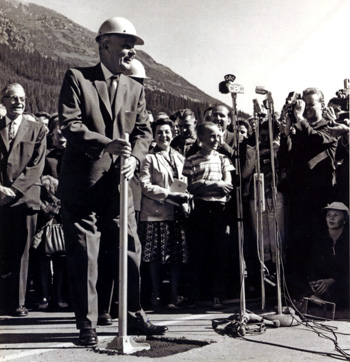
-
Article
Fur Trade Route Networks
Throughout the period of the historical fur trade (early 17th to the mid-19th century), water routes were the natural “highways” of First Nations trappers and European fur traders. Water trading networks connected Indigenous societies from the Atlantic Ocean, along the St. Lawrence River to the Great Lakes, and then on towards the Hudson Bay watershed. North America’s waterborne geography facilitated intracontinental travel, enabled European expansion and settlement into Indigenous North America, and shaped the contours of Euro-Indigenous relations in the context of the fur trade. These extensive and interconnected systems of rivers, lakes and overland trails criss-crossed Indigenous territories and had been used for generations. At the height of the fur trade, the principal canoe route extended westward from the Island of Montreal through the Great Lakes, and from the northwestern shore of Lake Superior over the height of land into the Hudson Bay watershed. From the Lake Winnipeg basin, Indigenous trappers and European traders fanned out towards the Western Prairies via the Assiniboine, Qu’Appelle and Souris rivers, towards the foothills of the Rocky Mountains via the North and South branches of the Saskatchewan River, and finally towards the Athabasca Country via the Sturgeon-weir River and the Methye Portage.
"https://d2ttikhf7xbzbs.cloudfront.net/media/media/6a52818a-3f78-427a-a201-5e6bc9c5d874.jpg" // resources/views/front/categories/view.blade.php
https://d2ttikhf7xbzbs.cloudfront.net/media/media/6a52818a-3f78-427a-a201-5e6bc9c5d874.jpg
-
Article
Grand Portage
Grand Portage was a fur-trade depot and route of the voyageurs at the western extremity of Lake Superior.
"https://d2ttikhf7xbzbs.cloudfront.net/media/media/a4d6e476-5e53-4126-9ee6-313b64235660.jpg" // resources/views/front/categories/view.blade.php
https://d2ttikhf7xbzbs.cloudfront.net/media/media/a4d6e476-5e53-4126-9ee6-313b64235660.jpg
-
Article
Grand Trunk Pacific Railway
The Grand Trunk Pacific Railway was a 4800 km system whose main line ran from Winnipeg via Melville and Edmonton to Prince Rupert, British Columbia.
"https://development.thecanadianencyclopedia.ca/images/tce_placeholder.jpg?v=e9dca980c9bdb3aa11e832e7ea94f5d9" // resources/views/front/categories/view.blade.php
https://development.thecanadianencyclopedia.ca/images/tce_placeholder.jpg?v=e9dca980c9bdb3aa11e832e7ea94f5d9
-
Article
Grand Trunk Railway of Canada
In late 19th Century, the Grand Trunk Railway of Canada was the major railroad in the Province of Canada (Ontario and Quebec), connecting Toronto to Montreal.
"https://d2ttikhf7xbzbs.cloudfront.net/media/media/f2fd266e-b4d2-42a3-8d88-e6e4166b1541.jpg" // resources/views/front/categories/view.blade.php
https://d2ttikhf7xbzbs.cloudfront.net/media/media/f2fd266e-b4d2-42a3-8d88-e6e4166b1541.jpg
-
Article
Great Divide Trail
Great Divide Trail is a long-distance hiking trail, paralleling where possible the CONTINENTAL DIVIDE of Canada's Rocky Mts range. Some 560 km of the trail lies within the boundaries of Banff, Kootenay, Yoho and Jasper national parks, extending from Palliser Pass in the S to Mt ROBSON in the N.
"https://development.thecanadianencyclopedia.ca/images/tce_placeholder.jpg?v=e9dca980c9bdb3aa11e832e7ea94f5d9" // resources/views/front/categories/view.blade.php
https://development.thecanadianencyclopedia.ca/images/tce_placeholder.jpg?v=e9dca980c9bdb3aa11e832e7ea94f5d9
-
Article
Great Western Railway
The London and Gore Railroad Co, incorporated 6 May 1834, changed its name to the Great Western Rail Road Co in 1845 and to the Great Western Railway in 1853. Promoted by lawyer-politician Allan Napier MACNAB and more significantly by Hamilton merchants Isaac and Peter Buchanan, R.W.
"https://d2ttikhf7xbzbs.cloudfront.net/media/media/a580af8a-f4ac-492b-a8d0-ab27d566d754.jpg" // resources/views/front/categories/view.blade.php
https://d2ttikhf7xbzbs.cloudfront.net/media/media/a580af8a-f4ac-492b-a8d0-ab27d566d754.jpg
-
Collection
Heritage Minutes
The Heritage Minutes collection is a bilingual series of history-focused public service announcements. Each 60-second short film depicts a significant person, event or story in Canadian history. They are produced by Historica Canada, the not-for-profit organization that also publishes this encyclopedia. First released in 1991, the Heritage Minutes have been shown on television, in cinemas and online. They have become a recognizable part of Canadian culture. The collection currently includes 100 episodes.
"https://d2ttikhf7xbzbs.cloudfront.net/media/media/1bfa3d45-2952-4f79-b7d4-4c6cb6601164.jpg" // resources/views/front/categories/view.blade.php
https://d2ttikhf7xbzbs.cloudfront.net/media/media/1bfa3d45-2952-4f79-b7d4-4c6cb6601164.jpg
-
Article
Motor Vehicle Disasters in Canada
Numerous tragedies have unfolded on Canadian roads and highways, the deadliest being a bus crash that killed 44 people in Quebec in 1997. Despite the death toll in such headline-grabbing disasters, Canada’s motor vehicle fatality and injury rates are steadily declining, thanks to engineering improvements in vehicles, and the increasing promotion and awareness of safe driving practices.
"https://d2ttikhf7xbzbs.cloudfront.net/media/Twitter_Cards/humboldt-1.png" // resources/views/front/categories/view.blade.php
https://d2ttikhf7xbzbs.cloudfront.net/media/Twitter_Cards/humboldt-1.png
-
Article
Hudson Bay Railway
The idea of the Hudson Bay Railway, which eventually came to run from Winnipeg to The Pas, and then to Churchill, Manitoba, was conceived by public and private interests in the late 19th century as a means of transporting grain as quickly as possible onto ships for overseas sale. Over a period of almost 50 years, construction efforts ran into various problems — including engineering disputes, storms, a harsh northern climate, fires, labour unrest, and material and labour shortages. From 1910 onwards, the federal government took charge of paying for the engineering and construction work for the railway line, particularly after the creation of Canadian National Railways in 1919. The line was completed in 1929 and opened for full service in 1931. (See also Railway History in Canada.)
"https://d2ttikhf7xbzbs.cloudfront.net/hudsonbayrailway/engine2735.jpg" // resources/views/front/categories/view.blade.php
https://d2ttikhf7xbzbs.cloudfront.net/hudsonbayrailway/engine2735.jpg