Browse "Places"
-
Article
Russell (Man)
Russell, Manitoba, incorporated as a village in 1907 and as a town in 1913, population 1669 (2011c), 1590 (2006c). The Town of Russell is an agricultural service centre 350 km northwest of Winnipeg near the Manitoba-Saskatchewan border.
"https://development.thecanadianencyclopedia.ca/images/tce_placeholder.jpg?v=e9dca980c9bdb3aa11e832e7ea94f5d9" // resources/views/front/categories/view.blade.php
https://development.thecanadianencyclopedia.ca/images/tce_placeholder.jpg?v=e9dca980c9bdb3aa11e832e7ea94f5d9
-
Article
Russell (Ont)
Russell, Ontario, incorporated as a township in 1854, population 16,520 (2016 census), 15,247 (2011 census). The Township of Russell is located 33 km southeast of Ottawa. It was named after Peter Russell, an official in the government of Upper Canada.
"https://development.thecanadianencyclopedia.ca/images/tce_placeholder.jpg?v=e9dca980c9bdb3aa11e832e7ea94f5d9" // resources/views/front/categories/view.blade.php
https://development.thecanadianencyclopedia.ca/images/tce_placeholder.jpg?v=e9dca980c9bdb3aa11e832e7ea94f5d9
-
Article
Russell Theatre
Located at the corner of Queen and Elgin streets in Ottawa, the Russell Theatre opened on 15 October 1897.
"https://development.thecanadianencyclopedia.ca/images/tce_placeholder.jpg?v=e9dca980c9bdb3aa11e832e7ea94f5d9" // resources/views/front/categories/view.blade.php
https://development.thecanadianencyclopedia.ca/images/tce_placeholder.jpg?v=e9dca980c9bdb3aa11e832e7ea94f5d9
-
Article
Rutherford House
Rutherford House is an elegant Edwardian house built in 1909 for Alexander Cameron RUTHERFORD, the first premier of Alberta and chancellor of the UNIVERSITY OF ALBERTA (1927-41).
"https://development.thecanadianencyclopedia.ca/images/tce_placeholder.jpg?v=e9dca980c9bdb3aa11e832e7ea94f5d9" // resources/views/front/categories/view.blade.php
https://development.thecanadianencyclopedia.ca/images/tce_placeholder.jpg?v=e9dca980c9bdb3aa11e832e7ea94f5d9
-
Article
Saanich
Saanich, BC, incorporated as a district municipality in 1906, population 109 752 (2011c), 108 265 (2006c). The District of Saanich is located immediately northwest of the city of VICTORIA, and is an integral part of the Greater Victoria area.
"https://d2ttikhf7xbzbs.cloudfront.net/media/media/8eb263da-d26b-4197-b26c-936471f19fe6.jpg" // resources/views/front/categories/view.blade.php
https://d2ttikhf7xbzbs.cloudfront.net/media/media/8eb263da-d26b-4197-b26c-936471f19fe6.jpg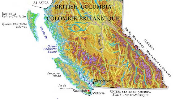
-
Article
Saanich Peninsula
Saanich Peninsula, BC, forms part of the Nanaimo Lowlands, along Vancouver Island's east coast. It extends from Sidney in the north to Victoria in the south, and is 33 km long and averages 4 km in width; 90 per cent of its perimeter is fronted by sea. The dominant geographical features are Mount Newton and Saanich Inlet.
"https://development.thecanadianencyclopedia.ca/images/tce_placeholder.jpg?v=e9dca980c9bdb3aa11e832e7ea94f5d9" // resources/views/front/categories/view.blade.php
https://development.thecanadianencyclopedia.ca/images/tce_placeholder.jpg?v=e9dca980c9bdb3aa11e832e7ea94f5d9
-
Article
Sable Island
Shaped like an open crescent, 35 km long and 1.6 km wide at its widest point, it narrows at both ends to West and East Spits, which continue offshore as shallow submerged bars.
"https://d2ttikhf7xbzbs.cloudfront.net/media/media/6607c641-cc62-438d-b372-fcea498c311b.jpg" // resources/views/front/categories/view.blade.php
https://d2ttikhf7xbzbs.cloudfront.net/media/media/6607c641-cc62-438d-b372-fcea498c311b.jpg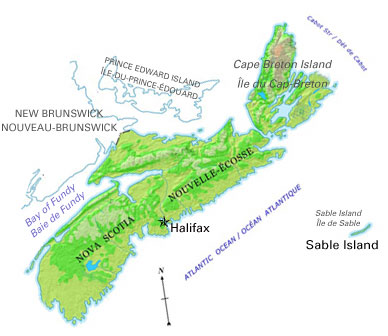
-
Article
Sackville
Sackville, NB, incorporated as a town in 1903, population 5558 (2011c), 5411 (2006c). Sackville is situated 50 km southeast of Moncton on the Tantramar River, near the Nova Scotia border.
"https://d2ttikhf7xbzbs.cloudfront.net/media/media/5dbfbca9-4ef2-40d8-b045-723f078917dd.jpg" // resources/views/front/categories/view.blade.php
https://d2ttikhf7xbzbs.cloudfront.net/media/media/5dbfbca9-4ef2-40d8-b045-723f078917dd.jpg
-
Article
Saguenay River
The Saguenay River, approximately 170 km long, issues from Lac Saint-Jean in the Laurentian Highlands of Quebec. It has a drainage basin of 88,000 km2 and a mean discharge of 1,750 m3/s. It discharges from the lake through two channels, which join some 10 km from the lake near Alma.
"https://d2ttikhf7xbzbs.cloudfront.net/media/media/a2c21ed3-15d9-49da-a892-5c898eeba2d4.jpg" // resources/views/front/categories/view.blade.php
https://d2ttikhf7xbzbs.cloudfront.net/media/media/a2c21ed3-15d9-49da-a892-5c898eeba2d4.jpg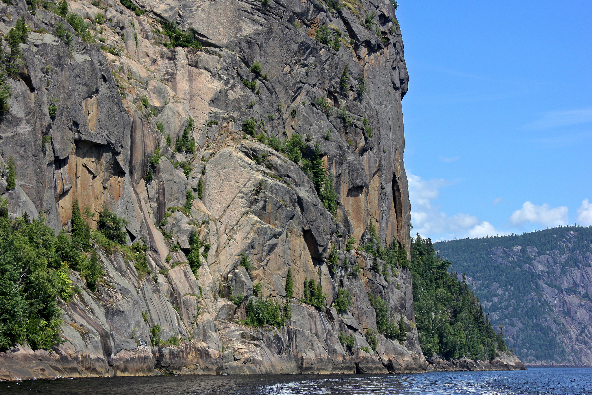
-
Article
Saint Andrews (NB)
Saint Andrews, NB, incorporated as a town in 1903, population 1889 (2011c), 1798 (2006c). The Town of Saint Andrews is located at the mouth of the ST CROIX RIVER in the southwest corner of New Brunswick.
"https://development.thecanadianencyclopedia.ca/images/tce_placeholder.jpg?v=e9dca980c9bdb3aa11e832e7ea94f5d9" // resources/views/front/categories/view.blade.php
https://development.thecanadianencyclopedia.ca/images/tce_placeholder.jpg?v=e9dca980c9bdb3aa11e832e7ea94f5d9
-
Article
Saint-Augustin-de-Desmaures
The area was first settled in 1658, more than 20 years before the creation of the parish of Saint-Augustin-de-Desmaures. The name Saint-Augustin was supposedly given to the parish in honour of the governor of New France from 1663-1665, Augustin de Saffray de MÉZY.
"https://development.thecanadianencyclopedia.ca/images/tce_placeholder.jpg?v=e9dca980c9bdb3aa11e832e7ea94f5d9" // resources/views/front/categories/view.blade.php
https://development.thecanadianencyclopedia.ca/images/tce_placeholder.jpg?v=e9dca980c9bdb3aa11e832e7ea94f5d9
-
Article
Saint-Basile-le-Grand
Saint-Basile-le-Grand, Qué, Town, pop 15 605 (2006c), 12 385 (2001c), inc 1969. Saint-Basile-le-Grand is located between Mont Saint-Bruno and the Rivière RICHELIEU about 35 km east of MONTRÉAL.
"https://development.thecanadianencyclopedia.ca/images/tce_placeholder.jpg?v=e9dca980c9bdb3aa11e832e7ea94f5d9" // resources/views/front/categories/view.blade.php
https://development.thecanadianencyclopedia.ca/images/tce_placeholder.jpg?v=e9dca980c9bdb3aa11e832e7ea94f5d9
-
Article
Saint-Benoît-du-Lac
The community was founded by Dom Paul Vannier in 1912 when he acquired a farm at Point Gibraltar, a peninsula sloping down towards the lake. He and 3 other monks began farming and providing religious services.
"https://d2ttikhf7xbzbs.cloudfront.net/media/media/31ddf4eb-2a59-4969-932c-cea873fe5f25.jpg" // resources/views/front/categories/view.blade.php
https://d2ttikhf7xbzbs.cloudfront.net/media/media/31ddf4eb-2a59-4969-932c-cea873fe5f25.jpg
-
Article
Saint-Bruno-de-Montarville
The seigneury of Montarville was originally granted to Pierre Boucher de Boucherville Junior in 1710. The Boucherville family combined the last 6 letters of their name to the first 2 syllables of the French word for mountain (montagne).
"https://development.thecanadianencyclopedia.ca/images/tce_placeholder.jpg?v=e9dca980c9bdb3aa11e832e7ea94f5d9" // resources/views/front/categories/view.blade.php
https://development.thecanadianencyclopedia.ca/images/tce_placeholder.jpg?v=e9dca980c9bdb3aa11e832e7ea94f5d9
-
Article
Saint-Charles-Borromée
Saint-Charles-Borromée was at one time an agricultural village but is now almost totally residential. It is a suburb of Montréal and Joliette. There is no industrial zone, so economic activity is almost exclusively commercial. The hospital is the largest employer.
"https://d2ttikhf7xbzbs.cloudfront.net/media/media/658ad4b0-7b40-456f-a582-61e2305fc015.jpg" // resources/views/front/categories/view.blade.php
https://d2ttikhf7xbzbs.cloudfront.net/media/media/658ad4b0-7b40-456f-a582-61e2305fc015.jpg