Browse "Places"
-
Article
South Nahanni River
South Nahanni River, 563 km long, flows southeast out of the Ragged Range of the Selwyn Mountains, cuts across successive spines of the Mackenzie Mountains and empties into the Liard River.
"https://d2ttikhf7xbzbs.cloudfront.net/media/media/f03ee7f1-6a31-4148-8ca4-a42264dd3a8e.jpg" // resources/views/front/categories/view.blade.php
https://d2ttikhf7xbzbs.cloudfront.net/media/media/f03ee7f1-6a31-4148-8ca4-a42264dd3a8e.jpg
-
Article
South Porcupine
South Porcupine, ON, one of five wards in the city of Timmins. Incorporated in 1911, South Porcupine became a part of Timmins in 1973. The town is named for an island in a local river reportedly shaped like a porcupine.
"https://d2ttikhf7xbzbs.cloudfront.net/media/media/32e4c070-eeb8-4b20-83d5-b09fd6ad1241.jpg" // resources/views/front/categories/view.blade.php
https://d2ttikhf7xbzbs.cloudfront.net/media/media/32e4c070-eeb8-4b20-83d5-b09fd6ad1241.jpg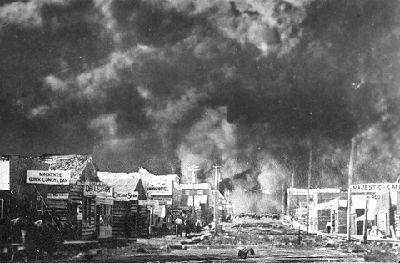
-
Article
South Saskatchewan River
The South Saskatchewan River (1,392 km long) is a heavily utilized water source in southern Alberta and Saskatchewan and is a major tributary to the Saskatchewan River, ultimately discharging to Hudson Bay. Mean flow is 280 m3/s, but varies throughout the year, largely controlled by several dams and reservoirs along the river system. The South Saskatchewan River flows through an agriculturally productive region and is prone to periodic droughts and floods.
"https://d2ttikhf7xbzbs.cloudfront.net/media/media/9e202c78-4a8b-4e2d-932a-446348de5a04.jpg" // resources/views/front/categories/view.blade.php
https://d2ttikhf7xbzbs.cloudfront.net/media/media/9e202c78-4a8b-4e2d-932a-446348de5a04.jpg
-
Article
Southampton Island
Southampton Island, 41 214 km2, is situated between FOXE BASIN and HUDSON BAY. It combines the 2 basic regional relief types. Its north and northeast consist of undulating highlands of Precambrian SHIELD rocks, reaching
"https://d2ttikhf7xbzbs.cloudfront.net/media/media/79d1e122-c898-4f67-8500-8c2d799e7700.jpg" // resources/views/front/categories/view.blade.php
https://d2ttikhf7xbzbs.cloudfront.net/media/media/79d1e122-c898-4f67-8500-8c2d799e7700.jpg
-
Article
Southern Alberta Art Gallery
The Southern Alberta Art Gallery was given the mandate to present historical and contemporary art of national and international significance to the region of southern Alberta.
"https://d2ttikhf7xbzbs.cloudfront.net/media/media/cf99751f-c88e-42ca-923d-c827234b5a4e.jpg" // resources/views/front/categories/view.blade.php
https://d2ttikhf7xbzbs.cloudfront.net/media/media/cf99751f-c88e-42ca-923d-c827234b5a4e.jpg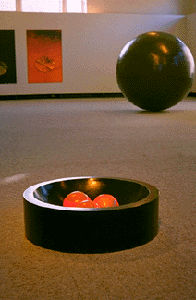
-
Article
Southern Indian Lake
Southern Indian Lake, 2015 km2, elev 254 m, max length 146 km, is located in north-central Manitoba.
"https://development.thecanadianencyclopedia.ca/images/tce_placeholder.jpg?v=e9dca980c9bdb3aa11e832e7ea94f5d9" // resources/views/front/categories/view.blade.php
https://development.thecanadianencyclopedia.ca/images/tce_placeholder.jpg?v=e9dca980c9bdb3aa11e832e7ea94f5d9
-
Article
Spallumcheen
Spallumcheen, BC, incorporated as a district municipality in 1892, population 5055 (2011c), 4960 (2006c). The Township of Spallumcheen is located about seven kilometres north of VERNON and completely encloses the city of ARMSTRONG.
"https://development.thecanadianencyclopedia.ca/images/tce_placeholder.jpg?v=e9dca980c9bdb3aa11e832e7ea94f5d9" // resources/views/front/categories/view.blade.php
https://development.thecanadianencyclopedia.ca/images/tce_placeholder.jpg?v=e9dca980c9bdb3aa11e832e7ea94f5d9
-
Article
Spaniard's Bay
Spaniard's Bay, NL, incorporated as a town in 1965, population 2622 (2011c), 2540 (2006c). The Town of Spaniard's Bay is located north of Bay Roberts on the west side of Conception Bay.
"https://development.thecanadianencyclopedia.ca/images/tce_placeholder.jpg?v=e9dca980c9bdb3aa11e832e7ea94f5d9" // resources/views/front/categories/view.blade.php
https://development.thecanadianencyclopedia.ca/images/tce_placeholder.jpg?v=e9dca980c9bdb3aa11e832e7ea94f5d9
-
Article
Sparwood
Sparwood, British Columbia, incorporated as a district municipality in 1966, population 3,784 (2016 census), 3,667 (2011 census). The District of Sparwood is located 32 km northeast of Fernie in the Elk River Valley, and on the traditional territory of the Ktunaxa people.
"https://development.thecanadianencyclopedia.ca/images/tce_placeholder.jpg?v=e9dca980c9bdb3aa11e832e7ea94f5d9" // resources/views/front/categories/view.blade.php
https://development.thecanadianencyclopedia.ca/images/tce_placeholder.jpg?v=e9dca980c9bdb3aa11e832e7ea94f5d9
-
Article
Spirit River
Spirit River, Alta, incorporated as a town in 1951, population 1025 (2011c), 1148 (2006c). The Town of Spirit River is located in the middle of a large prairie 78 km north of GRANDE PRAIRIE.
"https://development.thecanadianencyclopedia.ca/images/tce_placeholder.jpg?v=e9dca980c9bdb3aa11e832e7ea94f5d9" // resources/views/front/categories/view.blade.php
https://development.thecanadianencyclopedia.ca/images/tce_placeholder.jpg?v=e9dca980c9bdb3aa11e832e7ea94f5d9
-
Article
Spiritwood
The town is a service and administrative centre for the surrounding area. Grain growing and the raising of livestock are the main activities. The town lies in close proximity to a number of lakes and parks, with many recreational opportunities including fishing, snowmobiling, hunting and golfing.
"https://d2ttikhf7xbzbs.cloudfront.net/media/media/e00e474a-7659-48b5-ad0e-c8089a934a0c.jpg" // resources/views/front/categories/view.blade.php
https://d2ttikhf7xbzbs.cloudfront.net/media/media/e00e474a-7659-48b5-ad0e-c8089a934a0c.jpg
-
Article
Spitsbergen
Spitsbergen is a bleak Norwegian island group only 965 km from the North Pole. It became strategically significant in WWII when Germany attacked the USSR in June 1941.
"https://development.thecanadianencyclopedia.ca/images/tce_placeholder.jpg?v=e9dca980c9bdb3aa11e832e7ea94f5d9" // resources/views/front/categories/view.blade.php
https://development.thecanadianencyclopedia.ca/images/tce_placeholder.jpg?v=e9dca980c9bdb3aa11e832e7ea94f5d9
-
Article
Sports Facilities
Sports facilities in Canada - including arenas, stadiums and curling rinks, swimming pools and specialized Olympic installations - are among the country's most important cultural buildings.
"https://d2ttikhf7xbzbs.cloudfront.net/media/media/eac3c97c-5657-4435-9e1f-a006b151f413.jpg" // resources/views/front/categories/view.blade.php
https://d2ttikhf7xbzbs.cloudfront.net/media/media/eac3c97c-5657-4435-9e1f-a006b151f413.jpg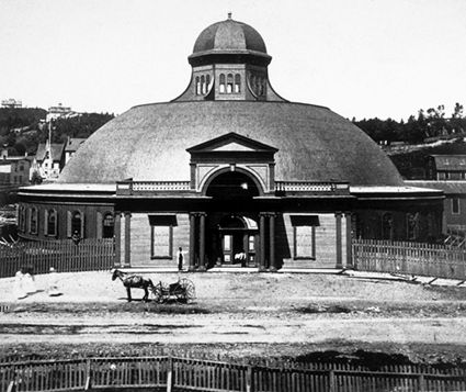
-
Article
Springdale
Springdale, NL, incorporated as a town in 1965, population 2907 (2011c), 2764 (2006c). The Town of Springdale is located on the northwest side of Halls Bay near the mouth of the Indian River.
"https://development.thecanadianencyclopedia.ca/images/tce_placeholder.jpg?v=e9dca980c9bdb3aa11e832e7ea94f5d9" // resources/views/front/categories/view.blade.php
https://development.thecanadianencyclopedia.ca/images/tce_placeholder.jpg?v=e9dca980c9bdb3aa11e832e7ea94f5d9
-
Article
Springfield
Springfield, Manitoba, incorporated as a rural municipality in 1873, population 14 069 (2011c), 12 990 (2006c).
"https://development.thecanadianencyclopedia.ca/images/tce_placeholder.jpg?v=e9dca980c9bdb3aa11e832e7ea94f5d9" // resources/views/front/categories/view.blade.php
https://development.thecanadianencyclopedia.ca/images/tce_placeholder.jpg?v=e9dca980c9bdb3aa11e832e7ea94f5d9