Browse "Places"
-
Article
Guysborough
Guysborough, NS, Community, population 403 (2011c), 428 (2006c). Guysborough, the shire town of Guysborough County, is located on the east shore of mainland Nova Scotia on Chedabucto Bay, 51 km from the Canso Causeway.
"https://development.thecanadianencyclopedia.ca/images/tce_placeholder.jpg?v=e9dca980c9bdb3aa11e832e7ea94f5d9" // resources/views/front/categories/view.blade.php
https://development.thecanadianencyclopedia.ca/images/tce_placeholder.jpg?v=e9dca980c9bdb3aa11e832e7ea94f5d9
-
Article
Gwaii Haanas
At 1,470 km2, Gwaii Haanas National Park Reserve, National Marine Conservation Area Reserve, and Haida Heritage Site (also known as Gwaii Haanas) encompasses 15 per cent of Haida Gwaii.
"https://d2ttikhf7xbzbs.cloudfront.net/media/media/77c96547-25d5-4295-a540-5a07340acb6c.jpg" // resources/views/front/categories/view.blade.php
https://d2ttikhf7xbzbs.cloudfront.net/media/media/77c96547-25d5-4295-a540-5a07340acb6c.jpg
-
Article
Gwaii Haanas National Park Reserve and Haida Heritage Site
Encompassing rainforests, alpine meadows and rocky shores of southern Haida Gwaii (formerly the Queen Charlotte Islands), Gwaii Haanas National Park Reserve and Haida Heritage Site (1495 km2) harbours some species of plants and animals not found anywhere else on the globe.
"https://d2ttikhf7xbzbs.cloudfront.net/media/media/1d34f43a-14db-43e0-8206-647ca92632f2.jpg" // resources/views/front/categories/view.blade.php
https://d2ttikhf7xbzbs.cloudfront.net/media/media/1d34f43a-14db-43e0-8206-647ca92632f2.jpg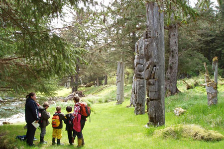
-
Editorial
Habitants and French-Speaking Quebec
The following article is an editorial written by The Canadian Encyclopedia staff. Editorials are not usually updated. Habitants were once a symbol of French-speaking Quebec, in much the same way that cowboys became an iconic image of the American West and gauchos a symbol of Argentina. In the word’s most familiar meaning, going back to the late 17th century, a habitant was a farmer who worked and lived on a plot of land granted him by a wealthy seigneur (see Seigneurial System). Although the system of land tenure in Quebec changed in the wake of the British Conquest, for many decades afterwards the notion of a habitant remained crucial to the perceived identity of the province.
"https://d2ttikhf7xbzbs.cloudfront.net/media/new_article_images/HabitantandQuebec/0967.jpg" // resources/views/front/categories/view.blade.php
https://d2ttikhf7xbzbs.cloudfront.net/media/new_article_images/HabitantandQuebec/0967.jpg
-
Article
Habitat 67
Habitat 67 is an experimental urban residential complex designed by Israeli-born architect Moshe Safdie and located in the Cité du Havre neighbourhood south of Montréal’s Old Port sector. Commissioned by the Canadian Corporation for Expo 67, the project derives its name from the theme of the fair, “Man and His World,” and became one of the major pavilions of the exhibition. It is the only remaining structure from Expo 67 to retain its original function. In 2015, the Guardian called Habitat “a functioning icon of 1960s utopianism, and one of that period’s most important buildings.”
"https://d2ttikhf7xbzbs.cloudfront.net/media/new_article_images/Habitat67/d378c1fa-9a6d-400c-aa2b-eb5b8351d306.jpg" // resources/views/front/categories/view.blade.php
https://d2ttikhf7xbzbs.cloudfront.net/media/new_article_images/Habitat67/d378c1fa-9a6d-400c-aa2b-eb5b8351d306.jpg
-
Article
Haida Gwaii
The Haida Gwaii is a group of islands off the north coast of British Columbia. The name means "Islands of the People" in the language of the Haida, who claim the archipelago as their ancestral lands. Captain George Dixon named this group of islands the Queen Charlotte Islands in 1787 after one of his ships, which in turn was named for the wife of King George III. This was its official name until 2010, when Haida Gwaii was accepted. On 11 April 2024, leaders from both the Haida Nation and the British Columbia government attended a ceremony to cement a title agreement which returned the crown land on the Haida Gwaii islands to the Haida Nation.
"https://d2ttikhf7xbzbs.cloudfront.net/media/media/440414f5-caff-4536-9eac-90dceba5603d.jpg" // resources/views/front/categories/view.blade.php
https://d2ttikhf7xbzbs.cloudfront.net/media/media/440414f5-caff-4536-9eac-90dceba5603d.jpg
-
Article
Haileybury
Haileybury, Ontario, unincorporated place, population 3,266 (2016 census) 3,462 (2011 census). Haileybury is located on the northwestern shore of Lake Timiskaming, 150 km north of North Bay. Incorporated as a town in 1904, it amalgamated with the town of New Liskeard and Dymond Township (incorporated 1901) to create the city of Temiskaming Shores in 2004.
"https://development.thecanadianencyclopedia.ca/images/tce_placeholder.jpg?v=e9dca980c9bdb3aa11e832e7ea94f5d9" // resources/views/front/categories/view.blade.php
https://development.thecanadianencyclopedia.ca/images/tce_placeholder.jpg?v=e9dca980c9bdb3aa11e832e7ea94f5d9
-
Article
Haines Junction
Haines Junction, Yukon, incorporated as a village in 1984, population 688 (2021 census), 613 (2016 census). The Village of Haines Junction is located in the Shakwak Valley of southwestern Yukon at the junction of the Haines and Alaska highways. With Kluane National Park and Reserve lying to the west, the village is the park's headquarters and offers a range of recreational activities, including trail riding and guided tours.
"https://d2ttikhf7xbzbs.cloudfront.net/hainesjunction/haines-junction-sunrise.jpg" // resources/views/front/categories/view.blade.php
https://d2ttikhf7xbzbs.cloudfront.net/hainesjunction/haines-junction-sunrise.jpg
-
Article
Haldimand County
Haldimand County, Ont, incorporated as a city in 2001, population 44 876 (2011c), 45 212 (2006c). The City of Haldimand County is situated on the north shore of LAKE ERIE along the GRAND RIVER, 20 km south of HAMILTON.
"https://development.thecanadianencyclopedia.ca/images/tce_placeholder.jpg?v=e9dca980c9bdb3aa11e832e7ea94f5d9" // resources/views/front/categories/view.blade.php
https://development.thecanadianencyclopedia.ca/images/tce_placeholder.jpg?v=e9dca980c9bdb3aa11e832e7ea94f5d9
-
Article
Haliburton House
Haliburton House, a 1½ storey villa in WINDSOR, NS, was built in 1836 and originally set in a 16 ha estate. It was the home of Thomas Chandler HALIBURTON, one of Nova Scotia's most famous 19th-century figures.
"https://development.thecanadianencyclopedia.ca/images/tce_placeholder.jpg?v=e9dca980c9bdb3aa11e832e7ea94f5d9" // resources/views/front/categories/view.blade.php
https://development.thecanadianencyclopedia.ca/images/tce_placeholder.jpg?v=e9dca980c9bdb3aa11e832e7ea94f5d9
-
Article
Halifax
Halifax, Nova Scotia, incorporated as a city in 1841, population 439,819 (2021 census), 403,131 (2016 census). Halifax is the capital of Nova Scotia and the largest urban area in Atlantic Canada. On 1 April 1996 Halifax was amalgamated with neighbouring communities to form the Halifax Regional Municipal Government. Halifax Regional Municipality occupies a strategic and central location on the province's east coast and is one of the world's largest harbours. Sometimes called "Warden of the North" for its historic military role, today it is a major regional centre for Atlantic Canada's economy.
"https://d2ttikhf7xbzbs.cloudfront.net/media/media/f3b5c3e8-74d8-4d23-be7b-429777f9a0f3.jpg" // resources/views/front/categories/view.blade.php
https://d2ttikhf7xbzbs.cloudfront.net/media/media/f3b5c3e8-74d8-4d23-be7b-429777f9a0f3.jpg
-
Article
Halifax Citadel
The general introduction of rifled artillery (with greater range and accuracy than earlier guns) shortly after completion of the Citadel rendered the costly installation obsolescent. It was partially rearmed in the 1860s and 1870s, and continued in use as a barracks into the 20th century.
"https://d2ttikhf7xbzbs.cloudfront.net/media/media/2a4ab68a-776a-430a-9155-c6d6ae17697b.jpg" // resources/views/front/categories/view.blade.php
https://d2ttikhf7xbzbs.cloudfront.net/media/media/2a4ab68a-776a-430a-9155-c6d6ae17697b.jpg
-
Article
Music in Halifax
Capital of Nova Scotia and major seaport established in 1749 as a British settlement (population 2500) and military base. The influx of Loyalists resulting from the American Revolution caused the population to rise to about 9000 by 1800.
"https://development.thecanadianencyclopedia.ca/images/tce_placeholder.jpg?v=e9dca980c9bdb3aa11e832e7ea94f5d9" // resources/views/front/categories/view.blade.php
https://development.thecanadianencyclopedia.ca/images/tce_placeholder.jpg?v=e9dca980c9bdb3aa11e832e7ea94f5d9
-
Article
Sanirajak
Sanirajak, Nunavut, incorporated as a hamlet in 1978, population 891 (2021 census), 848 (2016 census). Sanirajak, previously known as Hall Beach, is located on the east shore of the Melville Peninsula.
"https://development.thecanadianencyclopedia.ca/images/tce_placeholder.jpg?v=e9dca980c9bdb3aa11e832e7ea94f5d9" // resources/views/front/categories/view.blade.php
https://development.thecanadianencyclopedia.ca/images/tce_placeholder.jpg?v=e9dca980c9bdb3aa11e832e7ea94f5d9
-
Article
Halton Hills
Halton Hills, Ontario, incorporated as a town in 1974, population 62,951 (2021 census), 61,161 (2016 census). Halton Hills is located approximately 45 km west of Toronto and was created by the amalgamation of Acton, Georgetown and Esquesing Township. The town also encompasses several hamlets — Ballinafad, Glen Williams, Stewarttown, Limehouse, Glen Lawson, Speyside, Ashgrove, Crewson’s Corners, Bannockburn, Henderson’s Corners, Whaley’s Corners, Mansewood, Hornby, Silver Creek, Terra Cotta and Norval. From 1926 to 1935, Norval was home to Lucy Maud Montgomery, author of Anne of Green Gables.
"https://d2ttikhf7xbzbs.cloudfront.net/media/media/bea43b6e-722e-4df1-832a-44dba7c585e5.jpg" // resources/views/front/categories/view.blade.php
https://d2ttikhf7xbzbs.cloudfront.net/media/media/bea43b6e-722e-4df1-832a-44dba7c585e5.jpg