Browse "Places"
-
Article
Mechanics' Hall (Montréal)
Mechanics' Hall/Salle des artisans was an assembly hall at Montréal’s Mechanics’ Institute, which opened in 1855 at the corner of what are now Saint-Pierre and Saint-Jacques streets.
"https://development.thecanadianencyclopedia.ca/images/tce_placeholder.jpg?v=e9dca980c9bdb3aa11e832e7ea94f5d9" // resources/views/front/categories/view.blade.php
https://development.thecanadianencyclopedia.ca/images/tce_placeholder.jpg?v=e9dca980c9bdb3aa11e832e7ea94f5d9
-
Article
Medicine Hat
Medicine Hat, Alberta, incorporated as a city in 1906, population 63,271 (2021 census), 63,260 (2016 census). The city of Medicine Hat is one of Alberta's largest cities. It is located on the Canadian Pacific Railway main line and the Trans-Canada Highway in the southeastern corner of the province, bisected by the South Saskatchewan River. Canada's “sunniest” city, Medicine Hat averages 330 days of sunshine per year. A council of eight councillors and a mayor govern the city.
"https://d2ttikhf7xbzbs.cloudfront.net/media/media/3897d8ea-97cb-4069-8f58-433a41de83d2.jpg" // resources/views/front/categories/view.blade.php
https://d2ttikhf7xbzbs.cloudfront.net/media/media/3897d8ea-97cb-4069-8f58-433a41de83d2.jpg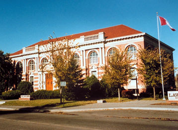
-
Article
Music in Medicine Hat
City of almost 43,000 on the South Saskatchewan River in Southern Alberta. With the arrival of the CPR in 1883, the city became the major commercial centre of the area.
"https://development.thecanadianencyclopedia.ca/images/tce_placeholder.jpg?v=e9dca980c9bdb3aa11e832e7ea94f5d9" // resources/views/front/categories/view.blade.php
https://development.thecanadianencyclopedia.ca/images/tce_placeholder.jpg?v=e9dca980c9bdb3aa11e832e7ea94f5d9
-
Article
Melfort
The rail line, which arrived in 1909, made Melfort a trade and cultural centre for the surrounding area. It was incorporated as a village in 1903, as a town in 1907 and a city in 1980.
"https://development.thecanadianencyclopedia.ca/images/tce_placeholder.jpg?v=e9dca980c9bdb3aa11e832e7ea94f5d9" // resources/views/front/categories/view.blade.php
https://development.thecanadianencyclopedia.ca/images/tce_placeholder.jpg?v=e9dca980c9bdb3aa11e832e7ea94f5d9
-
Article
Melville
The community's growth beyond that of others in the area came as a result of its designation as a divisional point by the railway. The importance of the railway has since been balanced somewhat by the city's role as a service centre for the poultry, livestock and grain farmers in the area.
"https://development.thecanadianencyclopedia.ca/images/tce_placeholder.jpg?v=e9dca980c9bdb3aa11e832e7ea94f5d9" // resources/views/front/categories/view.blade.php
https://development.thecanadianencyclopedia.ca/images/tce_placeholder.jpg?v=e9dca980c9bdb3aa11e832e7ea94f5d9
-
Article
Melville Island
Melville Island, 42 149 km 2 , is the fourth-largest of the QUEEN ELIZABETH ISLANDS . The Northwest Territories-Nunavut boundary splits the island in half. Its western half, which is in the Northwest Territories, is hilly,
"https://d2ttikhf7xbzbs.cloudfront.net/media/media/4ec28530-d4e5-4d8e-9ba1-9b66e7af9ec1.jpg" // resources/views/front/categories/view.blade.php
https://d2ttikhf7xbzbs.cloudfront.net/media/media/4ec28530-d4e5-4d8e-9ba1-9b66e7af9ec1.jpg
-
Article
Melville Peninsula
The Melville Peninsula is approximately 400 km long and 100 km wide. It is joined to the Canadian mainland by Rae Isthmus, is bounded on its west side by Committee Bay and is separated from BAFFIN ISLAND in the north by Fury and Hecla Strait; it faces FOXE BASIN in the east.
"https://development.thecanadianencyclopedia.ca/images/tce_placeholder.jpg?v=e9dca980c9bdb3aa11e832e7ea94f5d9" // resources/views/front/categories/view.blade.php
https://development.thecanadianencyclopedia.ca/images/tce_placeholder.jpg?v=e9dca980c9bdb3aa11e832e7ea94f5d9
-
Article
Mermaid Theatre of Nova Scotia
the mixed-up chameleon from The Very Hungry Caterpillar & Other Eric Carle Favourites (photo by Margo Ellen Gesser, courtesy Mermaid Theatre of Nova Scotia). Mermaid Theatre of Nova Scotia The Mermaid Theatre of Nova Scotia was established in Wolfville, NS, in 1972 (after a 1971 summer trial funded through the Opportunities for Youth programme) by Evelyn Garbary, advisor, Tom Miller, artistic director, and Sara Lee Lewis, business manager, to bring live puppet drama to young...
"https://d2ttikhf7xbzbs.cloudfront.net/media/media/750a698a-7677-4bb4-ab9b-0835ce06c0d9.jpg" // resources/views/front/categories/view.blade.php
https://d2ttikhf7xbzbs.cloudfront.net/media/media/750a698a-7677-4bb4-ab9b-0835ce06c0d9.jpg
-
Article
Merrickville-Wolford
Merrickville-Wolford, Ont, incorporated as a village in 1998, population 2850 (2011c), 2867 (2006c). The Village of Merrickville-Wolford is located on the Rideau River, 55 km southwest of Ottawa.
"https://development.thecanadianencyclopedia.ca/images/tce_placeholder.jpg?v=e9dca980c9bdb3aa11e832e7ea94f5d9" // resources/views/front/categories/view.blade.php
https://development.thecanadianencyclopedia.ca/images/tce_placeholder.jpg?v=e9dca980c9bdb3aa11e832e7ea94f5d9
-
Article
Merritt
Merritt, BC, incorporated as a city in 1981, population 7113 (2011c), 6998 (2006c). The City of Merritt is located in the Nicola Valley of south-central British Columbia, at the junction of the Coldwater and Nicola rivers, 88 km southof Kamloops on the COQUIHALLA HIGHWAY.
"https://development.thecanadianencyclopedia.ca/images/tce_placeholder.jpg?v=e9dca980c9bdb3aa11e832e7ea94f5d9" // resources/views/front/categories/view.blade.php
https://development.thecanadianencyclopedia.ca/images/tce_placeholder.jpg?v=e9dca980c9bdb3aa11e832e7ea94f5d9
-
Article
Metchosin
Metchosin, British Columbia, incorporated as a district municipality in 1984, population 4,708 (2016 census), 4,803 (2011 census). The District of Metchosin is located on Vancouver Island. It overlooks the Juan de Fuca Strait. Metchosin is part of the Greater Victoria area. From the late 1800s to 1958, a quarantine station operated at William Head in Metchosin. Many immigrants arriving to Canada by ship were quarantined at William Head before being allowed to enter the country. This was done in an effort to prevent the spread of infectious diseases common on overcrowded ships. In addition, from 1924 to 1956, there was a leper colony on nearby Bentinck Island.
"https://d2ttikhf7xbzbs.cloudfront.net/media/media/853b5d41-e9b6-4b2e-a205-03a54f80d5b2.jpg" // resources/views/front/categories/view.blade.php
https://d2ttikhf7xbzbs.cloudfront.net/media/media/853b5d41-e9b6-4b2e-a205-03a54f80d5b2.jpg
-
"https://development.thecanadianencyclopedia.ca/images/tce_placeholder.jpg?v=e9dca980c9bdb3aa11e832e7ea94f5d9" // resources/views/front/categories/view.blade.php
https://development.thecanadianencyclopedia.ca/images/tce_placeholder.jpg?v=e9dca980c9bdb3aa11e832e7ea94f5d9
-
Article
Métis Experiences at Residential School
Although the first residential schools in Canada were established with the intention of assimilating First Nations children into Euro-Canadian culture, Métis and Inuit children were also institutionalized in such facilities. Métis children experienced similar day-to-day conditions to those of other students in residential schools, but they were often considered “outsiders” by their peers and administrators. This perception affected their experiences within these institutions in particular ways.
"https://d2ttikhf7xbzbs.cloudfront.net/MetisExperiences/Webp.net-resizeimage.jpg" // resources/views/front/categories/view.blade.php
https://d2ttikhf7xbzbs.cloudfront.net/MetisExperiences/Webp.net-resizeimage.jpg
-
Article
Métis Road Allowance Communities
Road allowance communities were home to Métis families throughout the late 1800s until the mid- to late 1900s. Métis peoples used the road allowances as new home communities after experiencing relocations, migrations and dispossession from their homelands. After resistance and violence in a period during and after the Riel Resistance of 1869–1870 and the North–West Resistance in 1885, Métis were marginalized and labelled as rebellious or troublesome by the government of Canada and the provinces.
"https://d2ttikhf7xbzbs.cloudfront.net/media/media/RoosterTownFamily.jpg" // resources/views/front/categories/view.blade.php
https://d2ttikhf7xbzbs.cloudfront.net/media/media/RoosterTownFamily.jpg
-
Article
History of Métis Settlements in Canada
Métis communities are found in many provinces and territories in Canada; however, the only legislated Métis land base is in Alberta. Eight Métis settlements are located across the northern and central-eastern part of the province: Paddle Prairie, Peavine, Gift Lake, East Prairie, Buffalo Lake, Kikino, Elizabeth and Fishing Lake. As of 2021, the settlements cover 1.25 million acres of land and are home to approximately 4,238 people. That year, 3,540 people reported that they were registered members of Métis Settlements in Alberta. The Métis Settlements are self-governing and provide for the protection of Métis culture and identity.
"https://d2ttikhf7xbzbs.cloudfront.net/MetisSettlementsFlag/Metis_Settlements_Flag.gif" // resources/views/front/categories/view.blade.php
https://d2ttikhf7xbzbs.cloudfront.net/MetisSettlementsFlag/Metis_Settlements_Flag.gif