Browse "Places"
-
Article
National War Memorial
The National War Memorial in Ottawa was originally built to commemorate Canada's sacrifice in the First World War (1914–18). It now honours all who have served Canada in wartime.
"https://d2ttikhf7xbzbs.cloudfront.net/media/media/b0914be8-66f3-4128-9ed6-84f814d2d612.jpg" // resources/views/front/categories/view.blade.php
https://d2ttikhf7xbzbs.cloudfront.net/media/media/b0914be8-66f3-4128-9ed6-84f814d2d612.jpg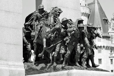
-
Article
Native People's Caravan
The Native People’s Caravan was a cross-country mobile protest that took place in 1974. Its main purpose was to raise awareness about the poor living conditions and discrimination experienced by Indigenous peoples in Canada. It travelled from Vancouver to Ottawa, where the subsequent occupation of a vacant warehouse on Victoria Island, near Parliament Hill, extended into 1975. The caravan brought various Indigenous groups together in protest of broken treaties, as well as a lack of government-supported education, housing and health care. As a result, meetings between Cabinet ministers and Indigenous leaders became more frequent. The protest is remembered as an important turning point in Indigenous activism in Canada.
"https://d2ttikhf7xbzbs.cloudfront.net/media/media/e9e4a925-a033-404d-9819-a3bb46fe9c8e.jpg" // resources/views/front/categories/view.blade.php
https://d2ttikhf7xbzbs.cloudfront.net/media/media/e9e4a925-a033-404d-9819-a3bb46fe9c8e.jpg
-
Article
Navy Island
Navy Island is the only Canadian island in the Niagara River. The 127.9 ha island is named after a British shipyard (1793) where the first naval vessels to sail the Upper Great Lakes were constructed.
"https://development.thecanadianencyclopedia.ca/images/tce_placeholder.jpg?v=e9dca980c9bdb3aa11e832e7ea94f5d9" // resources/views/front/categories/view.blade.php
https://development.thecanadianencyclopedia.ca/images/tce_placeholder.jpg?v=e9dca980c9bdb3aa11e832e7ea94f5d9
-
Article
Nechako River
The Nechako River rises in the Coast Mountains in west-central BC and flows east to form a principal tributary of the Fraser River. Because of massive damming of its headwaters, it is no longer possible to give its length or tell exactly where it used to rise.
"https://d2ttikhf7xbzbs.cloudfront.net/media/media/2ba613f3-f597-4da8-93a3-b376b6e74bec.jpg" // resources/views/front/categories/view.blade.php
https://d2ttikhf7xbzbs.cloudfront.net/media/media/2ba613f3-f597-4da8-93a3-b376b6e74bec.jpg
-
Article
Neepawa
Neepawa, Manitoba, incorporated as a town in 1883, population 3629 (2011c), 3298 (2006c). The Town of Neepawa on the fertile "Beautiful Plains," is 175 km west of Winnipeg.
"https://development.thecanadianencyclopedia.ca/images/tce_placeholder.jpg?v=e9dca980c9bdb3aa11e832e7ea94f5d9" // resources/views/front/categories/view.blade.php
https://development.thecanadianencyclopedia.ca/images/tce_placeholder.jpg?v=e9dca980c9bdb3aa11e832e7ea94f5d9
-
Article
Neguac
Neguac, NB, incorporated as a village in 1967, population 1678 (2011c), 1623 (2006c). The Village of Neguac is located in northeast New Brunswick near the head of Miramichi Bay, 41 km northeast of Miramichi.
"https://d2ttikhf7xbzbs.cloudfront.net/media/media/916d6c3d-9da2-4e33-bdc6-70bb07dfa1b5.jpg" // resources/views/front/categories/view.blade.php
https://d2ttikhf7xbzbs.cloudfront.net/media/media/916d6c3d-9da2-4e33-bdc6-70bb07dfa1b5.jpg
-
Article
Nelson
Nelson, BC, incorporated as a city in 1897, population 10 230 (2011c), 9258 (2006c). The City of Nelson, named after Hugh Nelson, lieutenant-governor of BC, overlooks the west arm of KOOTENAY LAKE. The prehistoric boundary of the INTERIOR SALISH and the KOOTENAY is nearby.
"https://development.thecanadianencyclopedia.ca/images/tce_placeholder.jpg?v=e9dca980c9bdb3aa11e832e7ea94f5d9" // resources/views/front/categories/view.blade.php
https://development.thecanadianencyclopedia.ca/images/tce_placeholder.jpg?v=e9dca980c9bdb3aa11e832e7ea94f5d9
-
Article
Nelson River
The Nelson River, 2,575 km long, flows north northeast out of Playgreen Lake, at the northwest tip of Lake Winnipeg. It spills out into a number of lakes, including Cross, Sipiwesk, Split and Stevens, flowing east from the latter into Hudson Bay.
"https://development.thecanadianencyclopedia.ca/images/tce_placeholder.jpg?v=e9dca980c9bdb3aa11e832e7ea94f5d9" // resources/views/front/categories/view.blade.php
https://development.thecanadianencyclopedia.ca/images/tce_placeholder.jpg?v=e9dca980c9bdb3aa11e832e7ea94f5d9
-
Article
Nepean
Nepean, Ont, was a city (incorporated from 1978 to 2001) until it and 10 other municipalities were merged into the new city of Ottawa.
"https://d2ttikhf7xbzbs.cloudfront.net/media/media/8b6598e1-368c-4b32-9a48-972cad0adc00.jpg" // resources/views/front/categories/view.blade.php
https://d2ttikhf7xbzbs.cloudfront.net/media/media/8b6598e1-368c-4b32-9a48-972cad0adc00.jpg
-
Article
Nettilling Lake
Nettilling Lake, 5,542 km2, elevation 30 m, max length 123 km, is located toward the south end of Baffin Island. The lake is in the Great Plain of the Koukdjuak, about 110 km southwest of Auyuittuq National Parkand 280 km northwest of Iqaluit. The name is of Inuktitut origin but its meaning is unclear. (See also Largest Lakes in Canada.)
"https://development.thecanadianencyclopedia.ca/images/tce_placeholder.jpg?v=e9dca980c9bdb3aa11e832e7ea94f5d9" // resources/views/front/categories/view.blade.php
https://development.thecanadianencyclopedia.ca/images/tce_placeholder.jpg?v=e9dca980c9bdb3aa11e832e7ea94f5d9
-
Article
New Brunswick
New Brunswick is one of three provinces collectively known as the "Maritimes." Joined to Nova Scotia by the narrow Chignecto Isthmus and separated from Prince Edward Island by the Northumberland Strait, New Brunswick forms the land bridge linking this region to continental North America. It is bounded in the north by Quebec and in the west by the US (Maine). In 1784, the British divided Nova Scotia at the Chignecto Isthmus, naming the west and north portion New Brunswick after the German duchy of Brunswick-Lunenburg. New Brunswick is now the only officially bilingual province in Canada.
"https://d2ttikhf7xbzbs.cloudfront.net/media/media/0ad6e160-c61e-4c22-b4ad-5db332fb3e11.jpg" // resources/views/front/categories/view.blade.php
https://d2ttikhf7xbzbs.cloudfront.net/media/media/0ad6e160-c61e-4c22-b4ad-5db332fb3e11.jpg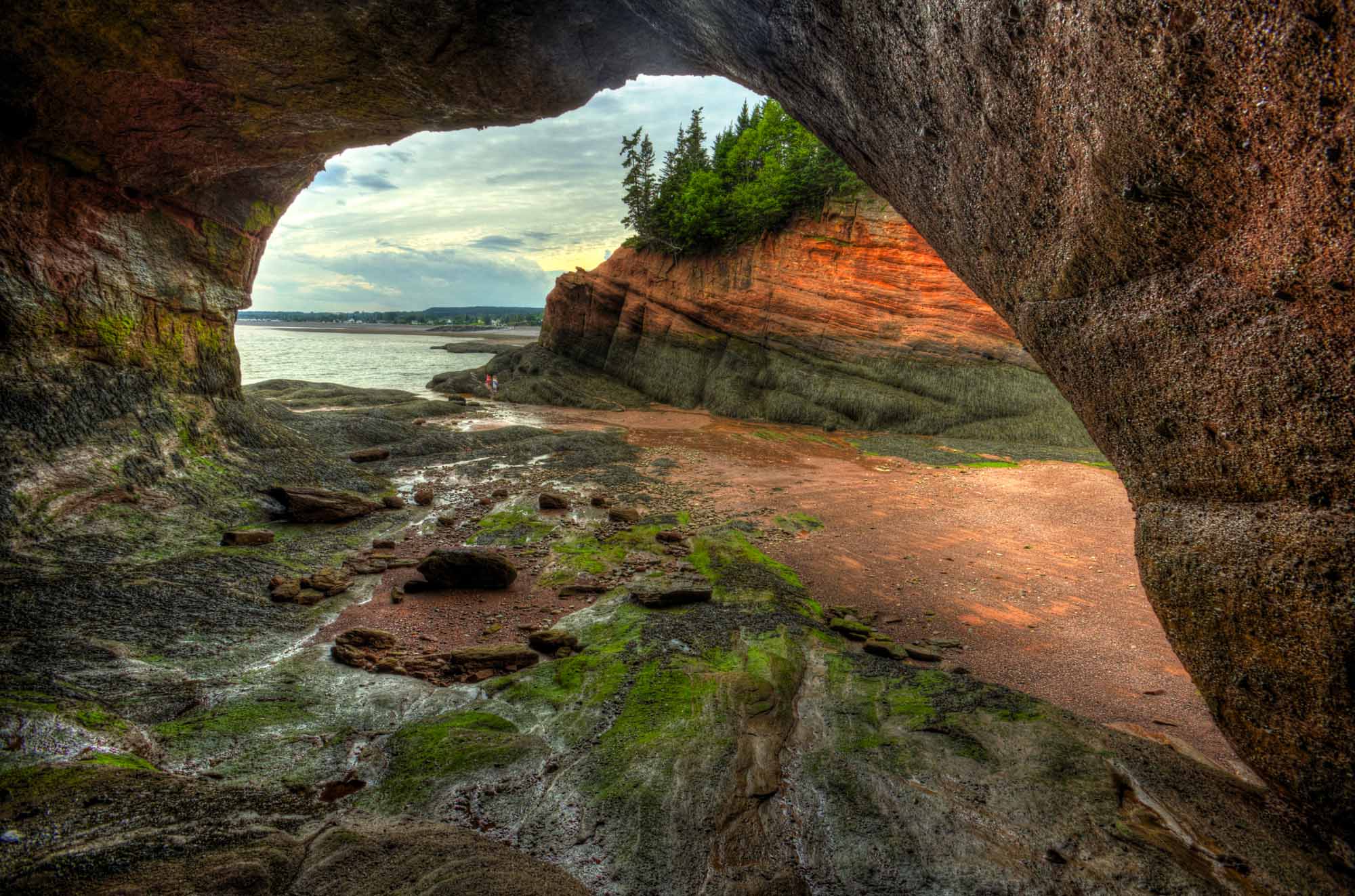
-
Timelines
New Brunswick
New Brunswick is one of three provinces collectively known as the "Maritimes." Joined to Nova Scotia by the narrow Chignecto Isthmus and separated from Prince Edward Island by the Northumberland Strait, New Brunswick forms the land bridge linking this region to continental North America.
"https://d2ttikhf7xbzbs.cloudfront.net/media/media/06045521-0423-40e4-bb35-b6789d7556cf.jpg" // resources/views/front/categories/view.blade.php
https://d2ttikhf7xbzbs.cloudfront.net/media/media/06045521-0423-40e4-bb35-b6789d7556cf.jpg
-
Article
New Brunswick and Confederation
New Brunswick became one of the founding members of the Dominion of Canada on 1 July 1867 when it joined Nova Scotia, Ontario and Quebec in Confederation. Arthur Hamilton Gordon, the lieutenant-governor of New Brunswick, helped organize the Charlottetown Conference (1–9 September 1864), where a federal union of British North American colonies was first discussed. By 1865, however, a majority in the New Brunswick legislature had swung against it. Albert Smith defeated pro-Confederation premier Samuel Tilley in a snap election that year. But the Fenian Raids in 1866 fueled New Brunswick’s sense of insecurity and increased support for Confederation. After Tilley’s party won another election in 1866, the legislature voted 38–1 in favour of Confederation.
"https://d2ttikhf7xbzbs.cloudfront.net/media/media/bb8000df-c2b6-4d69-821d-db39907e5078.jpg" // resources/views/front/categories/view.blade.php
https://d2ttikhf7xbzbs.cloudfront.net/media/media/bb8000df-c2b6-4d69-821d-db39907e5078.jpg
-
Article
New Caledonia
New Caledonia ("New Scotland"), was a name given in 1806 to the central and highland plateau area of BRITISH COLUMBIA by Simon FRASER, a partner, trader and explorer in the NORTH WEST CO.
"https://development.thecanadianencyclopedia.ca/images/tce_placeholder.jpg?v=e9dca980c9bdb3aa11e832e7ea94f5d9" // resources/views/front/categories/view.blade.php
https://development.thecanadianencyclopedia.ca/images/tce_placeholder.jpg?v=e9dca980c9bdb3aa11e832e7ea94f5d9
-
Article
New Denver
New Denver, British Columbia, incorporated as a village in 1929, population 473 (2016 census), 504 (2011 census). The village of New Denver is located near the northeastern end of Slocan Lake, 100 km north of Nelson. The site was first called Eldorado, then New Denver (1892), after Denver, Colorado.
"https://development.thecanadianencyclopedia.ca/images/tce_placeholder.jpg?v=e9dca980c9bdb3aa11e832e7ea94f5d9" // resources/views/front/categories/view.blade.php
https://development.thecanadianencyclopedia.ca/images/tce_placeholder.jpg?v=e9dca980c9bdb3aa11e832e7ea94f5d9