Browse "Land Features"
-
Article
Lake Agassiz
Lake Agassiz was the largest glacial lake in North America. It was formed 11 500 years ago in front of the northeastwardly retreating Laurentide Ice Sheet, which acted as a dam.
"https://development.thecanadianencyclopedia.ca/images/tce_placeholder.jpg?v=e9dca980c9bdb3aa11e832e7ea94f5d9" // resources/views/front/categories/view.blade.php
https://development.thecanadianencyclopedia.ca/images/tce_placeholder.jpg?v=e9dca980c9bdb3aa11e832e7ea94f5d9
-
Article
Lakes in Canadian Music
With the exception of the Great Lakes which border Ontario on the south, Canada's lakes no longer play a significant role in the country's development; rather they serve recreation and tourism, provide hydro-power, and are valued for their natural beauty.
"https://development.thecanadianencyclopedia.ca/images/tce_placeholder.jpg?v=e9dca980c9bdb3aa11e832e7ea94f5d9" // resources/views/front/categories/view.blade.php
https://development.thecanadianencyclopedia.ca/images/tce_placeholder.jpg?v=e9dca980c9bdb3aa11e832e7ea94f5d9
-
Article
Land
Earth's surface experiences change driven by relief, sea level, hydroclimate and human activity. Extreme hydroclimatic events combined with human activity on steep slopes and/or adjacent to low-lying coasts generate natural hazards.
"https://d2ttikhf7xbzbs.cloudfront.net/media/media/da6ae2ec-e05e-46fd-916c-6185a6a86215.jpg" // resources/views/front/categories/view.blade.php
https://d2ttikhf7xbzbs.cloudfront.net/media/media/da6ae2ec-e05e-46fd-916c-6185a6a86215.jpg
-
"https://development.thecanadianencyclopedia.ca/images/tce_placeholder.jpg?v=e9dca980c9bdb3aa11e832e7ea94f5d9" // resources/views/front/categories/view.blade.php
https://development.thecanadianencyclopedia.ca/images/tce_placeholder.jpg?v=e9dca980c9bdb3aa11e832e7ea94f5d9
-
Article
Landslide
A landslide is a downward and outward movement of a soil mass that formed part of a slope.
"https://d2ttikhf7xbzbs.cloudfront.net/media/media/aa619f1e-89b3-414d-9f9c-3a5c9c0b0097.jpg" // resources/views/front/categories/view.blade.php
https://d2ttikhf7xbzbs.cloudfront.net/media/media/aa619f1e-89b3-414d-9f9c-3a5c9c0b0097.jpg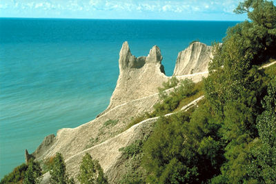
-
Article
Metamorphic Rock
Metamorphic rock is one of the 3 major classes of rock comprising the Earth's crust, the others being SEDIMENTARY and IGNEOUS ROCKS. Metamorphic rock has been transformed, while in the solid state, by pressure, temperature and deformation.
"https://d2ttikhf7xbzbs.cloudfront.net/media/media/e0a546d9-bcaf-41e5-a7d4-076b178b5592.jpg" // resources/views/front/categories/view.blade.php
https://d2ttikhf7xbzbs.cloudfront.net/media/media/e0a546d9-bcaf-41e5-a7d4-076b178b5592.jpg
-
Article
Natural Regions
Natural regions are intended to describe areas of the Earth's surface which possess similar qualities or attributes. They may refer to either land or water, and can vary in size. The term “natural region” is often used interchangeably with the word “ecozone.”
"https://d2ttikhf7xbzbs.cloudfront.net/media/media/9e60d609-62ab-4e7c-8233-12801bc0f8c1.jpg" // resources/views/front/categories/view.blade.php
https://d2ttikhf7xbzbs.cloudfront.net/media/media/9e60d609-62ab-4e7c-8233-12801bc0f8c1.jpg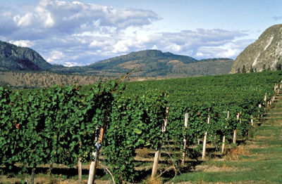
-
Article
Old Crow Plain
The vegetation is of the tundra type, with outliers of the boreal spruce forest; willow thickets line the course of the Old Crow River.
"https://d2ttikhf7xbzbs.cloudfront.net/media/media/3372115f-2e5f-492c-a1d9-de73d4668939.jpg" // resources/views/front/categories/view.blade.php
https://d2ttikhf7xbzbs.cloudfront.net/media/media/3372115f-2e5f-492c-a1d9-de73d4668939.jpg
-
Article
Peat
Peat, living and partially decomposed organic matter, consists principally of decayed brown mosses, Sphagnum plants, sedges and other semiaquatic plant remains.
"https://development.thecanadianencyclopedia.ca/images/tce_placeholder.jpg?v=e9dca980c9bdb3aa11e832e7ea94f5d9" // resources/views/front/categories/view.blade.php
https://development.thecanadianencyclopedia.ca/images/tce_placeholder.jpg?v=e9dca980c9bdb3aa11e832e7ea94f5d9
-
Article
Periglacial Landform
A periglacial landform is a feature resulting from the action of intense frost, often combined with the presence of permafrost. Periglacial landforms are restricted to areas that experience cold but essentially nonglacial climates.
"https://d2ttikhf7xbzbs.cloudfront.net/media/media/abcd7af0-a9a4-4141-9543-193539282103.jpg" // resources/views/front/categories/view.blade.php
https://d2ttikhf7xbzbs.cloudfront.net/media/media/abcd7af0-a9a4-4141-9543-193539282103.jpg
-
Article
Permafrost
Permafrost is ground remaining at or below 0°C continuously for at least two years. About 50 per cent of Canada is underlain by permafrost, mainly in the Arctic Archipelago, Yukon, Northwest Territories and Nunavut.
"https://d2ttikhf7xbzbs.cloudfront.net/media/media/5e658751-a56e-4535-9950-f641ec565a97.jpg" // resources/views/front/categories/view.blade.php
https://d2ttikhf7xbzbs.cloudfront.net/media/media/5e658751-a56e-4535-9950-f641ec565a97.jpg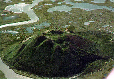
-
Article
Pingo
A pingo is an ice-cored hill typically conical in shape, growing and persisting only in PERMAFROST. The word "pingo" is of Inuit origin and was first used in the English-language literature by the botanist Alf E.
"https://d2ttikhf7xbzbs.cloudfront.net/media/media/5e658751-a56e-4535-9950-f641ec565a97.jpg" // resources/views/front/categories/view.blade.php
https://d2ttikhf7xbzbs.cloudfront.net/media/media/5e658751-a56e-4535-9950-f641ec565a97.jpg
-
Article
Québec's Postglacial Seas
Between about 100 000 and 12 000 years ago, the whole area of Québec as well as a major part of the northern hemisphere was covered with a thick layer of ice. In the late PLEISTOCENE era, just over 12 000 years ago, Québec underwent a gradual warming of the atmosphere.
"https://d2ttikhf7xbzbs.cloudfront.net/media/media/e3cfe0fb-4ec8-418c-b14c-582f156d72a1.jpg" // resources/views/front/categories/view.blade.php
https://d2ttikhf7xbzbs.cloudfront.net/media/media/e3cfe0fb-4ec8-418c-b14c-582f156d72a1.jpg
-
Article
Quill Lakes
The Quill Lakes are three connected saline lakes in southeastern Saskatchewan. They are located 150 km north of Regina and 152 km east of Saskatoon. From west to east the lakes are named Big Quill, Middle Quill (also known as Mud Lake) and Little Quill. Despite its name, at 181 km2 Little Quill is the second largest of the three lakes. Big Quill is the largest at 307 km2. The Quill Lakes’ elevation is 516 m.
"https://development.thecanadianencyclopedia.ca/images/tce_placeholder.jpg?v=e9dca980c9bdb3aa11e832e7ea94f5d9" // resources/views/front/categories/view.blade.php
https://development.thecanadianencyclopedia.ca/images/tce_placeholder.jpg?v=e9dca980c9bdb3aa11e832e7ea94f5d9
-
Article
Rocky Mountain Trench
The Rocky Mountain Trench is a long and deep valley extending approximately 1,500 km from the Bitterroot Valley in northwest Montana through British Columbia to the Liard Plain just south of the Yukon Territory. Its predominantly flat floor is 3–20 km wide and ranges in elevation between 600 m and 1,000 m above sea level. With walls made of sedimentary, volcanic and igneous rock, the Trench is sometimes referred to as the “Valley of a Thousand Peaks” because of the towering mountain ranges on either side: the Rocky Mountains to the east and the Columbia, Omineca and Cassiar mountains to the west. Humans have relied on the rich resources provided by this distinctive landscape from pre-colonial times to the present.
"https://d2ttikhf7xbzbs.cloudfront.net/media/media/061fe992-a3bf-45bc-906d-216d1bef45c7.jpg" // resources/views/front/categories/view.blade.php
https://d2ttikhf7xbzbs.cloudfront.net/media/media/061fe992-a3bf-45bc-906d-216d1bef45c7.jpg