Browse "Places"
-
Article
Quarry of the Ancestors Archaeological Site
The Quarry of the Ancestors is a 199-ha area located 48 km north of Fort McMurray, Alberta.
"https://d2ttikhf7xbzbs.cloudfront.net/media/media/cc3c2b00-1574-4756-b032-c6ec3e564c7a.jpg" // resources/views/front/categories/view.blade.php
https://d2ttikhf7xbzbs.cloudfront.net/media/media/cc3c2b00-1574-4756-b032-c6ec3e564c7a.jpg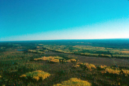
-
Article
Quebec
Quebec is the largest province in Canada. Its territory represents 15.5 per cent of the surface area of Canada and totals more than 1.5 million km2. Quebec shares borders with Ontario, New Brunswick and Newfoundland. The province also neighbours on four American states: Maine, New Hampshire, Vermont and New York. The name Quebec was inspired by an Algonquian word meaning “where the river narrows.” The French in New France used it solely to refer to the city of Quebec. The British were the first to use the name in a broader sense.
"https://d2ttikhf7xbzbs.cloudfront.net/media/media/98975740-c322-469b-9fe0-d603876f072d.png" // resources/views/front/categories/view.blade.php
https://d2ttikhf7xbzbs.cloudfront.net/media/media/98975740-c322-469b-9fe0-d603876f072d.png
-
Timelines
Quebec
Quebec is the largest Canadian province. At 1.5 million km², its territory accounts for 15.5 per cent of Canada's total area. The province shares borders with Ontario, New Brunswick, and Newfoundland and Labrador.
"https://d2ttikhf7xbzbs.cloudfront.net/media/media/26ba56cd-0975-483e-b342-5b276d9a793e.jpg" // resources/views/front/categories/view.blade.php
https://d2ttikhf7xbzbs.cloudfront.net/media/media/26ba56cd-0975-483e-b342-5b276d9a793e.jpg
-
Article
Quebec Act, 1774
The Quebec Act received royal assent on 22 June 1774. It revoked the Royal Proclamation of 1763, which had aimed to assimilate the French-Canadian population under English rule. The Quebec Act was put into effect on 1 May 1775. It was passed to gain the loyalty of the French-speaking majority of the Province of Quebec. Based on recommendations from Governors James Murray and Guy Carleton, the Act guaranteed the freedom of worship and restored French property rights. However, the Act had dire consequences for Britain’s North American empire. Considered one of the five “Intolerable Acts” by the Thirteen American Colonies, the Quebec Act was one of the direct causes of the American Revolutionary War (1775–83). It was followed by the Constitutional Act in 1791. This is the full-length entry about the Quebec Act of 1774. For a plain language summary, please see The Quebec Act, 1774 (Plain-Language Summary).
"https://d2ttikhf7xbzbs.cloudfront.net/media/media/bcf0dcc3-ce34-4098-8543-00bcccbaabe0.jpg" // resources/views/front/categories/view.blade.php
https://d2ttikhf7xbzbs.cloudfront.net/media/media/bcf0dcc3-ce34-4098-8543-00bcccbaabe0.jpg
-
Article
Québec Citadel National Historic Site of Canada
The Citadel has been an active military base since 1920. The Historic Sites and Monuments Board of Canada designated the uneven star-shaped Citadel as a national historic site in 1946 but its importance was recognized much earlier, and it was one of Canada's first heritage conservation projects.
"https://d2ttikhf7xbzbs.cloudfront.net/media/media/a7702171-fde4-4dd7-b794-ee21a1f28b6e.jpg" // resources/views/front/categories/view.blade.php
https://d2ttikhf7xbzbs.cloudfront.net/media/media/a7702171-fde4-4dd7-b794-ee21a1f28b6e.jpg
-
Article
Quebec City
Quebec City, Quebec, founded in 1608, population 549,459 (2021 census), 531,902 (2016 census). Quebec City, the capital of the province of Quebec, is located on the north shore of the St. Lawrence River where it meets the Rivière Saint-Charles. Here, the St. Lawrence narrows to a width of just over 1 km, and navigation is made difficult by a group of islands, the largest of which is Île d'Orléans. Cap-Diamant, a promontory with an elevation of 98 m, dominates the site and was used effectively as a fortification, earning Quebec City the name "Gibraltar of North America." The name "Quebec" is probably derived from an Algonquian word meaning "narrowing of the river."
"https://d2ttikhf7xbzbs.cloudfront.net/media/media/0b8d15c8-f384-4d69-b611-1fb9ccd5f02d.jpg" // resources/views/front/categories/view.blade.php
https://d2ttikhf7xbzbs.cloudfront.net/media/media/0b8d15c8-f384-4d69-b611-1fb9ccd5f02d.jpg
-
Article
Music in Quebec City
Quebec City. Capital of the province of Quebec. It was founded 3 Jul 1608 by the French navigator Samuel de Champlain on the site of the Indigenous village of Stadaconé at the mouth of the St Charles River.
"https://development.thecanadianencyclopedia.ca/images/tce_placeholder.jpg?v=e9dca980c9bdb3aa11e832e7ea94f5d9" // resources/views/front/categories/view.blade.php
https://development.thecanadianencyclopedia.ca/images/tce_placeholder.jpg?v=e9dca980c9bdb3aa11e832e7ea94f5d9
-
Article
Quebec City Mosque Shooting
The Quebec City mosque shooting took place in 2017 at the Islamic Cultural Centre of Quebec City, located in the suburb of Sainte-Foy. The gunman pleaded guilty to six counts of first-degree murder and six counts of attempted murder. It was one of the deadliest mass shootings in Canadian history, described as an act of terrorism by both Prime Minister Justin Trudeau and Quebec Premier Philippe Couillard. The event prompted widespread public debate around Islamophobia, racism and the rise of right-wing terrorism in Canada.
"https://d2ttikhf7xbzbs.cloudfront.net/media/new_article_images/QuebecCityMosqueShooting/31852213713_0fbc414412_o.jpg" // resources/views/front/categories/view.blade.php
https://d2ttikhf7xbzbs.cloudfront.net/media/new_article_images/QuebecCityMosqueShooting/31852213713_0fbc414412_o.jpg
-
Article
Quebec, North Shore and Labrador Railway
Quebec, North Shore and Labrador Railway links the towns of Labrador City, Wabush and Schefferville to the port of Sept-Îles.
"https://development.thecanadianencyclopedia.ca/images/tce_placeholder.jpg?v=e9dca980c9bdb3aa11e832e7ea94f5d9" // resources/views/front/categories/view.blade.php
https://development.thecanadianencyclopedia.ca/images/tce_placeholder.jpg?v=e9dca980c9bdb3aa11e832e7ea94f5d9
-
Article
Québec Sports Hall of Fame (Le Panthéon des sports du Québec)
In the early 1970s, the project of a Québec Sports Hall of Fame took shape through the initiative of Carl Schwende, a Swiss émigré who had settled in Québec in 1948. Thus, on June 26, 1973, the Panthéon des sports amateurs du Québec took out its charter.
"https://d2ttikhf7xbzbs.cloudfront.net/media/media/cd397a6d-d7d0-4e41-867c-137d6040aed3.jpg" // resources/views/front/categories/view.blade.php
https://d2ttikhf7xbzbs.cloudfront.net/media/media/cd397a6d-d7d0-4e41-867c-137d6040aed3.jpg
-
Article
Queen Elizabeth Hotel
The opening of the prestigious Queen Elizabeth Hotel in Montreal took place on 15 March 1958.
"https://development.thecanadianencyclopedia.ca/images/tce_placeholder.jpg?v=e9dca980c9bdb3aa11e832e7ea94f5d9" // resources/views/front/categories/view.blade.php
https://development.thecanadianencyclopedia.ca/images/tce_placeholder.jpg?v=e9dca980c9bdb3aa11e832e7ea94f5d9
-
Article
Queen Elizabeth Islands
The Queen Elizabeth Islands, NWT/Nunavut, are a group of islands in the Canadian Arctic Archipelago lying north of a great bathometric trench composed of (east to west) Lancaster Sound, Barrow Strait, Viscount Melville Sound and M'Clure Strait.
"https://development.thecanadianencyclopedia.ca/images/tce_placeholder.jpg?v=e9dca980c9bdb3aa11e832e7ea94f5d9" // resources/views/front/categories/view.blade.php
https://development.thecanadianencyclopedia.ca/images/tce_placeholder.jpg?v=e9dca980c9bdb3aa11e832e7ea94f5d9
-
Article
Queen Elizabeth Theatre
Queen Elizabeth Theatre. 2,575-seat theatre, home of the Vancouver Opera, the Vancouver Symphony Orchestra (1960-77), and Ballet British Columbia, and administered by the City of Vancouver.
"https://development.thecanadianencyclopedia.ca/images/tce_placeholder.jpg?v=e9dca980c9bdb3aa11e832e7ea94f5d9" // resources/views/front/categories/view.blade.php
https://development.thecanadianencyclopedia.ca/images/tce_placeholder.jpg?v=e9dca980c9bdb3aa11e832e7ea94f5d9
-
Article
Queen Elizabeth Way
Queen Elizabeth Way, connecting Toronto with Niagara Falls and Fort Erie, Ont, was Canada's first 4-lane, controlled-access superhighway.
"https://development.thecanadianencyclopedia.ca/images/tce_placeholder.jpg?v=e9dca980c9bdb3aa11e832e7ea94f5d9" // resources/views/front/categories/view.blade.php
https://development.thecanadianencyclopedia.ca/images/tce_placeholder.jpg?v=e9dca980c9bdb3aa11e832e7ea94f5d9
-
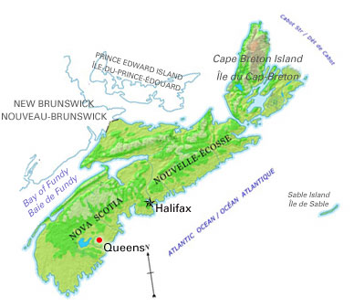
Article
Queens
Queens, NS, incorporated as a regional municipality in 1996, population 10 917 (2011c), 11 177 (2006c). The Region of Queens Municipality is located approximately 150 km southwest of Halifax.
"https://d2ttikhf7xbzbs.cloudfront.net/media/media/22724662-cbf7-461d-9649-5a5c6a3a3b7f.jpg" // resources/views/front/categories/view.blade.php
https://d2ttikhf7xbzbs.cloudfront.net/media/media/22724662-cbf7-461d-9649-5a5c6a3a3b7f.jpg