Browse "Places"
-
Article
Niagara Falls (Waterfalls)
Niagara Falls, a spectacular waterfall in the Niagara River, is the world’s greatest waterfall by volume at 2,832 m3. It is split in two by Goat Island. The American Falls are 59 m high (21–34 m to rock debris at the base of the falls) and 260 m wide and carry about 10 per cent of the flow. The Canadian, or Horseshoe, Falls are 54 m high and 670 m wide, with the remaining 90 per cent of the flow. However, only the Canadian Falls fall freely to the Maid-of-the-Mist pool, where they have excavated a basin as deep or deeper than they are tall. The falls were formed some 14,000 years ago as retreating glaciers exposed the Niagara Escarpment, permitting the waters of Lake Erie, which formerly drained south, to flow northward into Lake Ontario.
"https://d2ttikhf7xbzbs.cloudfront.net/TCEImages/6ee4c921-2ba5-47cb-bfc5-8eebd83e3d65.jpg" // resources/views/front/categories/view.blade.php
https://d2ttikhf7xbzbs.cloudfront.net/TCEImages/6ee4c921-2ba5-47cb-bfc5-8eebd83e3d65.jpg
-
Article
Niagara Falls
Niagara Falls, Ontario, incorporated as a city in 1904, population 88,071 (2016 c), 82,997 (2011 c). The City of Niagara Falls possesses a fame and name that are based on the stunning, world-famous Niagara Falls on the Niagara River. Growth has combined tourism and gambling with railhead developments at this Canadian–US border crossing. In the past the manufacturing industry (including electrochemicals and abrasives) dominated, fuelled by cheap and readily available hydroelectric power.
"https://d2ttikhf7xbzbs.cloudfront.net/TCEImages/6ee4c921-2ba5-47cb-bfc5-8eebd83e3d65.jpg" // resources/views/front/categories/view.blade.php
https://d2ttikhf7xbzbs.cloudfront.net/TCEImages/6ee4c921-2ba5-47cb-bfc5-8eebd83e3d65.jpg
-
Article
Music in Niagara Falls
City first settled in 1782, adjacent to and named after the seventh wonder of the world, and situated directly across the Canadian-US border from Niagara Falls, NY.
"https://development.thecanadianencyclopedia.ca/images/tce_placeholder.jpg?v=e9dca980c9bdb3aa11e832e7ea94f5d9" // resources/views/front/categories/view.blade.php
https://development.thecanadianencyclopedia.ca/images/tce_placeholder.jpg?v=e9dca980c9bdb3aa11e832e7ea94f5d9
-
Article
Niagara Historic Frontier
On the west (Canadian) side of the river, across from Fort Niagara, stand FORT GEORGE, FORT MISSISSAUGA and Butler's Barracks, all under the auspices of PARKS CANADA.
"https://d2ttikhf7xbzbs.cloudfront.net/media/media/659c26df-741b-477d-8d28-b5a7c4212206.jpg" // resources/views/front/categories/view.blade.php
https://d2ttikhf7xbzbs.cloudfront.net/media/media/659c26df-741b-477d-8d28-b5a7c4212206.jpg
-
Article
Niagara-on-the-Lake
Niagara-on-the-Lake, Ontario, incorporated as a town in 1792 and reincorporated in 1970, population 17,511 (2016 census), 15,400 (2011 census). The town of Niagara-on-the-Lake is located where the Niagara River enters Lake Ontario. In 1970, the old town of Niagara-on-the-Lake joined the Township of Niagara. The township included the villages of Virgil, Queenston, St. Davids, Homer and McNab. Together they became a regional town retaining the name Niagara-on-the-Lake.
"https://d2ttikhf7xbzbs.cloudfront.net/media/media/ea2f6b4b-d499-42a2-b95f-3ee49922b58b.jpg" // resources/views/front/categories/view.blade.php
https://d2ttikhf7xbzbs.cloudfront.net/media/media/ea2f6b4b-d499-42a2-b95f-3ee49922b58b.jpg
-
Article
Music in Niagara-on-the-Lake
Niagara-on-the-Lake, Ont (Newark until 1798, Niagara 1798-1906). First capital of Upper Canada (Ontario) and the site of the Shaw Festival.
"https://development.thecanadianencyclopedia.ca/images/tce_placeholder.jpg?v=e9dca980c9bdb3aa11e832e7ea94f5d9" // resources/views/front/categories/view.blade.php
https://development.thecanadianencyclopedia.ca/images/tce_placeholder.jpg?v=e9dca980c9bdb3aa11e832e7ea94f5d9
-
Article
Niagara Peninsula
The Niagara Peninsula lies between Lake Ontario, Lake Erie and the Niagara River in southwestern Ontario. As the river is on the international boundary between Canada and the United States, the peninsula has played a frontier role since 1783.
"https://d2ttikhf7xbzbs.cloudfront.net/media/media/11b0547f-e280-4329-9558-48e0948dc5cc.jpg" // resources/views/front/categories/view.blade.php
https://d2ttikhf7xbzbs.cloudfront.net/media/media/11b0547f-e280-4329-9558-48e0948dc5cc.jpg
-
Article
Niagara River
The Niagara River, 58 km long, issues from Lake Erie and flows north over Niagara Falls to Lake Ontario. The river’s drainage area is about 684,000 km2, and its average flow at Queenston is 5,885 m3/s. The Niagara River forms part of the border between Canada and the United States.
"https://d2ttikhf7xbzbs.cloudfront.net/media/media/c9fad2bb-2972-411a-8527-e908fa8254b6.jpg" // resources/views/front/categories/view.blade.php
https://d2ttikhf7xbzbs.cloudfront.net/media/media/c9fad2bb-2972-411a-8527-e908fa8254b6.jpg
-
Article
Nickle Arts Museum
Nickle Arts Museum started with a philanthropic gesture. In 1970, on the occasion of his 81st birthday, Alberta oil pioneer Samuel C. Nickle gave the University of Calgary $1 million which the Alberta government matched.
"https://development.thecanadianencyclopedia.ca/images/tce_placeholder.jpg?v=e9dca980c9bdb3aa11e832e7ea94f5d9" // resources/views/front/categories/view.blade.php
https://development.thecanadianencyclopedia.ca/images/tce_placeholder.jpg?v=e9dca980c9bdb3aa11e832e7ea94f5d9
-
Article
Nicolet
In the early 19th century it became a major agricultural town and an important crossroads for the townships of the S shore. With its economic activity based on the forest and dairy industries and retail commerce, Nicolet was increasingly the centre for back-country agricultural parishes.
"https://development.thecanadianencyclopedia.ca/images/tce_placeholder.jpg?v=e9dca980c9bdb3aa11e832e7ea94f5d9" // resources/views/front/categories/view.blade.php
https://development.thecanadianencyclopedia.ca/images/tce_placeholder.jpg?v=e9dca980c9bdb3aa11e832e7ea94f5d9
-
Article
Nipawin
Nipawin is situated at a point on the Saskatchewan River where the prairie and woodland meet. It also lies between 2 lakes (Tobin, 1963 and Codette, 1986) that are the result of hydroelectricity development on the river.
"https://development.thecanadianencyclopedia.ca/images/tce_placeholder.jpg?v=e9dca980c9bdb3aa11e832e7ea94f5d9" // resources/views/front/categories/view.blade.php
https://development.thecanadianencyclopedia.ca/images/tce_placeholder.jpg?v=e9dca980c9bdb3aa11e832e7ea94f5d9
-
Article
Niska Archaeological Site
The Niska site (Borden No. DkNu-3) covers an area of 64 ha in southwestern Saskatchewan, east of the town of Ponteix.
"https://d2ttikhf7xbzbs.cloudfront.net/media/media/4643ad16-739c-485e-a87f-b6bbfb5dc881.jpg" // resources/views/front/categories/view.blade.php
https://d2ttikhf7xbzbs.cloudfront.net/media/media/4643ad16-739c-485e-a87f-b6bbfb5dc881.jpg
-
Article
Niverville
Niverville, Manitoba, incorporated as a town in 1993, population 3540 (2011c), 2464 (2006c). The Town of Niverville is located 40 km south of Winnipeg.
"https://d2ttikhf7xbzbs.cloudfront.net/media/media/1c001a0e-d166-4498-9c92-afec11f0a146.jpg" // resources/views/front/categories/view.blade.php
https://d2ttikhf7xbzbs.cloudfront.net/media/media/1c001a0e-d166-4498-9c92-afec11f0a146.jpg
-
Article
Nootka Sound
Nootka Sound, British Columbia, is an inlet on Vancouver Island's western coast, 270 km northwest of Victoria. This area is known for its natural beauty.
"https://d2ttikhf7xbzbs.cloudfront.net/nootkasound/Bligh-Island-Nootka-Sound.jpg" // resources/views/front/categories/view.blade.php
https://d2ttikhf7xbzbs.cloudfront.net/nootkasound/Bligh-Island-Nootka-Sound.jpg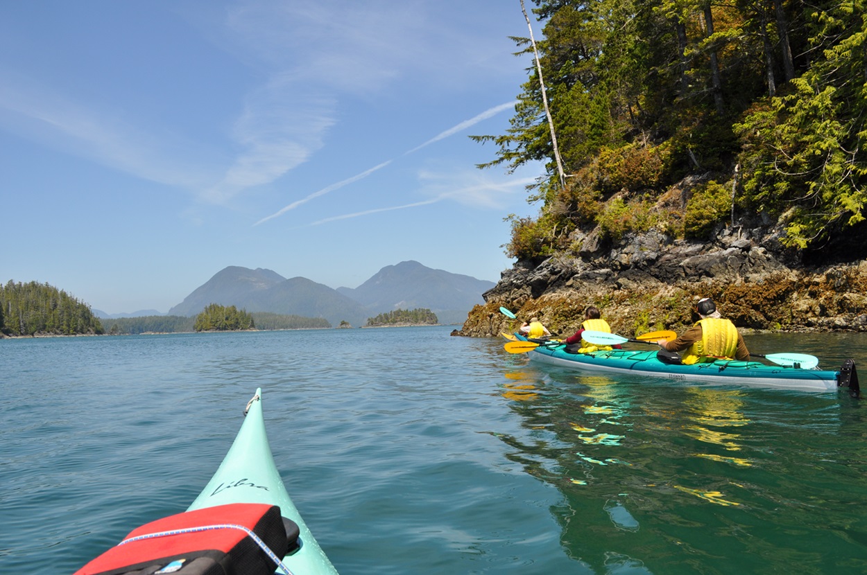
-
Article
Norfolk County
Norfolk County, Ont, incorporated as a city in 2001, population 63 175 (2011c), 62 563 (2006c). The City of Norfolk County is located 56 km southwest of Hamilton and 97 km southeast of London.
"https://d2ttikhf7xbzbs.cloudfront.net/media/media/6928ba8e-68f0-4309-a242-259e8cc1000b.jpg" // resources/views/front/categories/view.blade.php
https://d2ttikhf7xbzbs.cloudfront.net/media/media/6928ba8e-68f0-4309-a242-259e8cc1000b.jpg