Share on Facebook
 Share on X
 Share by Email
 Share on Google Classroom
Alberta is divided by three of Canada’s seven physiographic regions. These three regions are the Cordillera, Interior Plains and Canadian Shield. However, the vast majority of the province falls within the Interior Plains region. The Interior Plains may be further divided into prairie grassland, parkland and boreal forest. The prairie portion includes most of southern Alberta. This gently rolling grassland is relatively dry and mostly treeless. The parkland region predominates in central Alberta. This area varies from the flatland of old lake bottoms to rolling landscape with numerous lakes and depressions. The boreal forest region covers the northern half of the province. Here great rivers and lakes dominate the landscape, draining northward to the Arctic Ocean. In Alberta’s southwest corner an area of foothill ridges rise to the Rocky Mountains, forming part of Canada’s Cordillera region.

Geology
Alberta’s oldest surface landscape is its extreme northeastern part, east of the Slave and lower Athabasca rivers. Here, crystalline rocks formed during the Precambrian era (4.6 billion to 541 million years ago) appear at the surface. This small outcrop of the Canadian Shield does not end in the northeast. Its rocks form a basement under the rest of the province.
During the Paleozoic era (540 to 252 million years ago) Alberta alternated between dry land and sea. Life evolved from simple plants and animals to vertebrates and dryland vegetation. The decay of this plant and animal life, especially during the Devonian period (419 to 359 million years ago), formed the basis of most of the province’s oil and natural gas deposits.

The Mesozoic era (252 to 66 million years ago) also subjected Alberta to alternating upraisings of the land and infloodings of ocean waters. This was the era of the dinosaurs. Geological processes during this period created the badland formations of the Red Deer River valley. They also formed most of the province’s coal resources.
The Cenozoic era (66 million years ago to the present) saw the uplifting of the Rocky Mountains. About 25,000 years ago the last advance of continental ice scoured the terrain. The ice covered virtually the entire province. Only the highest parts of the Rockies, the Cypress Hills and the Porcupine Hills escaped. The final retreat of the ice age, beginning about 13,000 years ago, created the current river systems and soils.
Surface

The prairie region of southern Alberta includes both short-grass and mixed-grass characteristics. The short-grass area in the southeastern corner features short, drought-resistant grasses. These grasses include blue grama. Blue grama grows on light brown soil deficient in nitrogen and phosphorus, and about 12 cm deep. Annual water deficiency and wind erosion cause considerable soil drifting. The mixed-grass area forms an arc to the west and north of the short-grass region. It contains more fertile, dark brown soil. Western wheat grass and other taller grasses grow in this area.
The parkland regions of central Alberta and the Peace River country are characterized by tall grasses and aspen trees. The central parkland contains fertile black soils. The grey soils of the Peace River area are slightly less fertile.
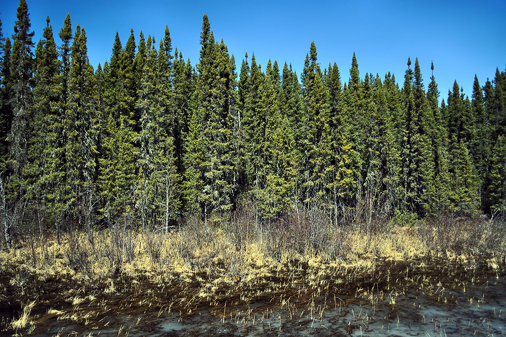
The boreal region of northern Alberta includes forests of aspen and white birch in the south, and white spruce, larch and black spruce farther north. Balsam fir and jack pine are also found in eastern areas. Alpine fir and lodgepole pine grow in the west. Nutrient-deficient grey soils underlie the forest cover. Alpine fir, white spruce and lodgepole pine dominate the lower elevations of the Rocky Mountains. At higher elevations, scattered stands of black spruce and alpine larch are interspersed with lichens and alpine flowers in alpine meadows. Rock, permanent snow cover and glacial ice dominate the highest elevations.
Water
The small Milk River basin in southeastern Alberta drains through the Missouri and Mississippi rivers south to the Gulf of Mexico. The rest of southern Alberta is drained by the South and North Saskatchewan river basins east to Hudson Bay via the Nelson River system. Northern Alberta is dominated by the Athabasca, Hay and Peace river basins. These basins drain north through the Mackenzie River to the Arctic Ocean.
Low annual precipitation, high evaporation rates and fast runoff produce chronic water deficits in southern Alberta. These water deficits vary from a moderate deficiency in the parkland region to a severe shortage in the short-grass prairie area. Irrigation has been used in the latter area since the late 19th century. Still, the amount of water available for irrigation is limited by the water flow in the South Saskatchewan River basin.
Lake Claire and Lesser Slave Lake are the two largest lakes entirely within Alberta.
Climate

Alberta’s northerly latitude puts the province in the northern cool-temperate zone. The province has cold winters and relatively short, cool summers. Yet the most important factors in determining both temperatures and precipitation are the height and width of the Rocky Mountains, as well as the direction of the prevailing winds.
The mountain ranges intercept air moving in from the Pacific Ocean and drain it of moisture. For this reason, the Rockies’ eastern slopes are in a rain shadow, and Alberta’s skies are predominantly clear. Precipitation is generally low. It ranges from about 30 cm annually in the southeast to 40–45 cm in the north. The exception is the foothills region, where precipitation reaches 55–60 cm annually.
The dry, clear air provides Albertans with plenty of sunshine. Annual sunshine averages range from 1,900 annual hours in the north to 2,300 in the Lethbridge area in the south. Air funnelling through the Rockies also produces warm, dry chinook winds. These winds are especially strong and prevalent in southwestern Alberta. Chinooks can raise temperatures dramatically within hours, melting snow and exposing grass.
Did you know?
An Alberta Clipper is a type of low-pressure weather system that forms in Alberta or nearby, on the eastern side of the Rocky Mountains. It is a fast-moving storm, hence the name “clipper,” which refers to 19th-century ships known for their speed. Such storms mostly occur in December and January but are common in the fall and spring, too. They form about 5–20 times per season.
The influence of the Pacific air mass weakens in eastern Alberta. Instead, continental air masses originating in the Arctic and mid-western US influence this part of the province. These air masses bring January mean temperatures ranging from -8°C in the south to -24°C in the north. July mean temperatures range from 20°C in the south to 16°C in the north. The growing season lasts about 120 days in southern Alberta, decreasing to 60 days in the north. In the north the shorter season is offset by longer days and lower altitudes. Wheat is grown as far north as the Peace River.
Resources
Alberta is Canada’s foremost energy-resource province. It is home to the largest oil reserve in the country, called the oil sands. It is also home vast amounts of natural gas and coal. Alberta also possesses much of the country’s farmable land.
Conservation
Two of Alberta’s five national parks began as wildlife sanctuaries. Elk Island (east of Edmonton) and Wood Buffalo (44,802 km2 straddling the border with the Northwest Territories) were created to help the species whose names they bear. Both parks have had success preserving plains bison. A number of provincial parks and wilderness areas function as wildlife reserves, including Cypress Hills Interprovincial Park in the southeast, Sir Winston Churchill Park on Lac La Biche and Willmore Wilderness Park north of Jasper. ( See also National Parks of Canada ; Environmental and Conservation Movements.)