Browse "Roads & Highways"
-
Article
Alaska Highway
The Alaska Highway was constructed from 1942 to 1943 during the Second World War. It went from Dawson Creek, British Columbia to Alaska.
"https://d2ttikhf7xbzbs.cloudfront.net/media/media/a05d65be-42fb-40dd-8b0f-a3a3f4b44506.jpg" // resources/views/front/categories/view.blade.php
https://d2ttikhf7xbzbs.cloudfront.net/media/media/a05d65be-42fb-40dd-8b0f-a3a3f4b44506.jpg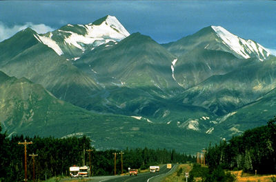
-
Article
Bus Transportation
The word "bus," short for omnibus, refers to any self-propelled road vehicle capable of carrying more persons than a private automobile.
"https://development.thecanadianencyclopedia.ca/images/tce_placeholder.jpg?v=e9dca980c9bdb3aa11e832e7ea94f5d9" // resources/views/front/categories/view.blade.php
https://development.thecanadianencyclopedia.ca/images/tce_placeholder.jpg?v=e9dca980c9bdb3aa11e832e7ea94f5d9
-
Article
Coquihalla Highway
The Coquihalla follows the old cattle trails in BC (Corel Professional Photos). Coquihalla Highway is the largest of 4 routes connecting the Vancouver area with interior centres. Built to enhance regional tourism and to lighten traffic on the busy trucking routes, the 303 km, 4-lane highway has 3 segments. The 115 km section between Hope and Merritt follows earlier cattle trails (1876), the Kettle Valley Railway (1913-59) and oil and gas industry pipelines (begun 1958)...
"https://development.thecanadianencyclopedia.ca/images/tce_placeholder.jpg?v=e9dca980c9bdb3aa11e832e7ea94f5d9" // resources/views/front/categories/view.blade.php
https://development.thecanadianencyclopedia.ca/images/tce_placeholder.jpg?v=e9dca980c9bdb3aa11e832e7ea94f5d9
-
Article
Dawson Road
Dawson Road, a trail running from the northwest corner of LAKE OF THE WOODS to Fort Garry [Winnipeg], a distance of about 120 km, was the western end of the "Dawson Route," an all-Canadian route from Thunder Bay to
"https://d2ttikhf7xbzbs.cloudfront.net/media/media/64bbd51d-6212-4004-98a5-caa045d12fb0.jpg" // resources/views/front/categories/view.blade.php
https://d2ttikhf7xbzbs.cloudfront.net/media/media/64bbd51d-6212-4004-98a5-caa045d12fb0.jpg
-
Article
Dempster Highway
The Dempster Highway runs from near Dawson, YT, 730 km across the northern Yukon through the Richardson Mountains to Fort McPherson and Inuvik, in the Mackenzie Delta of the Northwest Territories. Begun in 1959, it was the
"https://development.thecanadianencyclopedia.ca/images/tce_placeholder.jpg?v=e9dca980c9bdb3aa11e832e7ea94f5d9" // resources/views/front/categories/view.blade.php
https://development.thecanadianencyclopedia.ca/images/tce_placeholder.jpg?v=e9dca980c9bdb3aa11e832e7ea94f5d9
-
Editorial
Far Out on the Left Coast: British Columbia's Sense of Isolation and Belonging
The following article is an editorial written by The Canadian Encyclopedia staff. Editorials are not usually updated.
"https://d2ttikhf7xbzbs.cloudfront.net/media/media/7b06d87e-9726-4b65-b3c8-96f77dd85c63.jpg" // resources/views/front/categories/view.blade.php
https://d2ttikhf7xbzbs.cloudfront.net/media/media/7b06d87e-9726-4b65-b3c8-96f77dd85c63.jpg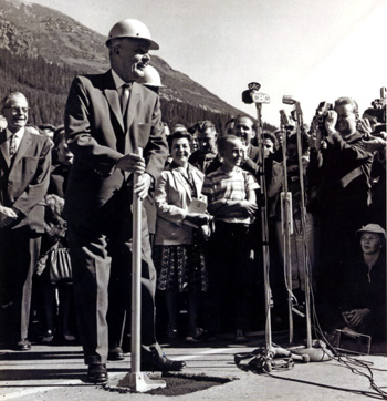
-
Article
Motor Vehicle Disasters in Canada
Numerous tragedies have unfolded on Canadian roads and highways, the deadliest being a bus crash that killed 44 people in Quebec in 1997. Despite the death toll in such headline-grabbing disasters, Canada’s motor vehicle fatality and injury rates are steadily declining, thanks to engineering improvements in vehicles, and the increasing promotion and awareness of safe driving practices.
"https://d2ttikhf7xbzbs.cloudfront.net/media/Twitter_Cards/humboldt-1.png" // resources/views/front/categories/view.blade.php
https://d2ttikhf7xbzbs.cloudfront.net/media/Twitter_Cards/humboldt-1.png
-
List
Iconic Streets in Canada
Every city has a few streets that stand out above the rest. Perhaps they’re a shopping haven, like Vancouver’s Robson Street, or lined with landmarks, like Ottawa’s Sussex Drive. Other roads earned their fame as the site of a rebellion or a gold rush. Below is a list of ten of Canada’s most iconic streets, but there are many more. What street tells the story of your city?
"https://d2ttikhf7xbzbs.cloudfront.net/media/new_article_images/IconicStreets/SaintLaurentBlvd.jpg" // resources/views/front/categories/view.blade.php
https://d2ttikhf7xbzbs.cloudfront.net/media/new_article_images/IconicStreets/SaintLaurentBlvd.jpg
-
Article
Liard Highway
Liard Highway is an all-weather road linking northern British Columbia and the Northwest Territories. Beginning 27 km north of Fort Nelson on the Alaska Highway, it runs 400 km north to join the Mackenzie Highway a short distance south of Fort Simpson, NWT.
"https://development.thecanadianencyclopedia.ca/images/tce_placeholder.jpg?v=e9dca980c9bdb3aa11e832e7ea94f5d9" // resources/views/front/categories/view.blade.php
https://development.thecanadianencyclopedia.ca/images/tce_placeholder.jpg?v=e9dca980c9bdb3aa11e832e7ea94f5d9
-
Article
Mackenzie Highway
Eighty km northwest of Enterprise, a ferry connects with the highway to Yellowknife, and connecting roads to the east serve Fort Resolution and Fort Smith. The section from Enterprise to Hay River is now a separate highway. First built as an all-weather road, some of its length has been paved.
"https://d2ttikhf7xbzbs.cloudfront.net/media/media/2862aeaf-cace-4b85-aac6-6d4f4ad9c96e.jpg" // resources/views/front/categories/view.blade.php
https://d2ttikhf7xbzbs.cloudfront.net/media/media/2862aeaf-cace-4b85-aac6-6d4f4ad9c96e.jpg
-
Article
Native People's Caravan
The Native People’s Caravan was a cross-country mobile protest that took place in 1974. Its main purpose was to raise awareness about the poor living conditions and discrimination experienced by Indigenous peoples in Canada. It travelled from Vancouver to Ottawa, where the subsequent occupation of a vacant warehouse on Victoria Island, near Parliament Hill, extended into 1975. The caravan brought various Indigenous groups together in protest of broken treaties, as well as a lack of government-supported education, housing and health care. As a result, meetings between Cabinet ministers and Indigenous leaders became more frequent. The protest is remembered as an important turning point in Indigenous activism in Canada.
"https://d2ttikhf7xbzbs.cloudfront.net/media/media/e9e4a925-a033-404d-9819-a3bb46fe9c8e.jpg" // resources/views/front/categories/view.blade.php
https://d2ttikhf7xbzbs.cloudfront.net/media/media/e9e4a925-a033-404d-9819-a3bb46fe9c8e.jpg
-
Article
Queen Elizabeth Way
Queen Elizabeth Way, connecting Toronto with Niagara Falls and Fort Erie, Ont, was Canada's first 4-lane, controlled-access superhighway.
"https://development.thecanadianencyclopedia.ca/images/tce_placeholder.jpg?v=e9dca980c9bdb3aa11e832e7ea94f5d9" // resources/views/front/categories/view.blade.php
https://development.thecanadianencyclopedia.ca/images/tce_placeholder.jpg?v=e9dca980c9bdb3aa11e832e7ea94f5d9
-
Article
Roads and Highways
Canada's first highways were the rivers and lakes used by Indigenous peoples, travelling by canoe in summer and following the frozen waterways in winter. (See also Birchbark Canoe; Dugout Canoe.) The water network was so practical that explorers, settlers and soldiers followed the example of the Indigenous peoples. (See also Coureurs des bois; Voyageurs.) To a greater extent than most other countries, Canada depends for its social, economic and political life on efficient communication and transportation. (See also Economy; Politics.)
"https://d2ttikhf7xbzbs.cloudfront.net/media/media/a2f5cb61-ed14-46ed-9cea-f9bdc1ee18bd.jpg" // resources/views/front/categories/view.blade.php
https://d2ttikhf7xbzbs.cloudfront.net/media/media/a2f5cb61-ed14-46ed-9cea-f9bdc1ee18bd.jpg
-
Article
Toronto Feature: Gardiner Expressway
This article is from our Toronto Feature series. Features from past programs are not updated.
"https://d2ttikhf7xbzbs.cloudfront.net/media/media/a56bbbf8-c568-4a5a-b6b9-d5398e088667.jpg" // resources/views/front/categories/view.blade.php
https://d2ttikhf7xbzbs.cloudfront.net/media/media/a56bbbf8-c568-4a5a-b6b9-d5398e088667.jpg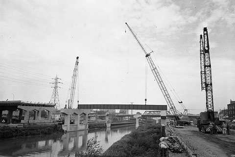
-
Article
Toronto Feature: Queen Elizabeth Way
This article is from our Toronto Feature series. Features from past programs are not updated.
"https://d2ttikhf7xbzbs.cloudfront.net/media/media/092556bf-9fce-49e6-9f86-ece58c99b46e.jpg" // resources/views/front/categories/view.blade.php
https://d2ttikhf7xbzbs.cloudfront.net/media/media/092556bf-9fce-49e6-9f86-ece58c99b46e.jpg