Browse "Places"
-
Article
Yellowhead Pass
Yellowhead Pass, elev 1133 m, crosses the continental divide between Alberta and BC, 25 km W of JASPER. The Miette R flows E from the pass to meet the Athabasca R at Jasper. Yellowhead Lk, on the W side, empties into the Fraser River.
"https://development.thecanadianencyclopedia.ca/images/tce_placeholder.jpg?v=e9dca980c9bdb3aa11e832e7ea94f5d9" // resources/views/front/categories/view.blade.php
https://development.thecanadianencyclopedia.ca/images/tce_placeholder.jpg?v=e9dca980c9bdb3aa11e832e7ea94f5d9
-
Article
Yellowknife
Yellowknife, Northwest Territories, incorporated as a city in 1970, population 20,340 (2021 census), 19,569 (2016 census). The city of Yellowknife is the capital of the Northwest Territories and the territory's only city. It sits on the Canadian Shield, on the north shore of Great Slave Lake, and about 400 km south of the Arctic Circle. Due to its northerly location, Yellowknife is the Canadian city with the most hours of summer sunshine, averaging 1,030 hours per year. The city and Yellowknife Bay were named after the Yellowknives, a Dene band who lived on the islands of Great Slave's East Arm and travelled as far north as the Arctic coast to obtain copper for knives and other implements. They, in turn, acquired their name from the copper-bladed knives they carried.
"https://d2ttikhf7xbzbs.cloudfront.net/media/media/59ab5c6b-7f7b-4307-ae04-bb0ce522fe38.jpg" // resources/views/front/categories/view.blade.php
https://d2ttikhf7xbzbs.cloudfront.net/media/media/59ab5c6b-7f7b-4307-ae04-bb0ce522fe38.jpg
-
Article
Yoho National Park
Yoho National Park is a protected area located in the Rocky Mountains, in the southeast corner of British Columbia. The park was established in 1886, initially as the Mount Stephen reserve, making it (along with Glacier National Park, established the same day) the second oldest national park in Canada, following Banff. Spanning 1,313 km2 the park features 28 mountain peaks above 3,000 metres. Yoho National Park is one of seven parks in the Rocky Mountains that make up the Canadian Rocky Mountains UNESCO World Heritage site (the others are Jasper, Banff and Kootenay national parks, and Mount Robson, Mount Assiniboine and Hamber provincial parks). Among the reasons for the UNESCO designation are the Burgess Shale sites, several of which are located in Yoho National Park, featuring fossils from 540 million years ago. The name Yoho comes from a Cree expression of awe and wonder.
"https://d2ttikhf7xbzbs.cloudfront.net/media/new_article_images/Yoho National Park-3.jpg" // resources/views/front/categories/view.blade.php
https://d2ttikhf7xbzbs.cloudfront.net/media/new_article_images/Yoho National Park-3.jpg
-
Editorial
Yonge Street - Governor Simcoe's Military Road
The following article is an editorial written by The Canadian Encyclopedia staff. Editorials are not usually updated.
"https://d2ttikhf7xbzbs.cloudfront.net/media/media/22b37e39-8f50-4238-a772-5deb2a69a9b3.jpg" // resources/views/front/categories/view.blade.php
https://d2ttikhf7xbzbs.cloudfront.net/media/media/22b37e39-8f50-4238-a772-5deb2a69a9b3.jpg
-
Article
York
York, Ont, is an urban community within the city of TORONTO and is separated from Etobicoke by the Humber River.
"https://development.thecanadianencyclopedia.ca/images/tce_placeholder.jpg?v=e9dca980c9bdb3aa11e832e7ea94f5d9" // resources/views/front/categories/view.blade.php
https://development.thecanadianencyclopedia.ca/images/tce_placeholder.jpg?v=e9dca980c9bdb3aa11e832e7ea94f5d9
-
Article
York Factory
York Factory, also known as York Fort, Fort Bourbon by the French, and Kischewaskaheegan by some Indigenous people, was a trading post on the Hayes River near its outlet to Hudson Bay, in what is now Manitoba. During its life, it served as a post and later as a major administrative centre in the Hudson’s Bay Company’s fur trade network. It also bore witness to the largest naval battle to take place in Arctic Canada, the Battle of Hudson Bay in 1697.
"https://d2ttikhf7xbzbs.cloudfront.net/YorkFactory1853.jpg" // resources/views/front/categories/view.blade.php
https://d2ttikhf7xbzbs.cloudfront.net/YorkFactory1853.jpg
-
Article
Yorkton
Although the York colony eventually faded, large numbers of immigrants from across Europe settled in the area. Of particular significance were the early UKRAINIANS and DOUKHOBORS who formed a large portion of the population.
"https://d2ttikhf7xbzbs.cloudfront.net/media/media/9dde7de9-5182-4dab-a6b3-f141ce3c9272.jpg" // resources/views/front/categories/view.blade.php
https://d2ttikhf7xbzbs.cloudfront.net/media/media/9dde7de9-5182-4dab-a6b3-f141ce3c9272.jpg
-
Article
Yukon
The name Yukon comes from the Gwich’in word Yu-kun-ah meaning "great river" and is a reference to the Yukon River. Lying in the northwestern corner of Canada and isolated by rugged mountains, the Yukon borders Alaska to the west, British Columbia to the south and the Northwest Territories to the east. Historically, it is indelibly associated with the great Klondike Gold Rush.
"https://d2ttikhf7xbzbs.cloudfront.net/media/article_files/yukon/Yukon-Sign.jpg" // resources/views/front/categories/view.blade.php
https://d2ttikhf7xbzbs.cloudfront.net/media/article_files/yukon/Yukon-Sign.jpg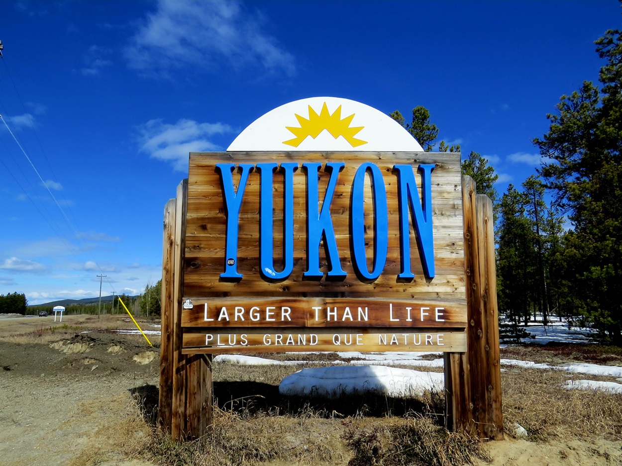
-
Timelines
Yukon
Lying in the northwestern corner of Canada and isolated by rugged mountains, the Yukon borders Alaska to the west, British Columbia to the south and the Northwest Territories to the east. Historically, it is indelibly associated with the great Klondike Gold Rush.
"https://d2ttikhf7xbzbs.cloudfront.net/media/media/fcaa1cbf-b998-4bea-aea8-95e86b2e468d.jpg" // resources/views/front/categories/view.blade.php
https://d2ttikhf7xbzbs.cloudfront.net/media/media/fcaa1cbf-b998-4bea-aea8-95e86b2e468d.jpg
-
Article
Yukon River
At 3,185 km (1,149 km of which lie in Canada), the Yukon River is among the longest rivers in the country (see also Longest Rivers in Canada). Its headwaters are in the northwest corner of British Columbia, at the province’s border with the Yukon. It flows north and northwest across the Yukon into Alaska, then west to Norton Sound on the Bering Sea. Within the large central plateau of the Yukon, ringed by the Mackenzie Mountains to the east and the St. Elias range to the southwest, the Yukon River and its tributaries form the region’s dominant drainage basin.
"https://d2ttikhf7xbzbs.cloudfront.net/media/media/ff363965-bf2f-46bd-b393-88e9847456fa.jpg" // resources/views/front/categories/view.blade.php
https://d2ttikhf7xbzbs.cloudfront.net/media/media/ff363965-bf2f-46bd-b393-88e9847456fa.jpg