Baffin Island, Nunavut, 507,451 km2, 1,500 km long and 200–700 km wide, is the largest island in Canada and the fifth-largest island in the world. Located in Nunavut in the Arctic Archipelago, it is separated from Greenland by Davis Strait and Baffin Bay, from northern Québec by Hudson Strait, and from the Melville Peninsula by the Foxe Basin and the narrow Fury and Hecla Strait. The island's immensity and bewildering coastline confused early explorers and concealed its geography until recent times.
Geology
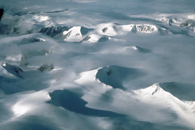
It was likely here that one of the great ice sheets that covered most of Canada originated some 18,000 years ago, and ice lingered on the island until almost 1,500 years ago. Vast areas are still sheathed in ice year-round.
Geologically, Baffin Island is a continuation of the eastern edge of the Canadian Shield, which tilts upward in the east to form a mountainous spine, sloping away into plateaus and lowlands in the west. Its east coast is deeply indented by Cumberland Sound and Frobisher Bay. A desolate plateau in the north comprises the Brodeur and Borden peninsulas, separated by Admiralty Inlet — thought to be one of the world's largest fjords. From south of the Hantzsch River to Foxe Peninsula is the remarkable Great Plain of the Koukdjuak, consisting of a coastal strip of flat, grassy marshland and a slightly higher plain showing a series of old beaches. The Foxe Peninsula is rocky in the south and drops over dramatic bluffs to the sea on the west coast. There are numerous freshwater lakes on the island, including Nettilling (5,542 km2) and Amadjuak (3,115 km2).
Ecology
Wildlife
Baffin Bay is the wintering ground for narwhal, walrus, beluga and bowhead whales, as well as bearded and harp seals. The island is also the nesting ground for millions of birds, including thick-billed murres, kittiwakes and fulmars. The Dewey Soper Migratory Bird Sanctuary protects the summer nesting area for some 2 million migratory birds.
A 2012 survey of the South Baffin caribou confirmed reports by elders and hunters that there has been a serious decline in herds, which had numbered some 60–180,000 in the early 1990s. Communities on the island have expressed concerns about the negative impacts of land use and other factors on caribou and their habitat. The survey cites climate change, disease and economic activities, including mineral development, as possible threats to the herd.
Environmental Concerns
The effects of climate change on the Arctic are of growing concern. Various studies document these changes, including a 2009 study of sediment in a lake on Baffin Island. By studying the sediment, scientists were able to examine changes in the environment over a period of 200,000 years. Up until the 20th century, the environmental shifts could be explained by natural processes. However, beginning in the 20th century the lake sediment revealed environmental changes deviating from the natural trajectory of the last 200,000 years. Scientists attributed these changes to human-induced warming.
History
Early Settlement and Exploration
Around 2000 BCE the peoples of the Pre-Dorset Culture began to establish themselves in northern Baffin Island. These peoples were succeeded by the Dorset Culture, so named because the first physical evidence of this culture was found near Cape Dorset off the island's southwestern coast. Between the 11th and 13th centuries the Thule spread over the island displacing the Dorset.
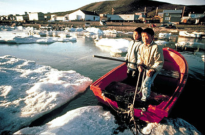
Baffin Island was probably visited by Norse seafarers at the turn of the 11th century, and is likely the Helluland of the Viking sagas. The English arrived off the coast in the 16th century. Martin Frobisher reached the island in 1576 and met the descendants of the Thule, the Baffin Island Inuit.
Frobisher made two more voyages (1577 and 1578), carting back to England loads of worthless ore he thought was gold. John Davis led three expeditions to the area (1585, 1586 and 1587), each taking him to Cumberland Sound. William Baffin, for whom the island is named, charted the east coast in 1616, and Luke Fox penetrated Foxe Channel in 1631.
Despite these successful explorations, the island's bays and fjords continued to perplex navigators seeking a Northwest Passage, and Baffin Bay was not rediscovered until 1818. Sir William Parry explored the west coast in 1821–23. He was followed by Scottish and New England whalers who established whaling stations in Cumberland Sound (on Kekerten and Blacklead islands) in the late 1850s. Sailors' graves and relics of the whaling, which lasted until the early 20th century, have been uncovered at Kivitoo on the Davis Coast. The Anglican Church set up missions at the whaling stations and the Hudson's Bay Company established its first post on the island at Lake Harbour (now Kimmirut) in 1911.
German scientists built a meteorological station on Kingua Fjord (now Clearwater Fjord) at the head of Cumberland Sound in 1882–83. Anthropologist Franz Boas wintered at Kekertuk in the winter of 1883–84 and was able to sketch a reasonably accurate map of the whole island. Robert Bell was the first to do a Canadian survey, which took him along the southern coast in 1897. Joseph-Elzéar Bernier wintered at Pond Inlet in 1906–07 and Arctic Bay in 1910. From 1909 until his death, Bernhard Hantzsch surveyed the interior of southern Baffin Island and the Foxe Basin coast. He died at his base camp at the mouth of the river that now bears his name.
Present Day
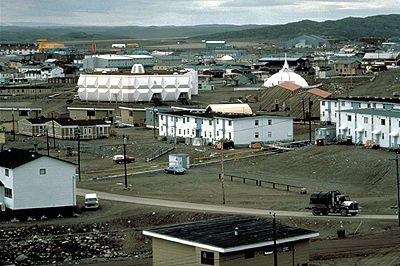
At the head of Frobisher Bay on the southern part of the island lies Iqaluit, the capital of Nunavut. Significant quantities of lead, zinc and silver were mined at Nanisivik (1976–2002) and shipped to smelters in southern Canada. The hamlet of Pangnirtung is the southern gateway to Auyuittuq National Park, Canada's first national park north of the Arctic Circle, while the hamlet of Qikiqtarjuaq is the park's northern gateway. The park contains some of the island's most spectacular scenery, including Pangnirtung Pass (a 100 km U-shaped trench), glaciers, lakes, waterfalls and the 2,143 m peak Mount Odin. Much of Sirmilik National Park, on the northwestern part of the island, is covered in glaciers; hence its Inuktituk name meaning “place of glaciers.” The park can be reached from Pond Inlet and Arctic Bay.
There are also a number of provincial and historical parks on Baffin Island including Kekerten, Katannilik, Sylvia Grinnell, Mallikjuaq (featuring Dorset Culture sites) and Qaummaarviit (featuring Thule sites). Clyde River lies on the island's northeastern coast, which is heavily indented with fjords. The hamlet is becoming a staging area for adventurers attracted to the area's fjords, particularly the sheer cliffs of Sam Ford Fjord.
Economic development of Baffin Island is fraught with environmental concerns and international economic uncertainty. The iron ore deposits of the Mary River Property on North Baffin Island in the Qikqtani Region is one of the largest iron ore developments in Canada. The feasibility of developing diamond resources at Chidliak, located 120 km northeast of Iqaluit, is also being explored.

 Share on Facebook
 Share on X
 Share by Email
 Share on Google Classroom


