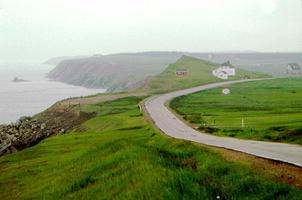
Cape Breton Island, Nova Scotia, 10 311 km2, a rugged and irregularly shaped island, approximately 175 km long by 135 km at its widest, is located at the eastern extremity of the Gulf of St. Lawrence. Its land mass slopes upward from south to north, culminating in the massive highlands of its northern cape, the highest elevation in the Atlantic region. A saltwater lake (the Bras d'or) forms the island's core and has provided the only significant access to its interior for purposes of settlement. Divided politically into four counties - Cape Breton, Inverness, Richmond and Victoria - it is separated from mainland NS by the narrow Strait of Canso (bridged by a 2 km causeway in 1955), and from neighbouring Newfoundland by the 110 km wide Cabot Strait. Its name likely derives from the Basque Cap Breton, a location near Bayonne, France.
One-fifth of Nova Scotia's total population live on Cape Breton Island, but over 70 per cent live in industrialized Cape Breton County, which has been steadily declining in numbers since the Second World War. Its principal city is Sydney, a large industrial, commercial and administrative centre, which is surrounded by a group of declining coal-mining towns, the largest of which is Glace Bay. More recently, there has been a surge of urbanization in the southeast corner of the island, where a substantial oil-refining and pulp- and paper-making industry has emerged at Port Hawkesbury, taking advantage of the large harbour created by construction of the causeway to the mainland.
History
The island was probably known to Basque fishermen as early as the 15th century and was sighted and identified by John Cabot (1497) and Jacques Cartier (1534). Claimed by the French as part of Acadia, it remained largely undeveloped and unsettled, apart from a minor role as a fur-trading and fishing outpost. When the Treaty of Utrecht, 1713, ceded most of Acadia to the British, the French retained Cape Breton, which they renamed Ile Royale. Shortly thereafter, they began construction of the fortress of Louisbourg at a small harbour along the southeast coast. For its time, it was the most imposing European-style fortress in North America. When Louisbourg and the rest of New France fell to the British during the Seven Years' War, the fortress was destroyed; the Treaty of Paris, 1763, ceded the island and France's remaining possessions in the area to the British.
Cape Breton became part of the colony of Nova Scotia in 1763, but it remained largely undeveloped until 1784, when it became a separate colony, as one of several separate jurisdictions created for the Loyalist refugees. The Loyalists, who made Sydney the capital of their new colony, were soon overwhelmed by successive waves of Scottish immigrants. They occupied most of the available arable land along the seacoasts and around Bras d'Or Lake, and with a few hundred returning Acadians made up the bulk of the island's largely rural population, which subsisted mostly on farming and the inshore fishery. In 1820 the island was reunited to the jurisdiction of NS following almost 40 years of tempestuous separate status.
Economy
The emergence of a vital and expansive coal-mining industry from the 1830s on completely transformed the island economy. The mines surrounding Sydney harbour attracted the excess population of the already overpopulated rural areas and weighted the island towards the industrial base emerging in Cape Breton County. While the area was the most dynamic growth zone in the Atlantic region up to WWI, its boom was short-lived. When the coal mines were depleted and the steel mill became obsolete, the central Canadian capitalists who had come to dominate the industrial advance abandoned the area for greener fields, leaving the industrial sector to survive on a succession of inadequate subventions from federal and provincial governments. The result was a heritage of industrial decline, labour unrest and a massive out-migration.
Today the island is recovering somewhat. New coal seams are being exploited and the industry has rebounded somewhat from its post-WWII collapse. Smaller industries have taken root to some extent, and the rebirth of the fishery and an expanding pulp and paper industry has combined with the oil refineries and the promise of offshore petroleum resources in pointing to a better future. Despite continuing high unemployment (15.1 per cent in July 1987), investment in Cape Breton doubled between 1980 and 1986 (to more than $95 million).
Institutions
Cape Breton has a proud Scottish heritage that finds expression in lively performing arts and a commitment to maintaining traditional crafts. In addition, there are several important educational and cultural institutions: Cape Breton University in Sydney, the Miners' Memorial Museum in Glace Bay, the Alexander Graham Bell Museum in Baddeck and Fortress Louisbourg (a magnificent reconstruction of the 18th-century site). Cape Breton Highlands National Park preserves the rugged beauty of the island's northern cape, around which curves the scenic Cabot Trail.

 Share on Facebook
 Share on X
 Share by Email
 Share on Google Classroom


