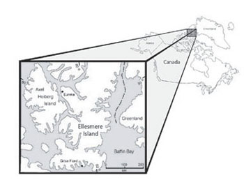
The Innuitian Region (also known as the Innuitian Orogen) is one of Canada’s six geological regions. It is part of an arc of geologically younger, layered sedimentary rock that surrounds the stable, ancient Canadian Shield. It comprises a triangle-shaped area of 540,000 km2 between the Shield and the Arctic Ocean, most commonly referred to as the Queen Elizabeth Islands. The name comes from the word Inuit, the Inuktitut word for people.
Topography
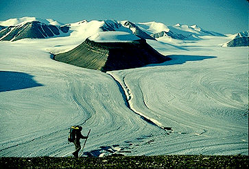
The Innuitian Orogen is Canada’s most northern region. The area is dominated by mountains and glaciers. The Innuitian mountain range extends for 1,300 km through the Queen Elizabeth Islands, and includes peaks reaching upwards of 2,500 m on Ellesmere Island.
Geological History
The region’s formation began in the Cambrian Period, when an ocean-covered area of subsidence and sedimentation bordered the northern edge of the Canadian Shield. Deformation occurred in the Middle Devonian Period, thrusting up a belt of mountains that today stretch in an arc from northeastern Ellesmere Island through Axel Heiberg Island, before progressively broadening and flattening into the plateaus of the western Parry Islands.

About 330 million years ago, the Sverdrup Basin developed as a regional depression in which successive formations were built up over 270 million years to thicknesses as great as 12,250 m. During the opening up of the Arctic Basin these rocks were subjected to enormous forces, being pushed towards the unyielding Canadian Shield then folding and buckling into a chain of mountains running 2,250 km from northwestern Ellesmere Island through the mountains of central and western Axel Heiberg Island. Less-disturbed Sverdrup sedimentary rocks now form shale and sandstone lowland areas of rolling topography. A narrow strip of thin, unconsolidated sand and gravel deposits is found along the Arctic Ocean coast.

 Share on Facebook
 Share on X
 Share by Email
 Share on Google Classroom


