Share on Facebook
 Share on X
 Share by Email
 Share on Google Classroom
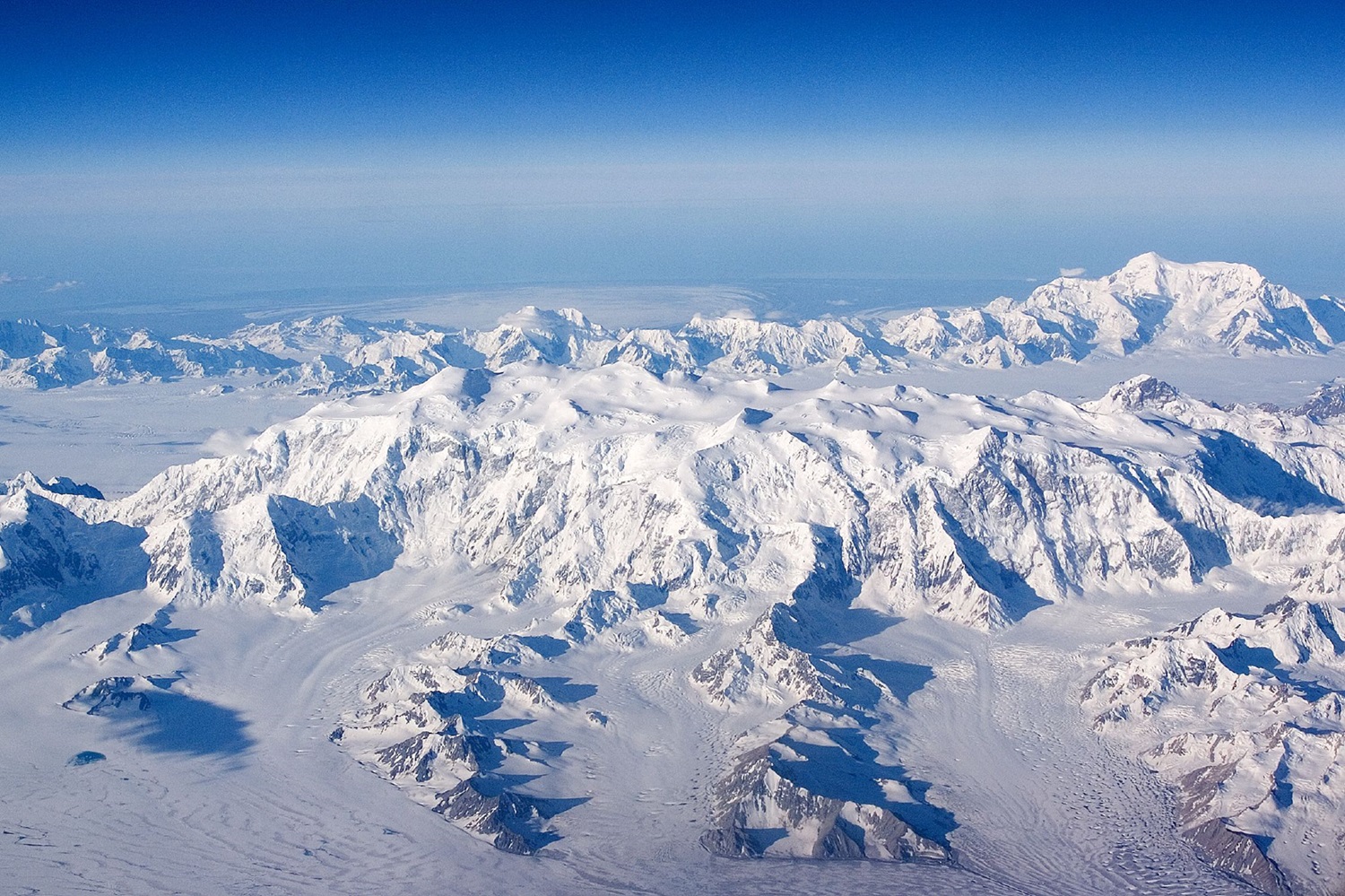
The Kluane Ranges are a chain of mountains in the Yukon that run parallel to Haines Road and the Alaska Highway. The Kluane Ranges extend 350 km northwest from the easternmost St. Elias Mountains in the Yukon to the Tatshenshini River just beyond the Yukon-Alaska boundary.

Description
The Kluane Ranges rise in a wall-like front at the southwestern edge of Shakwak Valley to 2,000–2,800 m and are bordered on the west by a succession of valleys and plateaus collectively known as the Duke Depression. Several large valleys drained by wide, braided rivers cut across the ranges. Although not as high as the Icefield Ranges farther west, the Kluane Ranges show a unique ruggedness typified by serrated narrow ridges, steep slopes and long talus screes. The Kluane Ranges and the Icefield Ranges make up the St. Elias Mountains, some of Canada's largest and most impressive mountains. They are sculpted mainly from Palaeozoic and Mesozoic volcanic and sedimentary rocks laced with faults, some of which may still be active. The St. Elias Icefield is a notable feature of the St. Elias Mountains and a remnant of the last Ice Age. This icefield is the world’s largest non-polar icefield but is decreasing rapidly due to climate change.

Spruce forests are common below about 1,200 m elevation, but the upper slopes of the ranges are treeless. The area supports an abundance of wildlife, including grizzly bears, black bears, wolves, Dall sheep, mountain goats, caribou and moose. The ranges are partly within Kluane National Park and are a popular destination among hikers and climbers.