The West Island is an informal name that has come to define the largely suburban western third of the Island of Montreal. Through suburbanization, the area shares a common history, culture and identity with the city of Montreal. However, because some of the West Island’s constituent communities developed separately from Montreal and because much of the Anglophone community of Quebec is now concentrated in the West Island, the area is politically, culturally and socially distinct from the rest of Greater Montreal and Quebec in general. The West Island is predominantly composed of bedroom suburbs developed in the middle decades of the 20th century. It also features large industrial sectors, Montreal’s international airport, large nature parks and several unique institutions, including the Macdonald agricultural college of McGill University.
Boundaries
Though the exact definition of the West Island is imprecise, it is generally taken to mean the suburbs located on the western third of the Island of Montreal and the community of Île-Bizard. Natural boundaries include Lac Saint-Louis to the south, Lac des Deux-Montagnes to the west and the Rivière des Prairies to the north. The West Island’s eastern boundary, which separates it from the rest of Montreal, tends to follow (from north to south) Quebec Autoroute 13, Quebec Autoroute 520 (the Côte-de-Liesse Expressway) and 55th Avenue, the latter of which separates the independent West Island community of Dorval from its neighbour, the Montreal borough of Lachine. The Pierre Elliott Trudeau International Airport, its associated highway infrastructure and the surrounding industrial park form a substantial part of this boundary.
Constituent Communities
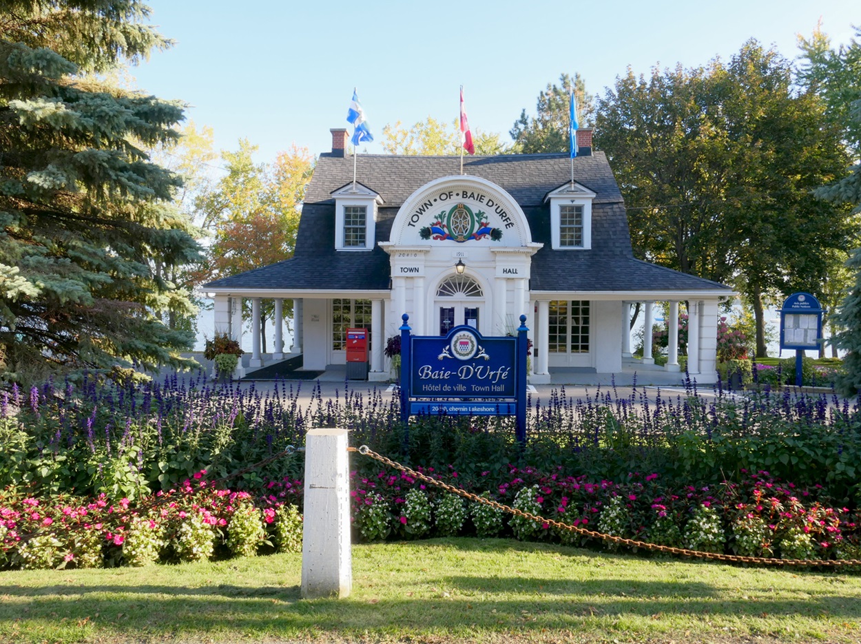
The communities generally included as part of the West Island are Senneville, Sainte-Anne-de-Bellevue, Baie-D'Urfé, Beaconsfield, Pointe-Claire, Dorval, L'Île-Dorval, Sainte-Geneviève, Pierrefonds, Kirkland, Roxboro, Île-Bizard and Dollard-des-Ormeaux. The Montreal boroughs of Lachine, LaSalle and Saint-Laurent are sometimes considered part of the West Island. The Town of Dorval Island, a small community of seasonal cottages that is only accessible by ferry from Dorval during the temperate months, is also considered to be part of the West Island.
Throughout the 20th century, the communities located in the West Island were all independent. In 2000, the Quebec government legislated municipal reorganizations throughout the province, including the forced merger of all the independent communities of the West Island with the city of Montreal. This was very unpopular with the residents of the West Island, eventually leading to demerger referendums in 2004 that were approved by the citizens of 8 out of 13 West Island communities. The communities of Pierrefonds, Roxboro, Sainte-Geneviève, and Île-Bizard did not have sufficient voter participation to reach quorum, and so remained part of the city of Montreal, albeit reorganized into the boroughs of Pierrefonds-Roxboro and L’Île-Bizard–Sainte-Geneviève.
Some of the suburbs located off the island farther west, such as the communities of Vaudreuil-Dorion, Pincourt and Hudson, are also sometimes considered part of the West Island.

History
Indigenous History
Archeological evidence collected at various sites on Montreal Island and in the Greater Montreal region indicates that various Indigenous peoples lived, hunted and regularly transited through the region at various times, stretching back at least 5,000 years. The St. Lawrence Iroquoians are believed to have lived on the Island of Montreal between about 1000 and the late 1500s CE.
17th Century
Much like the city of Montreal, the European history of the West Island extends as far back as the middle decades of the 17th century. About 25 years after the establishment of Ville Marie in 1642, the French explorer René-Robert Cavelier, Sieur de La Salle, was granted a seigneury of land on the western part of the island of Montreal. A trading post was established shortly thereafter, which would later become the community of Lachine. The adjacent community of LaSalle is named in his honour. The oldest intact building on the island of Montreal is the Le Ber-LeMoyne House, located in the borough of Lachine, which was built circa 1669–1671. Additional settlements were established during the French colonial period at Pointe-Claire and Sainte-Anne-de-Bellevue, and these would become important stops along the fur-trading route from Ville Marie into the Canadian interior. French settlement continued to expand westward from Ville Marie, leading to the creation of additional farming villages, such as Dorval and Beaurepaire (later Beaconsfield).
Two important confrontations occurred in the West Island during the Beaver Wars. First was the Haudenosaunee attack on the settlement at Lachine, also known as the Lachine Massacre, which occurred on 5 August 1689. The Battle of the Lake of Two Mountains occurred on 16 October 1689 and consisted of a retaliatory attack on a Haudenosaunee patrol. The battle took place in the present-day community of Senneville.
18th Century
Colonization of the western part of the Island of Montreal developed in earnest after the Great Peace of Montreal in 1701 ended the Beaver Wars. With the peace established, settlement could occur outside the protective walls of Ville-Marie or its numerous trading posts and outposts. The Pointe-Claire windmill, which has since become the city’s symbol, was erected circa 1709–1710. A king’s road, today called Gouin Boulevard, was laid out in the early 18th century. In 1717, a land area, the Côte-Sainte-Geneviève, was established along the northern edge of the West Island, stretching from Saint-Laurent parish in the east to Senneville in the west. It officially became a parish in 1641. A parish church was established in Sainte-Geneviève in the mid-18th century, and a new parish church (which still stands) was erected in 1843.
Fortifications for what would become Fort Senneville were constructed in 1686, at the western tip of Montreal Island to defend the settlements against attacks from First Nations coming down the Ottawa River. The fort was burned down in a 1691 Haudenosaunee attack and, in 1692, it was rebuilt with stone walls and towers. The fort was eventually destroyed by American general Benedict Arnold in 1776 during the American Revolution. The ruins of the fort remain but are located on private property.
By the middle decades of the 18th century, the West Island’s 17th-century outposts had evolved into distinct farming villages, and all the land had been divided and granted to colonists. By 1834, the principal roads of the area, many of which are still in use today, were laid out. The West Island would remain principally agricultural through to the middle decades of the 20th century. The names of the area’s farming dynasties, such as Robillard, Brunet, Meloche, Legault and Jasmin, remain numerous place names throughout the West Island.
19th Century
Nineteenth-century developments in transportation had a profound impact on the West Island. The first iteration of the Lachine Canal opened in 1825, linking Montreal’s harbour on the St. Lawrence River with Lac Saint-Louis, allowing ships to get around the Lachine Rapids and access the Great Lakes. By 1855, railway construction began extending west from Montreal as well. Land-use maps of the West Island indicate that the Grand Trunk Railway cut across the West Island by 1879. It was followed shortly after by the Canadian Pacific Railway (CP), which followed the same path. This railway corridor continues to be used by the Canadian National Railway (CN) and CP to this day. The arrival of the canal and railway would begin a transformation of land use in the West Island, from agricultural to residential, though the process would take about a century.
In 1865, future prime minister John Abbott purchased an estate in Senneville, likely the first wealthy Montrealer to buy land in the West Island for the purposes of building a summer home.
20th Century
After the First World War, a veterans’ hospital was established in Sainte-Anne-de-Bellevue. The facilities were expanded after the Second World War, including the construction of a lodge (built in Senneville) for the rehab and convalescence of veterans experiencing PTSD. A modern hospital complex opened in 1971.
Macdonald College was established in Sainte-Anne-de-Bellevue in 1907. Associated with McGill University, it started as an agricultural college, and included a School of Household Science, as well as McGill’s School for Teachers (later, the Faculty of Education). The Macdonald College continues in its latter role, while the buildings used by the Faculty of Education were leased for the creation of CEGEP John Abbott College in the early 1970s, and were eventually purchased by the College in 2002. The West Island’s first CEGEP (Quebec’s public junior colleges), John Abbott College, was named in Abbott’s honour. Today, it is the West Island’s largest educational institution.
Many of Montreal’s wealthiest families built summer homes in the West Island and funded the development of private clubs, golf courses and other sporting clubs (such as for yachting and curling).
Residential development continued in the latter decades of the 19th century on the West Island’s north shore, with a summer colony developing in the Cartierville and Saraguay sections of what would later become Saint-Laurent borough. This trend would continue into the middle decades of the 20th century when residential suburbanization would take over as the dominant development trend in the West Island. Continued developments in transportation would further shape and alter the character of the West Island, transforming it from a rural and largely agricultural area to one primed for residential development. This included the construction of the Canadian Northern Railway (later CN) across the town of Mont Royal, Saint-Laurent, and what would later become the communities of Dollard-des-Ormeaux, Roxboro and Pierrefonds. Dorval Airport, which would later become Montreal’s principal international airport, was established during the Second World War and expanded in the late 1950s and early 1960s, around the same time that highways 20 and 40 were created. With the creation of these new highways, the West Island was open for suburbanization, a process that would begin after the Second World War and continue into the early decades of the 21st century. The airport and highways 20 and 40 also stimulated the development of a large industrial sector that runs the length of the West Island.
21st Century
In 2019, Montreal announced plans for the Grand Parc de l’Ouest, a proposal to unite several nature parks and green spaces across Montreal’s West Island into a single cohesive park, accounting for roughly 30 square kilometres. The proposed park may also involve land owned by de-merged suburbs, as well as undeveloped land in private hands (such as the Morgan Arboretum—a 245-hectare forest reserve owned by McGill University and located in Sainte-Anne-de-Bellevue). If the project is fully realized, it will be the largest urban park in Canada.


 Share on Facebook
 Share on X
 Share by Email
 Share on Google Classroom


