Browse "Districts and municipalities"
-
Article
100 Mile House
100 Mile House, British Columbia, incorporated as a district municipality in 1991, population 1,980 (2016 census), 1,886 (2011 census). The district of 100 Mile House is located in the South Cariboo region of south-central British Columbia on Highway 97. It is 456 km northeast of Vancouver.
"https://d2ttikhf7xbzbs.cloudfront.net/media/new_article_images/100MileHouse/100_mile_house_1928.jpg" // resources/views/front/categories/view.blade.php
https://d2ttikhf7xbzbs.cloudfront.net/media/new_article_images/100MileHouse/100_mile_house_1928.jpg
-
Article
Acton Vale
Known as La porte de l'Estrie (Door to the Eastern Townships), Acton Vale is the county seat of the regional municipality of Acton. Its main employer is Peerless Carpets. The town's cultural life is centered on the old Grand Trunk railway station, now a tourist information bureau and art gallery. The river winds through the town offering green spaces and cycling paths.
"https://d2ttikhf7xbzbs.cloudfront.net/media/media/ace2f98d-2bc0-4992-a7c8-e67a7f9fffdc.jpg" // resources/views/front/categories/view.blade.php
https://d2ttikhf7xbzbs.cloudfront.net/media/media/ace2f98d-2bc0-4992-a7c8-e67a7f9fffdc.jpg
-
Article
Alma
Born of the lumber industry in 1860, Alma quickly became a prosperous agricultural parish. It burst into the industrial age in 1923 with the start of construction of the Isle-Maligne hydro station on the Grande Décharge.
"https://development.thecanadianencyclopedia.ca/images/tce_placeholder.jpg?v=e9dca980c9bdb3aa11e832e7ea94f5d9" // resources/views/front/categories/view.blade.php
https://development.thecanadianencyclopedia.ca/images/tce_placeholder.jpg?v=e9dca980c9bdb3aa11e832e7ea94f5d9
-
Article
Arthabaska
The founder of Arthabaska, Charles Beauchesne, arrived in 1834 and was impressed by the size of the trees and quality of the soil. The first industries were potash and maple-sugar production.
"https://d2ttikhf7xbzbs.cloudfront.net/media/media/4a328ded-ba4b-4436-9bf9-1636dd1a2779.jpg" // resources/views/front/categories/view.blade.php
https://d2ttikhf7xbzbs.cloudfront.net/media/media/4a328ded-ba4b-4436-9bf9-1636dd1a2779.jpg
-
Article
Assiniboia
Assiniboia is a name derived from the Assiniboine, an Indigenous people. The name Assiniboia applied to two political units in the 19th century. The first was a district centred on the forks of the Red and Assiniboine rivers — which became the site of the Red River Resistance (1869–70) — forerunner to the province of Manitoba. The second was a provisional district of the ever-changing North-West Territories (1870–1905). Two political constituencies (one federal and one Manitoban), a rural municipality (in Manitoba), and a town (in Saskatchewan) have also been called Assiniboia.
"https://d2ttikhf7xbzbs.cloudfront.net/media/media/7c750db8-996c-4553-a3ce-505301222eaa.jpg" // resources/views/front/categories/view.blade.php
https://d2ttikhf7xbzbs.cloudfront.net/media/media/7c750db8-996c-4553-a3ce-505301222eaa.jpg
-
Article
Aylmer (Qué)
Aylmer, Qué, Sector, pop 41 532 (2006c), 36 085 (2001c). Aylmer is located on Lac Deschênes on the Ottawa River and was a city from 1975-2002 before it merged with 4 other cities to form the new city of Gatineau.
"https://development.thecanadianencyclopedia.ca/images/tce_placeholder.jpg?v=e9dca980c9bdb3aa11e832e7ea94f5d9" // resources/views/front/categories/view.blade.php
https://development.thecanadianencyclopedia.ca/images/tce_placeholder.jpg?v=e9dca980c9bdb3aa11e832e7ea94f5d9
-
Article
Barrington
Barrington, NS, Unincorporated Place. Barrington, a small community within the municipal district of Barrington (incorporated in 1879), is located on the southwestern tip of Nova Scotia.
"https://d2ttikhf7xbzbs.cloudfront.net/media/media/b025b87d-c65d-40cc-af2a-c487a30e8c2c.jpg" // resources/views/front/categories/view.blade.php
https://d2ttikhf7xbzbs.cloudfront.net/media/media/b025b87d-c65d-40cc-af2a-c487a30e8c2c.jpg
-
Article
Beauport
In 1634, Robert Giffard received the seigneury of Beauport from the Compagnie des cent associés. In 1698, 444 French colonists settled just east of Rivière Beauport, attracted by the flour mill and agricultural land.
"https://d2ttikhf7xbzbs.cloudfront.net/media/media/189c2505-9f80-4fd1-bb15-556bc2fe2e24.jpg" // resources/views/front/categories/view.blade.php
https://d2ttikhf7xbzbs.cloudfront.net/media/media/189c2505-9f80-4fd1-bb15-556bc2fe2e24.jpg
-
Article
Bedford
Bedford, NS, Urban Community, is situated at the head of Bedford Basin, in Halifax Regional Municipality.
"https://development.thecanadianencyclopedia.ca/images/tce_placeholder.jpg?v=e9dca980c9bdb3aa11e832e7ea94f5d9" // resources/views/front/categories/view.blade.php
https://development.thecanadianencyclopedia.ca/images/tce_placeholder.jpg?v=e9dca980c9bdb3aa11e832e7ea94f5d9
-
Article
Beloeil
Beloeil, Quebec, incorporated as a in city 1914, population 22,458 (2016 census), 20,783 (2011 census). Beloeil is located 32 km east from Montreal on the west bank of the Rivière Richelieu, opposite the city of Mont-Saint-Hilaire. Beloeil, which loosely translated means “beautiful eye,” was probably given to the place by Jean-Baptiste Hertel in 1693. Upon looking out at the panoramic view from atop Mont St-Hilaire, he supposedly cried out, "Qu'elle est belle à oeil!" (What a beautiful eyeful!).
"https://development.thecanadianencyclopedia.ca/images/tce_placeholder.jpg?v=e9dca980c9bdb3aa11e832e7ea94f5d9" // resources/views/front/categories/view.blade.php
https://development.thecanadianencyclopedia.ca/images/tce_placeholder.jpg?v=e9dca980c9bdb3aa11e832e7ea94f5d9
-
Article
Blainville
In 1673, in order to develop the young colony of New France, Governor Louis de Buade de Frontenac gave large concessions of land to administrators, priests and high-ranking soldiers who became seigneurs. The seigneurie des Mille-Îles was created north of the river that bears the same name.
"https://d2ttikhf7xbzbs.cloudfront.net/media/media/f10e3371-4bbb-40a2-b591-f640fdca2af3.jpg" // resources/views/front/categories/view.blade.php
https://d2ttikhf7xbzbs.cloudfront.net/media/media/f10e3371-4bbb-40a2-b591-f640fdca2af3.jpg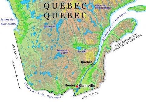
-
Article
Boisbriand
First set up as a municipality under the name of Sainte-Thérèse-Ouest in 1946, its name was changed in 1974. The name recalls Michel-Sidrac Dugué, Sieur de Boisbriand (1638-88), to whom was granted the seigneury des Mille-Îles in 1683.
"https://development.thecanadianencyclopedia.ca/images/tce_placeholder.jpg?v=e9dca980c9bdb3aa11e832e7ea94f5d9" // resources/views/front/categories/view.blade.php
https://development.thecanadianencyclopedia.ca/images/tce_placeholder.jpg?v=e9dca980c9bdb3aa11e832e7ea94f5d9
-
Article
Boucherville
Boucherville is one of the oldest municipalities in Québec. In 1668, Pierre Boucher began farming in the area and 4 years later received his seigneury, consisting of Îles-Percées and the adjacent islands. Boucher secured the community against Iroquois attack by constructing a palisade.
"https://development.thecanadianencyclopedia.ca/images/tce_placeholder.jpg?v=e9dca980c9bdb3aa11e832e7ea94f5d9" // resources/views/front/categories/view.blade.php
https://development.thecanadianencyclopedia.ca/images/tce_placeholder.jpg?v=e9dca980c9bdb3aa11e832e7ea94f5d9
-
Article
Bowmanville
Bowmanville, Ontario, population centre, population 39,371 (2016 census), 35,168 (2011 census). Bowmanville is located 25 km east of Toronto on Highway 401. Originally called Darlington Mills, it was renamed in the 1830s after Charles Bowman, the principal landowner. Bowmanville was incorporated as a village in 1852 and as a town in 1857. In January 1974, Bowmanville became part of the town of Newcastle (now Clarington) in the new Regional Municipality of Durham. Home of diverse manufacturers in the 19th century, Bowmanville now serves as a dormitory for Toronto and Oshawa.
"https://d2ttikhf7xbzbs.cloudfront.net/media/new_article_images/Bowmanville/POWcampBowmanville.jpg" // resources/views/front/categories/view.blade.php
https://d2ttikhf7xbzbs.cloudfront.net/media/new_article_images/Bowmanville/POWcampBowmanville.jpg
-
Article
Brighton
Brighton, Ont, incorporated as a municipality in 2001, population 10 928 (2011c), 10 253 (2006c). The Municipality of Brighton is located 12 km west of Trenton, near Lake Ontario.
"https://development.thecanadianencyclopedia.ca/images/tce_placeholder.jpg?v=e9dca980c9bdb3aa11e832e7ea94f5d9" // resources/views/front/categories/view.blade.php
https://development.thecanadianencyclopedia.ca/images/tce_placeholder.jpg?v=e9dca980c9bdb3aa11e832e7ea94f5d9