Browse "Villages"
-
Article
Salmo
Salmo, BC, incorporated as a village in 1946, population 1139 (2011c), 1007 (2006c). The Village of Salmo is located in the Selkirk Mountains on the Salmo River at its junction with Erie Creek, 24 km north of the United States border.
"https://development.thecanadianencyclopedia.ca/images/tce_placeholder.jpg?v=e9dca980c9bdb3aa11e832e7ea94f5d9" // resources/views/front/categories/view.blade.php
https://development.thecanadianencyclopedia.ca/images/tce_placeholder.jpg?v=e9dca980c9bdb3aa11e832e7ea94f5d9
-
Article
Sandon
Silver was found in 1891 and a rush followed, with thousands of prospectors staking the silver-bearing slopes. By 1895 Sandon was a thriving town and the terminus of 2 railways.
"https://development.thecanadianencyclopedia.ca/images/tce_placeholder.jpg?v=e9dca980c9bdb3aa11e832e7ea94f5d9" // resources/views/front/categories/view.blade.php
https://development.thecanadianencyclopedia.ca/images/tce_placeholder.jpg?v=e9dca980c9bdb3aa11e832e7ea94f5d9
-
Article
Sanikiluaq
Sanikiluaq, Nunavut, incorporated as a hamlet in 1976, population 812 (2011c), 744 (2006c).
"https://development.thecanadianencyclopedia.ca/images/tce_placeholder.jpg?v=e9dca980c9bdb3aa11e832e7ea94f5d9" // resources/views/front/categories/view.blade.php
https://development.thecanadianencyclopedia.ca/images/tce_placeholder.jpg?v=e9dca980c9bdb3aa11e832e7ea94f5d9
-
Article
Sexsmith
Sexsmith, Alta, incorporated as a village in 1929 and as a town in 1979, population 2418 (2011c), 1969 (2006c). The Town of Sexsmith is 43 km north of GRANDE PRAIRIE on Highway 2. The district was first settled in 1911, with a post office called Sexsmith established in 1912.
"https://d2ttikhf7xbzbs.cloudfront.net/media/media/fb6ef2de-ba1b-4446-8c02-467e561b7fe5.jpg" // resources/views/front/categories/view.blade.php
https://d2ttikhf7xbzbs.cloudfront.net/media/media/fb6ef2de-ba1b-4446-8c02-467e561b7fe5.jpg
-
Article
Sherbrooke Village
Sherbrooke Village in Sherbrooke, NS, is unusual in that it is not a collection of historic buildings moved into a reconstructed townsite, but rather the older portion of the actual village of Sherbrooke.
"https://development.thecanadianencyclopedia.ca/images/tce_placeholder.jpg?v=e9dca980c9bdb3aa11e832e7ea94f5d9" // resources/views/front/categories/view.blade.php
https://development.thecanadianencyclopedia.ca/images/tce_placeholder.jpg?v=e9dca980c9bdb3aa11e832e7ea94f5d9
-
Article
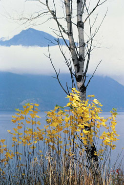
Slocan
Slocan, British Columbia, incorporated as a village in 1958, population 272 (2016 census), 296 (2011 census). The village of Slocan is located 70 km by road northwest of Nelson, at the south end of Slocan Lake. Slocan is an Okanagan word meaning “pierce or strike on the head,” referring to the salmon-fishing practice of the Okanagan (see Interior Salish). The community was also known as Slocan City when it was an incorporated city (1901-1958).
"https://d2ttikhf7xbzbs.cloudfront.net/media/media/ade75a0e-66ab-432e-af8e-3566a6dad341.jpg" // resources/views/front/categories/view.blade.php
https://d2ttikhf7xbzbs.cloudfront.net/media/media/ade75a0e-66ab-432e-af8e-3566a6dad341.jpg
-
Article
Snag
Snag, Yukon Territory, was a community located at the mouth of Snag Creek, 465 km northwest of Whitehorse. The creek was so named in 1898 by members of the US Geological Survey, possibly because it was choked with dead trees.
"https://development.thecanadianencyclopedia.ca/images/tce_placeholder.jpg?v=e9dca980c9bdb3aa11e832e7ea94f5d9" // resources/views/front/categories/view.blade.php
https://development.thecanadianencyclopedia.ca/images/tce_placeholder.jpg?v=e9dca980c9bdb3aa11e832e7ea94f5d9
-
Article
Spiritwood
The town is a service and administrative centre for the surrounding area. Grain growing and the raising of livestock are the main activities. The town lies in close proximity to a number of lakes and parks, with many recreational opportunities including fishing, snowmobiling, hunting and golfing.
"https://d2ttikhf7xbzbs.cloudfront.net/media/media/e00e474a-7659-48b5-ad0e-c8089a934a0c.jpg" // resources/views/front/categories/view.blade.php
https://d2ttikhf7xbzbs.cloudfront.net/media/media/e00e474a-7659-48b5-ad0e-c8089a934a0c.jpg
-
Article
St-Eustache
This village was the site of a fierce battle during the REBELLIONS OF 1837 as Chenier and the PATRIOTES barricaded themselves in the church, priest's house and convent. Nearly 100 Patriotes were killed and the British troops put the village to the torch.
"https://development.thecanadianencyclopedia.ca/images/tce_placeholder.jpg?v=e9dca980c9bdb3aa11e832e7ea94f5d9" // resources/views/front/categories/view.blade.php
https://development.thecanadianencyclopedia.ca/images/tce_placeholder.jpg?v=e9dca980c9bdb3aa11e832e7ea94f5d9
-
Article
St. Jacobs
St. Jacobs, ON, established as a Police Village in 1904 and dissolved as such in 1972 under the Regional Municipality of Waterloo Act (1972), population 1,891 (2011c), 1,597 (2006c).
"https://d2ttikhf7xbzbs.cloudfront.net/media/media/019c8ee4-7bf6-4277-84a6-04025bd7a60e.jpg" // resources/views/front/categories/view.blade.php
https://d2ttikhf7xbzbs.cloudfront.net/media/media/019c8ee4-7bf6-4277-84a6-04025bd7a60e.jpg
-
Article
St. Margarets Bay
St. Margarets Bay, 70 km2, is a small inlet of the Atlantic Ocean on the SE coast of Nova Scotia, 40 km W of HALIFAX. It is a favourite summer resort area, noted especially for its relatively warm surface water, sandy beaches and ideal sailing conditions for small craft.
"https://development.thecanadianencyclopedia.ca/images/tce_placeholder.jpg?v=e9dca980c9bdb3aa11e832e7ea94f5d9" // resources/views/front/categories/view.blade.php
https://development.thecanadianencyclopedia.ca/images/tce_placeholder.jpg?v=e9dca980c9bdb3aa11e832e7ea94f5d9
-
Article
St Peter's
St Peter's, NS, incorporated as a village in, inc 1940. St Peter's is situated between St Peter's Inlet and St Peter's Bay on the south shore of Cape Breton Island.
"https://development.thecanadianencyclopedia.ca/images/tce_placeholder.jpg?v=e9dca980c9bdb3aa11e832e7ea94f5d9" // resources/views/front/categories/view.blade.php
https://development.thecanadianencyclopedia.ca/images/tce_placeholder.jpg?v=e9dca980c9bdb3aa11e832e7ea94f5d9
-
Article
St. Peters Bay
St. Peters Bay, Prince Edward Island, Rural Municipality, incorporated in 1953, population 231 (2021 census), 237 (2016 census). St. Peters Bay the community is located at the eastern end of St. Peters Bay the body of water, along PEI’s northeastern shore. The village is known for its annual Blueberry Festival and the nearby PEI National Park in Greenwich.
"https://d2ttikhf7xbzbs.cloudfront.net/StPetersBay/DoctorRoddie.jpg" // resources/views/front/categories/view.blade.php
https://d2ttikhf7xbzbs.cloudfront.net/StPetersBay/DoctorRoddie.jpg
-
Article
St Pierre-Jolys
St-Pierre-Jolys, Manitoba, incorporated as a village in 1947, population 1099 (2011c), 839 (2006c). The Village of St-Pierre-Jolys is located 56 km southeast of WINNIPEG near the Rat River.
"https://development.thecanadianencyclopedia.ca/images/tce_placeholder.jpg?v=e9dca980c9bdb3aa11e832e7ea94f5d9" // resources/views/front/categories/view.blade.php
https://development.thecanadianencyclopedia.ca/images/tce_placeholder.jpg?v=e9dca980c9bdb3aa11e832e7ea94f5d9
-
Article
Stadacona
Stadacona was an Iroquoian village located at the present site of Quebec City, Quebec. It had an estimated population of about 500. French navigator Jacques Cartier was led to the village on his second voyage in 1535 and wintered at a safe distance, across the St-Charles River.
"https://d2ttikhf7xbzbs.cloudfront.net/media/media/24df7e90-74bb-4e4d-99ad-e63d85d72d54.jpg" // resources/views/front/categories/view.blade.php
https://d2ttikhf7xbzbs.cloudfront.net/media/media/24df7e90-74bb-4e4d-99ad-e63d85d72d54.jpg
