Browse "Rivers"
-
Article
Nechako River
The Nechako River rises in the Coast Mountains in west-central BC and flows east to form a principal tributary of the Fraser River. Because of massive damming of its headwaters, it is no longer possible to give its length or tell exactly where it used to rise.
"https://d2ttikhf7xbzbs.cloudfront.net/media/media/2ba613f3-f597-4da8-93a3-b376b6e74bec.jpg" // resources/views/front/categories/view.blade.php
https://d2ttikhf7xbzbs.cloudfront.net/media/media/2ba613f3-f597-4da8-93a3-b376b6e74bec.jpg
-
Article
Nelson River
The Nelson River, 2,575 km long, flows north northeast out of Playgreen Lake, at the northwest tip of Lake Winnipeg. It spills out into a number of lakes, including Cross, Sipiwesk, Split and Stevens, flowing east from the latter into Hudson Bay.
"https://development.thecanadianencyclopedia.ca/images/tce_placeholder.jpg?v=e9dca980c9bdb3aa11e832e7ea94f5d9" // resources/views/front/categories/view.blade.php
https://development.thecanadianencyclopedia.ca/images/tce_placeholder.jpg?v=e9dca980c9bdb3aa11e832e7ea94f5d9
-
Article
Niagara River
The Niagara River, 58 km long, issues from Lake Erie and flows north over Niagara Falls to Lake Ontario. The river’s drainage area is about 684,000 km2, and its average flow at Queenston is 5,885 m3/s. The Niagara River forms part of the border between Canada and the United States.
"https://d2ttikhf7xbzbs.cloudfront.net/media/media/c9fad2bb-2972-411a-8527-e908fa8254b6.jpg" // resources/views/front/categories/view.blade.php
https://d2ttikhf7xbzbs.cloudfront.net/media/media/c9fad2bb-2972-411a-8527-e908fa8254b6.jpg
-
Article
North Saskatchewan River
The North Saskatchewan River (1,287 km long, the first 48.5 km of which is designated as a Canadian Heritage River) is a major tributary to the Saskatchewan River, which ultimately flows into Hudson Bay. The mean annual flow is 241 m3/s; however, flow varies between the peak in July and minimum in February. It served as a major transportation route from the end of the last Ice Age through the mid-20th century.
"https://d2ttikhf7xbzbs.cloudfront.net/media/media/98d61a99-4200-4393-92c7-61a42587d6cf.jpg" // resources/views/front/categories/view.blade.php
https://d2ttikhf7xbzbs.cloudfront.net/media/media/98d61a99-4200-4393-92c7-61a42587d6cf.jpg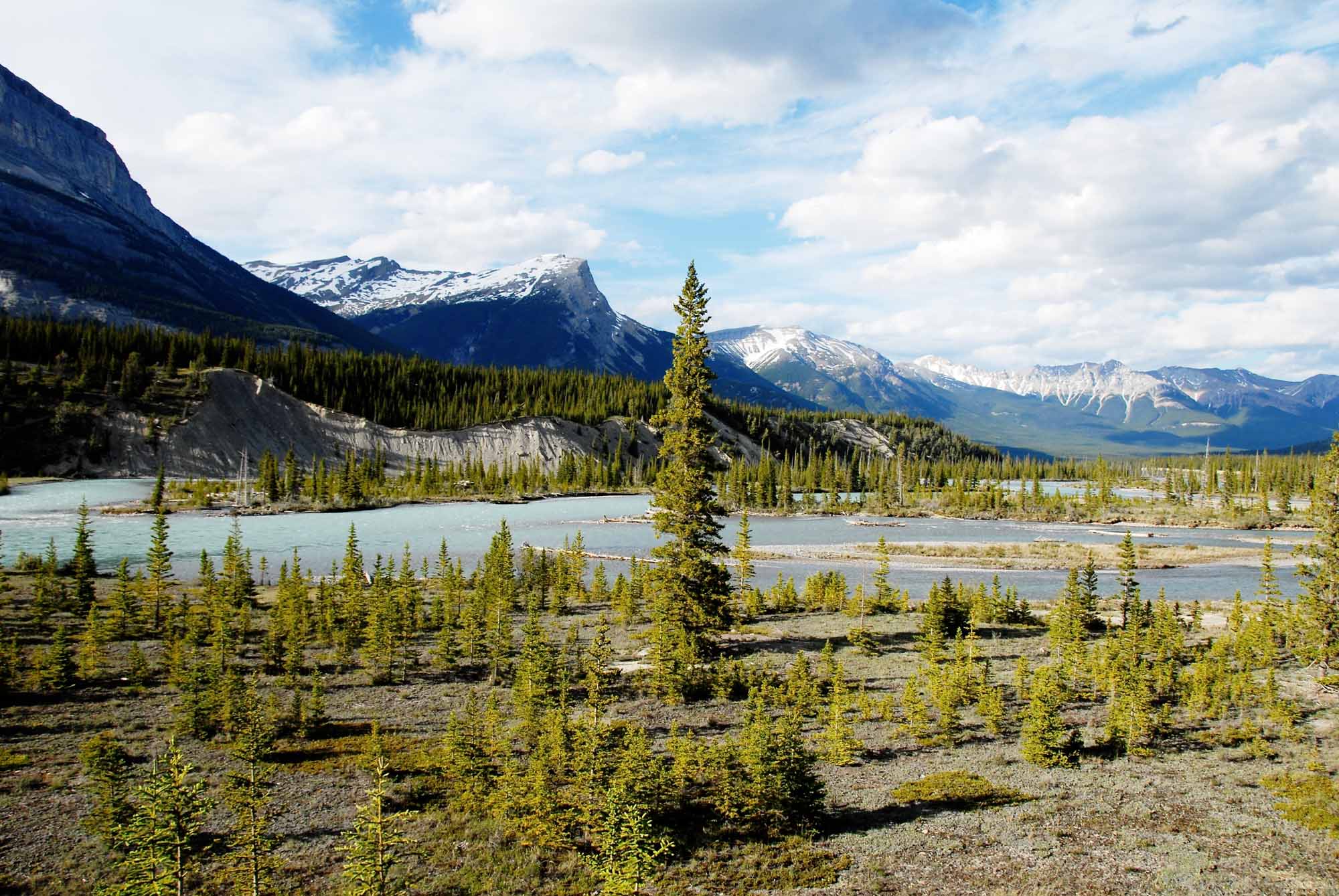
-
Article
Peace River
Peace River, 1,923 km long, is one of the principal tributaries of the Mackenzie River system. The name of the river refers to a settlement between Cree and Dane-Zaa (Beaver) warring parties around 1781 at Peace Point at the lower portion of the river. The Dane-Zaa word for the river is unchaga, meaning “big river”; the Cree word for the settlement there is sâkitawâhk.
"https://d2ttikhf7xbzbs.cloudfront.net/media/media/1086px-Sagitawa_Lookout,_Peace_River,_Alberta.jpg" // resources/views/front/categories/view.blade.php
https://d2ttikhf7xbzbs.cloudfront.net/media/media/1086px-Sagitawa_Lookout,_Peace_River,_Alberta.jpg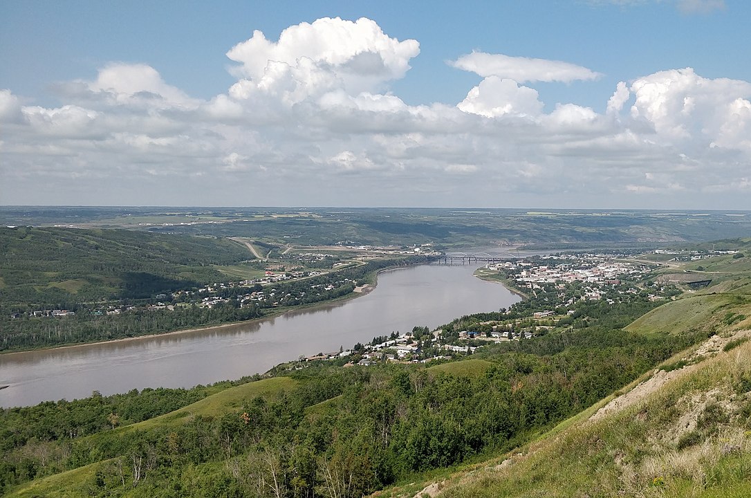
-
Article
Principal Rivers of Canada
Principal Rivers of Canada Principal Rivers of Canada and Their Basins Drainage Basin and River Drainage Area (km²) Length (km) Mean Discharge (m³/s) Pacific Ocean: 1 009 100 24 951 Columbia 102 800* 801 2 790² ³ Kootenay 37 700* 780 850³ Fraser 232 300 1 370 3 540 Thompson 55 400 489 750 Nass 21 100 380 950 Skeena 54 400 579 1 760 Stikine 49 800* 539 1 080² Yukon 323 800* 1...
"https://development.thecanadianencyclopedia.ca/images/tce_placeholder.jpg?v=e9dca980c9bdb3aa11e832e7ea94f5d9" // resources/views/front/categories/view.blade.php
https://development.thecanadianencyclopedia.ca/images/tce_placeholder.jpg?v=e9dca980c9bdb3aa11e832e7ea94f5d9
-
Article
Qu'Appelle River
The Qu'Appelle River, 430 km long, rises in Lake Diefenbaker and meanders generally east across southern Saskatchewan, joining the Assiniboine River just east of the Manitoba border.
"https://development.thecanadianencyclopedia.ca/images/tce_placeholder.jpg?v=e9dca980c9bdb3aa11e832e7ea94f5d9" // resources/views/front/categories/view.blade.php
https://development.thecanadianencyclopedia.ca/images/tce_placeholder.jpg?v=e9dca980c9bdb3aa11e832e7ea94f5d9
-
Article
Red Deer River
The Red Deer River (740 km, mean annual flow rate 62 m3/s), is glacier-fed by streams from Mount Drummond and Cyclone Mountain in the Rockies of Banff National Park in Alberta. It flows east then south to join the South SASKATCHEWAN RIVER just inside Saskatchewan.
"https://development.thecanadianencyclopedia.ca/images/tce_placeholder.jpg?v=e9dca980c9bdb3aa11e832e7ea94f5d9" // resources/views/front/categories/view.blade.php
https://development.thecanadianencyclopedia.ca/images/tce_placeholder.jpg?v=e9dca980c9bdb3aa11e832e7ea94f5d9
-
Article
Red River
The Red River (880 km long) begins at the confluence of the Bois de Sioux and Otter Tail rivers at the border between Minnesota and North Dakota. It then flows north through southern Manitoba and into Lake Winnipeg. The last 175 km of the Red River, the portion located in Manitoba, is designated as a Canadian Heritage River due to its cultural and historical value. The Red River flows through a productive agricultural region that is prone to both drought and severe flooding — the largest flood in the area in recent history, coined “the flood of the century,” occurred in 1997. The river’s basin was once the bottom of a glacial lake, Lake Agassiz, which covered the region 8,000 years ago. Currently, the Red River provides water for municipal, industrial and agricultural uses, and offers numerous summer and winter recreational opportunities, including boating, fishing (including ice fishing), camping and skating.
"https://d2ttikhf7xbzbs.cloudfront.net/media/media/c61bdc21-634f-4316-9ab1-acb89adc0cdf.jpg" // resources/views/front/categories/view.blade.php
https://d2ttikhf7xbzbs.cloudfront.net/media/media/c61bdc21-634f-4316-9ab1-acb89adc0cdf.jpg
-
Article
Restigouche River
Restigouche River (Ristigouche in Québec), 200 km long, rises in the highlands of northwestern New Brunswick as the Little Main Restigouche River.
"https://development.thecanadianencyclopedia.ca/images/tce_placeholder.jpg?v=e9dca980c9bdb3aa11e832e7ea94f5d9" // resources/views/front/categories/view.blade.php
https://development.thecanadianencyclopedia.ca/images/tce_placeholder.jpg?v=e9dca980c9bdb3aa11e832e7ea94f5d9
-
Article
Rideau River
The Rideau River flows 100 km northwards from the Rideau Lakes in eastern Ontario to the Ottawa River at Ottawa.
"https://d2ttikhf7xbzbs.cloudfront.net/media/media/7d8b1603-093b-431d-9c12-aa68e477912f.jpg" // resources/views/front/categories/view.blade.php
https://d2ttikhf7xbzbs.cloudfront.net/media/media/7d8b1603-093b-431d-9c12-aa68e477912f.jpg
-
"https://development.thecanadianencyclopedia.ca/images/tce_placeholder.jpg?v=e9dca980c9bdb3aa11e832e7ea94f5d9" // resources/views/front/categories/view.blade.php
https://development.thecanadianencyclopedia.ca/images/tce_placeholder.jpg?v=e9dca980c9bdb3aa11e832e7ea94f5d9
-
Article
Rivière Chaudière
Rivière Chaudière, 193 km long and with a basin 6690 km2, is located in southern Québec. It is named after the waters that "boil" from its falls or after the numerous glacial erosion kettles (chaudière is French for boiler and also for bucket).
"https://development.thecanadianencyclopedia.ca/images/tce_placeholder.jpg?v=e9dca980c9bdb3aa11e832e7ea94f5d9" // resources/views/front/categories/view.blade.php
https://development.thecanadianencyclopedia.ca/images/tce_placeholder.jpg?v=e9dca980c9bdb3aa11e832e7ea94f5d9
-
Article
Rivière de Rupert
Rivière de Rupert is 763 km long to the head of Lac Témiscamie. It drains Lac Mistassini and then follows a twisted course through a series of lakes and across a flat coastal plain to discharge into southeastern James Bay.
"https://development.thecanadianencyclopedia.ca/images/tce_placeholder.jpg?v=e9dca980c9bdb3aa11e832e7ea94f5d9" // resources/views/front/categories/view.blade.php
https://development.thecanadianencyclopedia.ca/images/tce_placeholder.jpg?v=e9dca980c9bdb3aa11e832e7ea94f5d9
-
Article
Rivière Dumoine
The Dumoine, 129 km long, rises in Lac Dumoine in southwest Québec and flows off the south edge of the Laurentian Highlands through a series of waterfalls, wild rapids and long chutes into the Ottawa River.
"https://development.thecanadianencyclopedia.ca/images/tce_placeholder.jpg?v=e9dca980c9bdb3aa11e832e7ea94f5d9" // resources/views/front/categories/view.blade.php
https://development.thecanadianencyclopedia.ca/images/tce_placeholder.jpg?v=e9dca980c9bdb3aa11e832e7ea94f5d9