Browse "Provincial parks"
-
Article
Algonquin Provincial Park
The oldest provincial park in Ontario and the first provincial park in Canada, Algonquin Provincial Park (established 27 May 1893, 7,625 km2) is located 250 km north of Toronto. The park is well known for its beauty, especially its numerous lakes and spectacular fall colours. It was a source of inspiration to members of the Group of Seven, especially Tom Thomson.
"https://d2ttikhf7xbzbs.cloudfront.net/algonquinprovincialpark/Wetland.jpg" // resources/views/front/categories/view.blade.php
https://d2ttikhf7xbzbs.cloudfront.net/algonquinprovincialpark/Wetland.jpg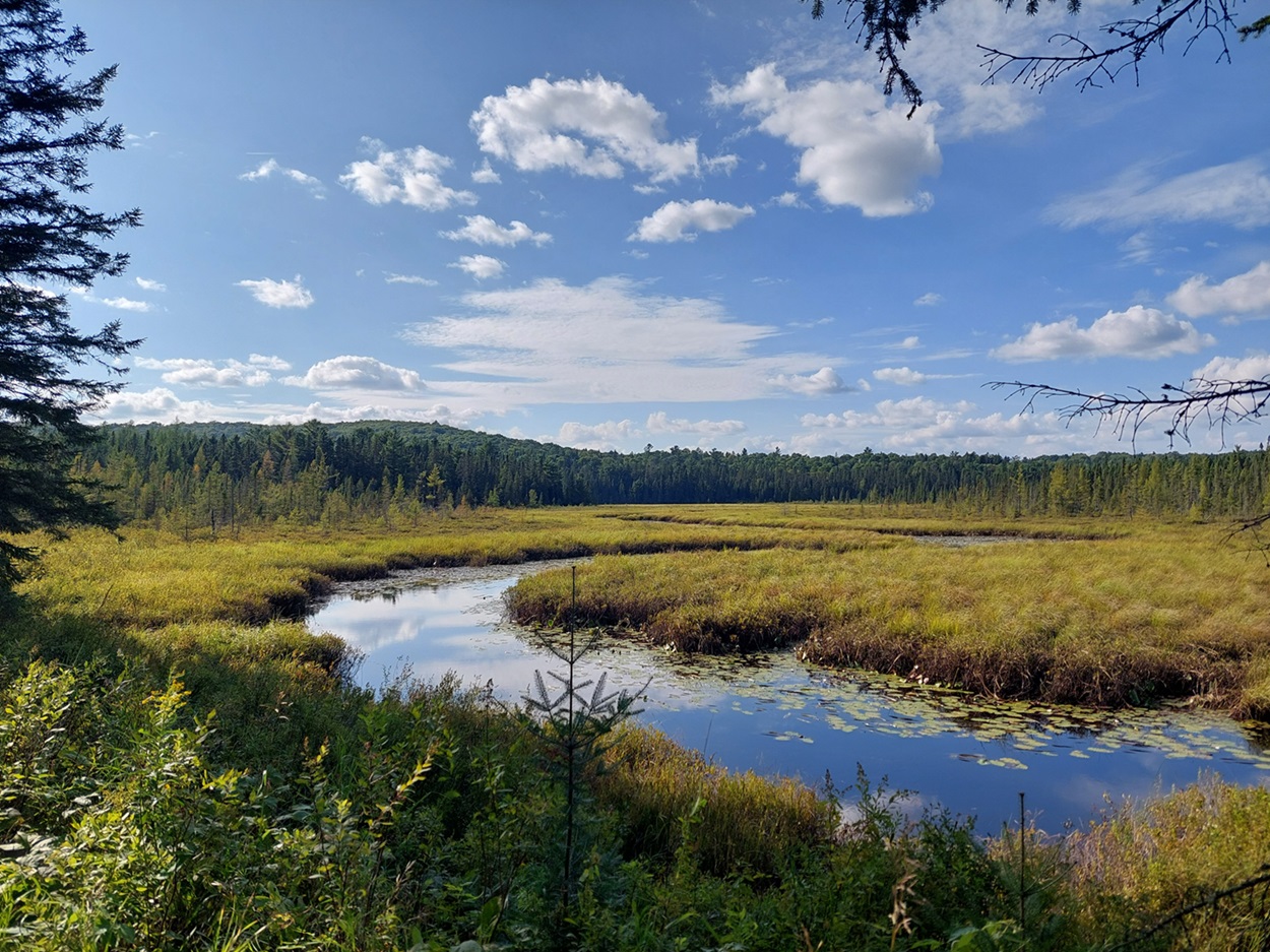
-
Article
Barachois Pond Provincial Park
One of the largest of 48 parks in Newfoundland and Labrador, Barachois Pond Provincial Park (established 1962, 35 km2), is located at the head of St George's Bay, 70 km south of Corner Brook along the Trans-Canada Highway.
"https://development.thecanadianencyclopedia.ca/images/tce_placeholder.jpg?v=e9dca980c9bdb3aa11e832e7ea94f5d9" // resources/views/front/categories/view.blade.php
https://development.thecanadianencyclopedia.ca/images/tce_placeholder.jpg?v=e9dca980c9bdb3aa11e832e7ea94f5d9
-
Article
Butter Pot Provincial Park
Located on the Avalon Peninsula, Butter Pot Provincial Park (established 1958, 2833 ha) is 36 km southwest of St John's, Newfoundland, along the Trans-Canada Highway.
"https://development.thecanadianencyclopedia.ca/images/tce_placeholder.jpg?v=e9dca980c9bdb3aa11e832e7ea94f5d9" // resources/views/front/categories/view.blade.php
https://development.thecanadianencyclopedia.ca/images/tce_placeholder.jpg?v=e9dca980c9bdb3aa11e832e7ea94f5d9
-
Article
Cape Scott Provincial Park
Cape Scott Provincial Park (established 1973, 50 km2), on the northwest tip of VANCOUVER I, BC, includes 64 km of coast with 23 km of sandy beaches interspersed by rocky headlands. The land rises inland to Mount St Patrick (415 m), and in it lies a 44 ha body of freshwater, Eric Lake.
"https://development.thecanadianencyclopedia.ca/images/tce_placeholder.jpg?v=e9dca980c9bdb3aa11e832e7ea94f5d9" // resources/views/front/categories/view.blade.php
https://development.thecanadianencyclopedia.ca/images/tce_placeholder.jpg?v=e9dca980c9bdb3aa11e832e7ea94f5d9
-
Article
Cedar Dunes Provincial Park
Tucked into the westernmost corner of Prince Edward Island, Cedar Dunes Provincial Park (established 1962, 37 ha) has been developed around an historic lighthouse. Known as West Point, the site is the result of centuries of accretion of sand from a north to south coastal current.
"https://development.thecanadianencyclopedia.ca/images/tce_placeholder.jpg?v=e9dca980c9bdb3aa11e832e7ea94f5d9" // resources/views/front/categories/view.blade.php
https://development.thecanadianencyclopedia.ca/images/tce_placeholder.jpg?v=e9dca980c9bdb3aa11e832e7ea94f5d9
-
Article
Dinosaur Provincial Park
Dinosaur Provincial Park (established 1955, 70 km2) lies along the Red Deer River in southeastern Alberta. The park is the primary fossil site of the more than 100 different species of dinosaurs found in Canada. In 1979, the park was declared a United Nations World Heritage Site. (See also Dinosaurs and Canada.)
"https://d2ttikhf7xbzbs.cloudfront.net/media/media/e8e23bed-66e7-4173-9e92-b61c0b06e940.jpg" // resources/views/front/categories/view.blade.php
https://d2ttikhf7xbzbs.cloudfront.net/media/media/e8e23bed-66e7-4173-9e92-b61c0b06e940.jpg
-
Article
Garibaldi Provincial Park
Natural History The mountains, which dominate the park and rise to 2678 m at Mount Garibaldi, are of recent volcanic origin. Lava from Price Mountain created a dam allowing 300 m deep Lake Garibaldi to form.
"https://d2ttikhf7xbzbs.cloudfront.net/media/media/422e8bec-0d3c-48b7-b19e-f4fd6cfaaa96.jpg" // resources/views/front/categories/view.blade.php
https://d2ttikhf7xbzbs.cloudfront.net/media/media/422e8bec-0d3c-48b7-b19e-f4fd6cfaaa96.jpg
-
Article
Grass River Provincial Park
Located some 45 km east of Flin Flon, Grass River Provincial Park (established 1963, 2289.63 km2) straddles 2 of Manitoba's natural regions (Boreal Plains and Boreal Shield).
"https://development.thecanadianencyclopedia.ca/images/tce_placeholder.jpg?v=e9dca980c9bdb3aa11e832e7ea94f5d9" // resources/views/front/categories/view.blade.php
https://development.thecanadianencyclopedia.ca/images/tce_placeholder.jpg?v=e9dca980c9bdb3aa11e832e7ea94f5d9
-
Article
Hecla Provincial Park
Near the south end of Lake WINNIPEG some 160 km north of Winnipeg is Hecla Provincial Park (established 1969, 865.4 km2).
"https://development.thecanadianencyclopedia.ca/images/tce_placeholder.jpg?v=e9dca980c9bdb3aa11e832e7ea94f5d9" // resources/views/front/categories/view.blade.php
https://development.thecanadianencyclopedia.ca/images/tce_placeholder.jpg?v=e9dca980c9bdb3aa11e832e7ea94f5d9
-
Article
Herring Cove Provincial Park
Nestled among the West Isles in the Bay of Fundy is New Brunswick's Campobello Island, the home of Herring Cove Provincial Park (established 1959, 424 ha).
"https://development.thecanadianencyclopedia.ca/images/tce_placeholder.jpg?v=e9dca980c9bdb3aa11e832e7ea94f5d9" // resources/views/front/categories/view.blade.php
https://development.thecanadianencyclopedia.ca/images/tce_placeholder.jpg?v=e9dca980c9bdb3aa11e832e7ea94f5d9
-
Article
Killarney Provincial Park
Natural History The park's most striking feature is a series of rock ridges consisting mostly of white quartzite. These large, rounded hills are the remains of the La Cloche range, a ring of Precambrian mountains that once towered higher than the present-day Rockies.
"https://d2ttikhf7xbzbs.cloudfront.net/media/media/6c7cc9d2-c509-4259-a224-57a0a1216afa.jpg" // resources/views/front/categories/view.blade.php
https://d2ttikhf7xbzbs.cloudfront.net/media/media/6c7cc9d2-c509-4259-a224-57a0a1216afa.jpg
-
Article
Lake Superior Provincial Park
Natural History Pink granitic hills and boulders dominate the landscape but lavas are found near Cape Gargantua and sandstones on the offshore islands. The mixed forest of maple, birch, poplar and spruce produces a magnificent display of colour in autumn.
"https://d2ttikhf7xbzbs.cloudfront.net/media/media/670a98ba-b8c3-47aa-92f9-ac92cf084645.jpg" // resources/views/front/categories/view.blade.php
https://d2ttikhf7xbzbs.cloudfront.net/media/media/670a98ba-b8c3-47aa-92f9-ac92cf084645.jpg
-
Article
Lakeland Provincial Park
A landscape of forests and lakes, Lakeland Provincial Park (established 1992, 147 km2) is located east of LAC LA BICHE about 250 km northeast of Edmonton.
"https://development.thecanadianencyclopedia.ca/images/tce_placeholder.jpg?v=e9dca980c9bdb3aa11e832e7ea94f5d9" // resources/views/front/categories/view.blade.php
https://development.thecanadianencyclopedia.ca/images/tce_placeholder.jpg?v=e9dca980c9bdb3aa11e832e7ea94f5d9
-
Article
Lesser Slave Lake Provincial Park
Natural History Prevailing winds aided by major storms have produced some of the finest beaches in the province. Named after the Duke of DEVONSHIRE, who visited the area in 1920, Devonshire beach is popular for swimming, wind surfing and sand castle competitions.
"https://d2ttikhf7xbzbs.cloudfront.net/media/media/4ec4a212-b4ef-4fde-844a-ba30ef433515.jpg" // resources/views/front/categories/view.blade.php
https://d2ttikhf7xbzbs.cloudfront.net/media/media/4ec4a212-b4ef-4fde-844a-ba30ef433515.jpg
-
Article
Mount Assiniboine Provincial Park
Mount Assiniboine Provincial Park (est 1922, 386 km 2 ) is an area of mountain peaks, alpine meadows and lakes dominated by Mount ASSINIBOINE (about 35 km south of BANFF , Alberta). The park, which is mainly above 1500 m,
"https://development.thecanadianencyclopedia.ca/images/tce_placeholder.jpg?v=e9dca980c9bdb3aa11e832e7ea94f5d9" // resources/views/front/categories/view.blade.php
https://development.thecanadianencyclopedia.ca/images/tce_placeholder.jpg?v=e9dca980c9bdb3aa11e832e7ea94f5d9