Browse "Provincial parks"
-
Article
Mount Carleton Provincial Park
New Brunswick's largest PROVINCIAL PARK, Mount Carleton Provincial Park (established 1970, 174.27 km2), features forests and abundant wildlife.
"https://development.thecanadianencyclopedia.ca/images/tce_placeholder.jpg?v=e9dca980c9bdb3aa11e832e7ea94f5d9" // resources/views/front/categories/view.blade.php
https://development.thecanadianencyclopedia.ca/images/tce_placeholder.jpg?v=e9dca980c9bdb3aa11e832e7ea94f5d9
-
Article
Mount Edziza Provincial Park
Mount Edziza Provincial Park (est 1972, 2300 km 2 ha) comprises part of the Tahltan Highlands, between the Stikine and Iskut rivers in BC. The nearest community is Telegraph Creek, 20 km northwest of the park.
"https://development.thecanadianencyclopedia.ca/images/tce_placeholder.jpg?v=e9dca980c9bdb3aa11e832e7ea94f5d9" // resources/views/front/categories/view.blade.php
https://development.thecanadianencyclopedia.ca/images/tce_placeholder.jpg?v=e9dca980c9bdb3aa11e832e7ea94f5d9
-
Article
Notikewin Provincial Park
Interest from local residents led to the establishment of Notikewin Provincial Park (established 1979, 97 km2). Here is preserved a small piece of the quintessential natural landscape of northern Alberta, the once endless poplar and spruce forests deeply dissected by moody rivers.
"https://development.thecanadianencyclopedia.ca/images/tce_placeholder.jpg?v=e9dca980c9bdb3aa11e832e7ea94f5d9" // resources/views/front/categories/view.blade.php
https://development.thecanadianencyclopedia.ca/images/tce_placeholder.jpg?v=e9dca980c9bdb3aa11e832e7ea94f5d9
-
Article
Notre Dame Provincial Park
Nestled in the lush forests of central Newfoundland, Notre Dame Provincial Park (established 1959, 113 ha) borders on the serene waters of Junction Pond.
"https://development.thecanadianencyclopedia.ca/images/tce_placeholder.jpg?v=e9dca980c9bdb3aa11e832e7ea94f5d9" // resources/views/front/categories/view.blade.php
https://development.thecanadianencyclopedia.ca/images/tce_placeholder.jpg?v=e9dca980c9bdb3aa11e832e7ea94f5d9
-
Article
Ouimet Canyon Provincial Park
A spectacular, steep-sided gorge cut into volcanic rock of Lake Superior's northern shore is protected in Ouimet Canyon Provincial Park (established 1972, 777 ha), 65 km northeast of Thunder Bay, Ontario.
"https://d2ttikhf7xbzbs.cloudfront.net/media/media/fe2420b7-d26b-483e-b339-46a75ac65e13.jpg" // resources/views/front/categories/view.blade.php
https://d2ttikhf7xbzbs.cloudfront.net/media/media/fe2420b7-d26b-483e-b339-46a75ac65e13.jpg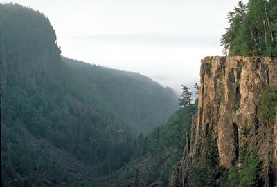
-
Article
Petroglyphs Provincial Park
Petroglyphs Provincial Park (established 1976, 1643 ha) is the site of one of Canada's archaeological and cultural treasures. On a flat expanse of rock are some 900 carvings or petroglyphs of symbolic shapes and figures, likely carved by Algonquian-speaking people. Established as a historic-class park, Petroglyphs Provincial Park is located 55 km northeast of Peterborough, Ontario. It is located on the southern edge of the Canadian Shield and in a transition zone between the Shield and the Great Lakes-St Lawrence Lowland area. Rocky ridges covered with thin soil are interspersed with low-lying wetlands.
"https://development.thecanadianencyclopedia.ca/images/tce_placeholder.jpg?v=e9dca980c9bdb3aa11e832e7ea94f5d9" // resources/views/front/categories/view.blade.php
https://development.thecanadianencyclopedia.ca/images/tce_placeholder.jpg?v=e9dca980c9bdb3aa11e832e7ea94f5d9
-
Article
Provincial Parks
This image of Reesor Lake in Cypress Hills Interprovincial Park depicts mixed spruce, aspen woodland and fescue grassland (photo by Cliff Wallis, courtesy Cottonwood Consultants Ltd.).Typical boreal shield country in northern Ontario (photo by Brian Milne/First Light).PreviousNext Parks, Provincial Provincial parks are areas of land and water, large or small, natural or man-modified, designated by any of the provincial governments for the purposes of nature protection, recreation, TOURISM, historic preservation and education. They range in...
"https://d2ttikhf7xbzbs.cloudfront.net/media/media/ca373d61-2489-44ec-a604-201d64f5116e.jpg" // resources/views/front/categories/view.blade.php
https://d2ttikhf7xbzbs.cloudfront.net/media/media/ca373d61-2489-44ec-a604-201d64f5116e.jpg
-
Article
Rondeau Provincial Park
Rondeau Provincial Park (established 1894, 33 km2) provides environmental protection and recreation on one of 3 peninsulas jutting south into Lake ERIE. It lies 120 km east of Windsor and 115 km southwest of London.
"https://development.thecanadianencyclopedia.ca/images/tce_placeholder.jpg?v=e9dca980c9bdb3aa11e832e7ea94f5d9" // resources/views/front/categories/view.blade.php
https://development.thecanadianencyclopedia.ca/images/tce_placeholder.jpg?v=e9dca980c9bdb3aa11e832e7ea94f5d9
-
Article
Rouge National Urban Park
Rouge National Urban Park is an ecologically protected zone in the Greater Toronto Area that encompasses much of the valleys of the Rouge River and Little Rouge Creek. A total of 79.1 km2 of land has been committed to the park, which straddles parts of the Ontario cities of Toronto, Markham, Pickering and the Township of Uxbridge. The historic area includes farmland, green space, wetlands and rivers alongside urban development, roads and highways. Established 15 May 2015 and managed by Parks Canada, Rouge is Canada’s first National Urban Park and the largest urban park in North America.
"https://d2ttikhf7xbzbs.cloudfront.net/media/media/89696c73-3105-407f-b3ce-ae56d9472b7d.jpg" // resources/views/front/categories/view.blade.php
https://d2ttikhf7xbzbs.cloudfront.net/media/media/89696c73-3105-407f-b3ce-ae56d9472b7d.jpg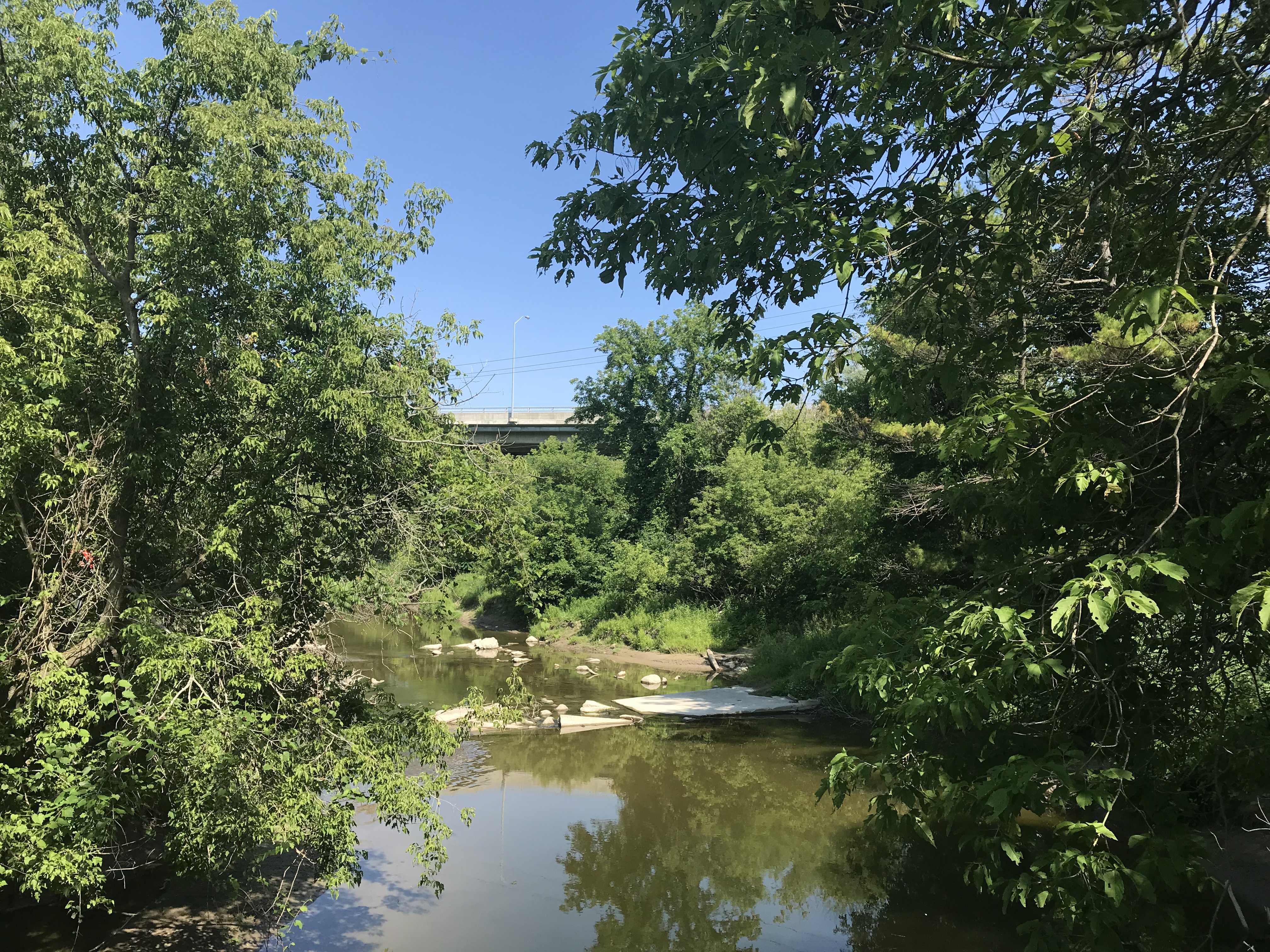
-
Article
St. Norbert Provincial Heritage Park
St. Norbert Provincial Heritage Park is located in St. Norbert, which is now a ward of Winnipeg. Designated as a park in 1985, St. Norbert Provincial Heritage Park traces the development of the area from Indigenous use to first a French-speaking Métis settlement and then a French-Canadian agricultural community of the pre-World War I period.
"https://d2ttikhf7xbzbs.cloudfront.net/media/media/e531362e-bb24-4c7f-a530-c90c224bb637.jpg" // resources/views/front/categories/view.blade.php
https://d2ttikhf7xbzbs.cloudfront.net/media/media/e531362e-bb24-4c7f-a530-c90c224bb637.jpg
-
Article
Strathcona Provincial Park
Strathcona Provincial Park (established 1911, 2504 km2) is a mountain wilderness in central Vancouver Island, 9 km east of Gold River and 26 km west of Campbell River.
"https://development.thecanadianencyclopedia.ca/images/tce_placeholder.jpg?v=e9dca980c9bdb3aa11e832e7ea94f5d9" // resources/views/front/categories/view.blade.php
https://development.thecanadianencyclopedia.ca/images/tce_placeholder.jpg?v=e9dca980c9bdb3aa11e832e7ea94f5d9
-
Article
Strathgartney Provincial Park
In Scots Gaelic Strath Gartney means "a valley in the hills." This description aptly fits Strathgartney Provincial Park (established 1959, 53 ha) located in the central hills of Prince Edward Island, 25 km west of CHARLOTTETOWN.
"https://development.thecanadianencyclopedia.ca/images/tce_placeholder.jpg?v=e9dca980c9bdb3aa11e832e7ea94f5d9" // resources/views/front/categories/view.blade.php
https://development.thecanadianencyclopedia.ca/images/tce_placeholder.jpg?v=e9dca980c9bdb3aa11e832e7ea94f5d9
-
Article
The Rocks Provincial Park
Mammoth pillars, the Rocks, rise out of the sea at Hopewell Cape on New Brunswick's southern coast. The Rocks Provincial Park (established 1958, 120 ha) is located halfway between Moncton and Fundy National Park.
"https://development.thecanadianencyclopedia.ca/images/tce_placeholder.jpg?v=e9dca980c9bdb3aa11e832e7ea94f5d9" // resources/views/front/categories/view.blade.php
https://development.thecanadianencyclopedia.ca/images/tce_placeholder.jpg?v=e9dca980c9bdb3aa11e832e7ea94f5d9
-
Article
Turtle Mountain Provincial Park
Named after the western painted turtle found in the park, Turtle Mountain Provincial Park (established 1961, 189 km2) is 100 km south of Brandon, Manitoba, butted against the international boundary.
"https://d2ttikhf7xbzbs.cloudfront.net/media/media/551e57b8-5735-4754-a520-399331837275.jpg" // resources/views/front/categories/view.blade.php
https://d2ttikhf7xbzbs.cloudfront.net/media/media/551e57b8-5735-4754-a520-399331837275.jpg
-
Article
Whiteshell Provincial Park
Whiteshell Provincial Park (established 1961, 2737.15 km2), 105 km E of Winnipeg, Manitoba, by the Trans-Canada Highway, is Precambrian SHIELD country. Whiteshell is connected to Nopiming Provincial Park to the north.
"https://development.thecanadianencyclopedia.ca/images/tce_placeholder.jpg?v=e9dca980c9bdb3aa11e832e7ea94f5d9" // resources/views/front/categories/view.blade.php
https://development.thecanadianencyclopedia.ca/images/tce_placeholder.jpg?v=e9dca980c9bdb3aa11e832e7ea94f5d9