Browse "Places"
-
Article
Alert Bay
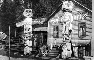
Alert Bay, BC, incorporated as a village in 1946, population 445 (2011c), 456 (2006c). The Village of Alert Bay is located on Cormorant Island, off Vancouver Island, 288 km north of Vancouver.
"https://d2ttikhf7xbzbs.cloudfront.net/media/media/691936c7-8d2d-4aad-9409-ab3bda1de214.jpg" // resources/views/front/categories/view.blade.php
https://d2ttikhf7xbzbs.cloudfront.net/media/media/691936c7-8d2d-4aad-9409-ab3bda1de214.jpg
-
Article
Alexandria
Alexandria, ON, population centre, population 2,906 (2021 census), 2,845 (2016 census). Incorporated as a town in 1903, Alexandria lost this status in 1998 as the result of municipal restructuring in Ontario. It is now part of the new township of North Glengarry (population 10,109). Alexandria is located midway on the Canadian National Railway line between Montreal and Ottawa.
"https://development.thecanadianencyclopedia.ca/images/tce_placeholder.jpg?v=e9dca980c9bdb3aa11e832e7ea94f5d9" // resources/views/front/categories/view.blade.php
https://development.thecanadianencyclopedia.ca/images/tce_placeholder.jpg?v=e9dca980c9bdb3aa11e832e7ea94f5d9
-
Article
Algoma Central Railway
Algoma Central Railway was chartered in 1899 by Francis Hector Clergue as a "feeder line" to his industrial-resource empire at Sault Ste Marie.
"https://development.thecanadianencyclopedia.ca/images/tce_placeholder.jpg?v=e9dca980c9bdb3aa11e832e7ea94f5d9" // resources/views/front/categories/view.blade.php
https://development.thecanadianencyclopedia.ca/images/tce_placeholder.jpg?v=e9dca980c9bdb3aa11e832e7ea94f5d9
-
Article
Algonquin Provincial Park
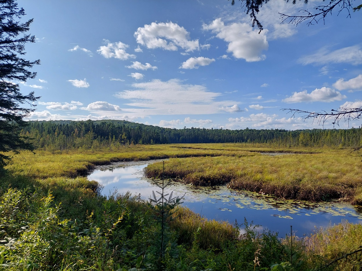
The oldest provincial park in Ontario and the first provincial park in Canada, Algonquin Provincial Park (established 27 May 1893, 7,625 km2) is located 250 km north of Toronto. The park is well known for its beauty, especially its numerous lakes and spectacular fall colours. It was a source of inspiration to members of the Group of Seven, especially Tom Thomson.
"https://d2ttikhf7xbzbs.cloudfront.net/algonquinprovincialpark/Wetland.jpg" // resources/views/front/categories/view.blade.php
https://d2ttikhf7xbzbs.cloudfront.net/algonquinprovincialpark/Wetland.jpg
-
Article
Allison Pass
Allison Pass, elevation 1,352 metres, is located at kilometre 60, the highest point on the Hope-Princeton Highway (opened 1949) through the Cascade Mountains of southern British Columbia.
"https://development.thecanadianencyclopedia.ca/images/tce_placeholder.jpg?v=e9dca980c9bdb3aa11e832e7ea94f5d9" // resources/views/front/categories/view.blade.php
https://development.thecanadianencyclopedia.ca/images/tce_placeholder.jpg?v=e9dca980c9bdb3aa11e832e7ea94f5d9
-
Article
Alma
Born of the lumber industry in 1860, Alma quickly became a prosperous agricultural parish. It burst into the industrial age in 1923 with the start of construction of the Isle-Maligne hydro station on the Grande Décharge.
"https://development.thecanadianencyclopedia.ca/images/tce_placeholder.jpg?v=e9dca980c9bdb3aa11e832e7ea94f5d9" // resources/views/front/categories/view.blade.php
https://development.thecanadianencyclopedia.ca/images/tce_placeholder.jpg?v=e9dca980c9bdb3aa11e832e7ea94f5d9
-
Article
Almonte
Almonte, Ont, urban area, population 4752 (2011c), 4538 (2006c). Almonte is located on the Mississippi River, 48 km southwest of Ottawa.
"https://development.thecanadianencyclopedia.ca/images/tce_placeholder.jpg?v=e9dca980c9bdb3aa11e832e7ea94f5d9" // resources/views/front/categories/view.blade.php
https://development.thecanadianencyclopedia.ca/images/tce_placeholder.jpg?v=e9dca980c9bdb3aa11e832e7ea94f5d9
-
Article
Alsek River
The Alsek River originates in the highest mountains in Canada, the St Elias Range.
"https://development.thecanadianencyclopedia.ca/images/tce_placeholder.jpg?v=e9dca980c9bdb3aa11e832e7ea94f5d9" // resources/views/front/categories/view.blade.php
https://development.thecanadianencyclopedia.ca/images/tce_placeholder.jpg?v=e9dca980c9bdb3aa11e832e7ea94f5d9
-
Article
Altona
The town site was established in 1895 on a Canadian Pacific Railway spur near the agricultural village of Altona, settled in 1880 as part of a reserve W of the Red River for Mennonites from Russia.
"https://development.thecanadianencyclopedia.ca/images/tce_placeholder.jpg?v=e9dca980c9bdb3aa11e832e7ea94f5d9" // resources/views/front/categories/view.blade.php
https://development.thecanadianencyclopedia.ca/images/tce_placeholder.jpg?v=e9dca980c9bdb3aa11e832e7ea94f5d9
-
Article
Amadjuak Lake
Amadjuak Lake, 3115 km2, elevation 113 m, is one of 2 lakes situated in the Great Plain of the Koukdjuak in south-central Baffin Island. This lower-lying area only emerged recently (in geological terms) from beneath the waters of Foxe Basin. Amadjuak Lake is the third-largest in Nunavut.
"https://development.thecanadianencyclopedia.ca/images/tce_placeholder.jpg?v=e9dca980c9bdb3aa11e832e7ea94f5d9" // resources/views/front/categories/view.blade.php
https://development.thecanadianencyclopedia.ca/images/tce_placeholder.jpg?v=e9dca980c9bdb3aa11e832e7ea94f5d9
-
Article
Amber Valley
The community of Amber Valley (originally Pine Creek), Alberta was founded in 1910 by African American families from Oklahoma, Texas and other nearby states. Seeking a life away from segregationist Jim Crow laws, racial hostility and violence in the US, they came in response to the Canadian government’s offer of free land in the western part of the country (see Dominion Lands Policy). Amber Valley is located about 170 kilometres north of Edmonton and 24 kilometres east of the town of Athabasca. It was one of several Alberta communities settled by Black people in the early 20th century (see Black Canadians), and the furthest north.
"https://d2ttikhf7xbzbs.cloudfront.net/media/new_article_images/AmberValley/Amber_Valley_ball_team_03237.jpg" // resources/views/front/categories/view.blade.php
https://d2ttikhf7xbzbs.cloudfront.net/media/new_article_images/AmberValley/Amber_Valley_ball_team_03237.jpg
-
Article
Amherst
Amherst, NS, incorporated as a town in 1889, population 9717 (2011c), 9505 (2006c). The Town of Amherst is located near the border with New Brunswick, 15 km east of Sackville, NB.
"https://development.thecanadianencyclopedia.ca/images/tce_placeholder.jpg?v=e9dca980c9bdb3aa11e832e7ea94f5d9" // resources/views/front/categories/view.blade.php
https://development.thecanadianencyclopedia.ca/images/tce_placeholder.jpg?v=e9dca980c9bdb3aa11e832e7ea94f5d9
-
Article
Amherstburg
Amherstburg, Ontario, incorporated as a town in 1878, population 21,936 (2016 census), 21,556 (2011 census). The town of Amherstburg is located on the Detroit River near Lake Erie. It is located on the traditional territory of the Three Fires Confederacy, which includes Ojibwe, Odawa and Potawatomi peoples (see also Anishinaabe). The land is covered by Treaty 35. During the 1850s, Amherstburg was a principal terminus of the Underground Railroad.
"https://d2ttikhf7xbzbs.cloudfront.net/media/new_article_images/Amherstburg/a163923.jpg" // resources/views/front/categories/view.blade.php
https://d2ttikhf7xbzbs.cloudfront.net/media/new_article_images/Amherstburg/a163923.jpg
-
Article
Amos
Founded in 1914, Amos became in the mid-1920s the most important town in Abitibi and the county town of this newly settled region of Québec. It took its name from Alice Amos, the wife of Sir Lomer Gouin, premier of Québec.
"https://development.thecanadianencyclopedia.ca/images/tce_placeholder.jpg?v=e9dca980c9bdb3aa11e832e7ea94f5d9" // resources/views/front/categories/view.blade.php
https://development.thecanadianencyclopedia.ca/images/tce_placeholder.jpg?v=e9dca980c9bdb3aa11e832e7ea94f5d9
-
Article
Amqui
Amqui's municipal history is more complex than it seems. In 1907, the village centre had split away from the parish municipality of Saint-Benoît-Joseph-Labre. It adopted the name Amqui in 1948 and was given town status in 1961.
"https://d2ttikhf7xbzbs.cloudfront.net/media/media/2a5eab94-428b-4000-9254-22f5270be518.jpg" // resources/views/front/categories/view.blade.php
https://d2ttikhf7xbzbs.cloudfront.net/media/media/2a5eab94-428b-4000-9254-22f5270be518.jpg
