Browse "Places"
-
Article
Eaton Centre
The Eaton Centre, Toronto (designed by the Zeidler Partnership and Bregman and Hamann, phase 1 opening in 1977, phase 2 in 1979) is the epitome of those vast multistorey interior "atrium" spaces for which Canadian architecture became known internationally in the 1970s. The centre comprises The T.
"https://d2ttikhf7xbzbs.cloudfront.net/media/media/bd088120-a159-437f-adc3-befdf7f43e50.jpg" // resources/views/front/categories/view.blade.php
https://d2ttikhf7xbzbs.cloudfront.net/media/media/bd088120-a159-437f-adc3-befdf7f43e50.jpg
-
Article
Eckville
Eckville, Alta, incorporated as a village in 1921 and as a town in 1966, population 1125 (2011c), 951 (2006c).
"https://development.thecanadianencyclopedia.ca/images/tce_placeholder.jpg?v=e9dca980c9bdb3aa11e832e7ea94f5d9" // resources/views/front/categories/view.blade.php
https://development.thecanadianencyclopedia.ca/images/tce_placeholder.jpg?v=e9dca980c9bdb3aa11e832e7ea94f5d9
-
Article
Edenwold
Edenwold, Sask, incorporated as a village in 1912, population 238 (2011c), 242 (2006c). The Village of Edenwold is located 44 km northeast of REGINA. The name was originally Edenwald after the Garden of Eden and wald, meaning forest in German.
"https://development.thecanadianencyclopedia.ca/images/tce_placeholder.jpg?v=e9dca980c9bdb3aa11e832e7ea94f5d9" // resources/views/front/categories/view.blade.php
https://development.thecanadianencyclopedia.ca/images/tce_placeholder.jpg?v=e9dca980c9bdb3aa11e832e7ea94f5d9
-
Article
Edmonton
Edmonton, Alberta, incorporated as a city in 1904, population 1,010,899 (2021 census), 933,088 (2016 census). Edmonton is the capital of Alberta, and is located on the North Saskatchewan River, near the geographical centre of the province. Commonly known as the "Gateway to the North," it is strategically situated on an economic divide between the highly-productive farmlands of central Alberta and a vast, resource-rich northern hinterland.
"https://d2ttikhf7xbzbs.cloudfront.net/media/media/eea23e59-cc99-4d53-a7e4-03625f457ad7.jpg" // resources/views/front/categories/view.blade.php
https://d2ttikhf7xbzbs.cloudfront.net/media/media/eea23e59-cc99-4d53-a7e4-03625f457ad7.jpg
-
Article
Music in Edmonton
Edmonton, Alta. Capital of Alberta. Established in 1795 as a Hudson's Bay Co post, it was settled first in the mid-1860s. The population had increased to approximately 2500 by 1900 because of the Klondike gold rush.
"https://d2ttikhf7xbzbs.cloudfront.net/media/media/713c958b-6009-42d0-8b3a-4a3977e43a21.jpg" // resources/views/front/categories/view.blade.php
https://d2ttikhf7xbzbs.cloudfront.net/media/media/713c958b-6009-42d0-8b3a-4a3977e43a21.jpg
-
Article
Edmonton Elks
The Edmonton Elks (formerly the Edmonton Football Team, or EE Football Team, and the Edmonton Eskimos) is a community-owned football team that plays in the West Division of the Canadian Football League (CFL). In the CFL’s modern era (post-Second World War), the team has won the second-most Grey Cup championships (14). This included three victories in a row from 1954 to 1956 and an unprecedented five straight championships from 1978 to 1982. The club also holds the North American professional sports record for reaching the playoffs in 34 consecutive seasons (1972–2005). Notable alumni include former Alberta premiers Peter Lougheed and Don Getty, former lieutenant-governor of Alberta Norman Kwong, former Edmonton mayor Bill Smith, and former NFL star Warren Moon.
"https://d2ttikhf7xbzbs.cloudfront.net/media/media/eea23e59-cc99-4d53-a7e4-03625f457ad7.jpg" // resources/views/front/categories/view.blade.php
https://d2ttikhf7xbzbs.cloudfront.net/media/media/eea23e59-cc99-4d53-a7e4-03625f457ad7.jpg
-
Article
Edmundston
Edmundston, NB, incorporated as a city in 1952, population 16 032 (2011c), 16 643 (2006c). The City of Edmundston is nestled on the eastern bank of the SAINT JOHN RIVER, opposite Madawaska, Maine, and 285 km north of FREDERICTON.
"https://d2ttikhf7xbzbs.cloudfront.net/media/media/2c4f402b-5afa-471d-a37c-786a92a57dc4.jpg" // resources/views/front/categories/view.blade.php
https://d2ttikhf7xbzbs.cloudfront.net/media/media/2c4f402b-5afa-471d-a37c-786a92a57dc4.jpg
-
Article
Edson
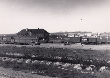
Edson, Alta, incorporated as a village then as a town in 1911, population 8475 (2011c), 8098 (2006c). The Town of Edson is the distribution centre for a mining, timber and oil area 200 km due west of Edmonton. Named for Edson J.
"https://d2ttikhf7xbzbs.cloudfront.net/media/media/2a873a72-a5a8-4819-8605-59b9966ba43d.jpg" // resources/views/front/categories/view.blade.php
https://d2ttikhf7xbzbs.cloudfront.net/media/media/2a873a72-a5a8-4819-8605-59b9966ba43d.jpg
-
Article
Eglinton Theatre
The Eglinton Theatre, designed for cinema by Kaplan & Sprachman, architects, Toronto (1935-36), is one of the fullest interpretations of Art Deco styling in the mid-1930s in Canada.
"https://development.thecanadianencyclopedia.ca/images/tce_placeholder.jpg?v=e9dca980c9bdb3aa11e832e7ea94f5d9" // resources/views/front/categories/view.blade.php
https://development.thecanadianencyclopedia.ca/images/tce_placeholder.jpg?v=e9dca980c9bdb3aa11e832e7ea94f5d9
-
Article
Elbow
The first settlers appear to have been ranchers. By 1903 settlers were taking up homesteads near Elbow, and by the end of the decade lands in the elbow were extensively occupied. The CANADIAN PACIFIC RAILWAY, which arrived in 1908, has accounted for the continued existence of the village.
"https://development.thecanadianencyclopedia.ca/images/tce_placeholder.jpg?v=e9dca980c9bdb3aa11e832e7ea94f5d9" // resources/views/front/categories/view.blade.php
https://development.thecanadianencyclopedia.ca/images/tce_placeholder.jpg?v=e9dca980c9bdb3aa11e832e7ea94f5d9
-
Article
Elgin and Winter Garden Theatre Centre
Marcus Loew, the American entrepreneur who formed the Loew's Theatres chain in the early 1900s (and later the MGM movie studio), commissioned the "movie palace" architect, Thomas W. Lamb, to design the Loew's Yonge Street and Winter Garden Theatres in Toronto.
"https://d2ttikhf7xbzbs.cloudfront.net/media/media/e17cbd5a-34fa-4c13-9368-f5fff60d3840.jpg" // resources/views/front/categories/view.blade.php
https://d2ttikhf7xbzbs.cloudfront.net/media/media/e17cbd5a-34fa-4c13-9368-f5fff60d3840.jpg
-
Article
Elgin Settlement
The Elgin Settlement, also known as Buxton, was one of four organized Black settlements developed in Southwestern Ontario in the mid-1800s. Established in 1849 by Reverend William King, the Elgin Settlement was one of the last stops on the Underground Railroad. Today, the settlement is a national historic site within the Municipality of Chatham-Kent. It was named in honour of Lord Elgin, governor general of Upper Canada. The name “Buxton” paid tribute to Sir Thomas Fowell Buxton, a slave trade abolitionist. While the community was officially known as the Elgin Settlement, at its heart was the Buxton Mission. The Elgin Settlement was the largest of the four Black settlements and considered the most successful.
"https://d2ttikhf7xbzbs.cloudfront.net/media/new_article_images/ElginSettlement/BuxtonMainStreet.jpg" // resources/views/front/categories/view.blade.php
https://d2ttikhf7xbzbs.cloudfront.net/media/new_article_images/ElginSettlement/BuxtonMainStreet.jpg
-
Article
Elk Island National Park
Elk Island National Park (established 1913, 194 km2) is a sanctuary of rolling woodlands and meadows dotted with lakes, bogs and ponds, 48 km east of Edmonton.
"https://d2ttikhf7xbzbs.cloudfront.net/media/media/f0d626c8-e7ab-4061-951e-3097fe21e3ad.jpg" // resources/views/front/categories/view.blade.php
https://d2ttikhf7xbzbs.cloudfront.net/media/media/f0d626c8-e7ab-4061-951e-3097fe21e3ad.jpg
-
Article
Elkford
Elkford, British Columbia, incorporated as a district municipality in 1981, population 2,499 (2016 census), 2,523 (2011 census). The District of Elkford is situated on the west side of the Elk River. The Elk River is a tributary to the Kootenay River, in the East Kootenay district of southeastern British Columbia. The district is 35 km north of Sparwood. It’s located among the Rocky Mountains, near the old coal-mining communities of Crowsnest Pass, and on the traditional territory of the Ktunaxa people. At 1,300 m elevation, Elkford is the highest community in British Columbia.
"https://development.thecanadianencyclopedia.ca/images/tce_placeholder.jpg?v=e9dca980c9bdb3aa11e832e7ea94f5d9" // resources/views/front/categories/view.blade.php
https://development.thecanadianencyclopedia.ca/images/tce_placeholder.jpg?v=e9dca980c9bdb3aa11e832e7ea94f5d9
-
Article
Ellef Ringnes Island
Ellef Ringnes Island, 11 295 km2, is part of the SVERDRUP group that borders the Arctic Ocean. Most of the island consists of great thicknesses of sedimentary rock, except for an occurrence of the arctic coastal plain in the northwest corner.
"https://development.thecanadianencyclopedia.ca/images/tce_placeholder.jpg?v=e9dca980c9bdb3aa11e832e7ea94f5d9" // resources/views/front/categories/view.blade.php
https://development.thecanadianencyclopedia.ca/images/tce_placeholder.jpg?v=e9dca980c9bdb3aa11e832e7ea94f5d9
