Browse "Places"
-
Article
Fort Beauséjour
Fort Beauséjour, on the west bank of the Missaguash River near present-day Sackville, New Brunswick was built 1751-55 by the French as a counter to nearby British Fort Lawrence (near Amherst, NS).
"https://development.thecanadianencyclopedia.ca/images/tce_placeholder.jpg?v=e9dca980c9bdb3aa11e832e7ea94f5d9" // resources/views/front/categories/view.blade.php
https://development.thecanadianencyclopedia.ca/images/tce_placeholder.jpg?v=e9dca980c9bdb3aa11e832e7ea94f5d9
-
Article
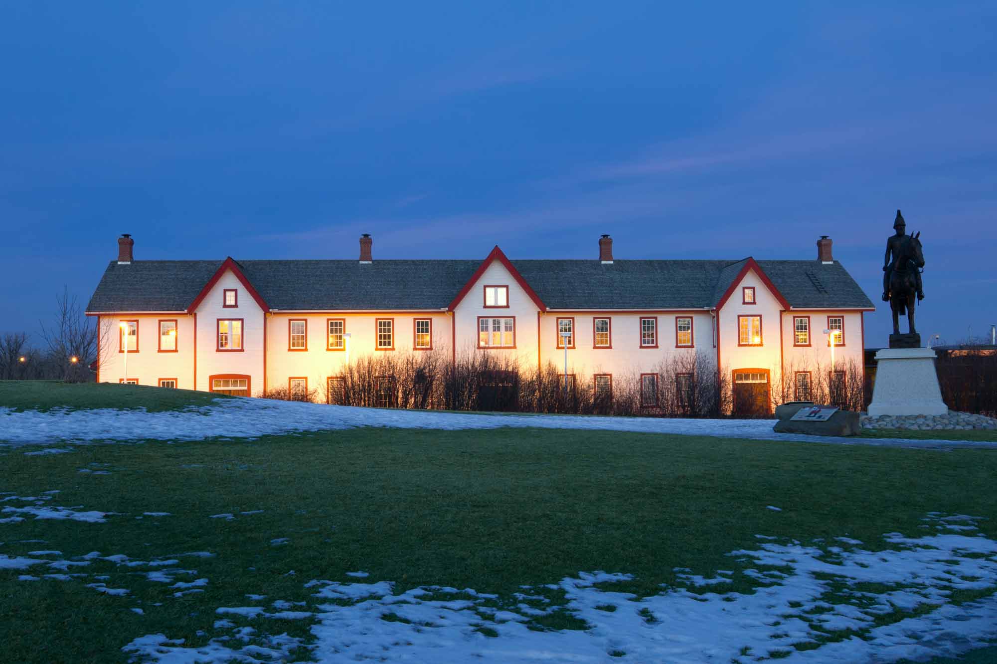
Fort Calgary
Fort Calgary is located at the junction of the Bow and Elbow rivers on the site of the present-day city of Calgary. It was established in 1875 as a post of the North-West Mounted Police. In 1925, Fort Calgary was designated a National Historic Site.
"https://d2ttikhf7xbzbs.cloudfront.net/media/media/e05805b7-fc65-443a-9f50-fbcf53aac66c.jpg" // resources/views/front/categories/view.blade.php
https://d2ttikhf7xbzbs.cloudfront.net/media/media/e05805b7-fc65-443a-9f50-fbcf53aac66c.jpg
-
Article
Fort Carlton
Fort Carlton, situated on the south branch of the North Saskatchewan River near Duck Lake (Saskatchewan), was established in 1810 as a Hudson's Bay Company fur trade and provision post.
"https://development.thecanadianencyclopedia.ca/images/tce_placeholder.jpg?v=e9dca980c9bdb3aa11e832e7ea94f5d9" // resources/views/front/categories/view.blade.php
https://development.thecanadianencyclopedia.ca/images/tce_placeholder.jpg?v=e9dca980c9bdb3aa11e832e7ea94f5d9
-
Article
Fort Chambly
In 1813, during the WAR OF 1812, construction of a vast military complex was undertaken. Insufficient maintenance reduced Chambly to a dilapidated condition, and it was abandoned in 1851. Private restoration in 1882-83 preserved the site, which became Fort Chambly National Historic Park in 1921.
"https://d2ttikhf7xbzbs.cloudfront.net/media/media/f449a69c-459a-4c23-b187-211f7516157b.jpg" // resources/views/front/categories/view.blade.php
https://d2ttikhf7xbzbs.cloudfront.net/media/media/f449a69c-459a-4c23-b187-211f7516157b.jpg
-
Article
Fort Chipewyan
Fort Chipewyan, Alta, Unincorporated Place, population 847 (2011c), 756(2006c). The community of Fort Chipewyan was established for the NORTH WEST CO in 1788 by Roderick Mackenzie, cousin of Alexander MACKENZIE.
"https://d2ttikhf7xbzbs.cloudfront.net/media/media/976a3aea-8ae7-4344-b07d-ab184befc974.jpg" // resources/views/front/categories/view.blade.php
https://d2ttikhf7xbzbs.cloudfront.net/media/media/976a3aea-8ae7-4344-b07d-ab184befc974.jpg
-
"https://development.thecanadianencyclopedia.ca/images/tce_placeholder.jpg?v=e9dca980c9bdb3aa11e832e7ea94f5d9" // resources/views/front/categories/view.blade.php
https://development.thecanadianencyclopedia.ca/images/tce_placeholder.jpg?v=e9dca980c9bdb3aa11e832e7ea94f5d9
-
Article
Fort Duquesne
Fort Duquesne, located at the confluence of the Allegheny and Monongahela Rivers at the site of present-day Pittsburgh, Penn, guarded the most important strategic location in the west at the time of the Seven Years' War.
"https://development.thecanadianencyclopedia.ca/images/tce_placeholder.jpg?v=e9dca980c9bdb3aa11e832e7ea94f5d9" // resources/views/front/categories/view.blade.php
https://development.thecanadianencyclopedia.ca/images/tce_placeholder.jpg?v=e9dca980c9bdb3aa11e832e7ea94f5d9
-
Article
Fort Edmonton
Fort Edmonton was established on the Northern Saskatchewan River in 1795 by the Hudson's Bay Company as a fortified trading post next to the rival North West Company, which had earlier built its own fort nearby.
"https://d2ttikhf7xbzbs.cloudfront.net/media/media/59b16b11-e6be-4cf9-812f-126f5a933c3f.jpg" // resources/views/front/categories/view.blade.php
https://d2ttikhf7xbzbs.cloudfront.net/media/media/59b16b11-e6be-4cf9-812f-126f5a933c3f.jpg
-
Article
Fort Ellice
Fort Ellice was a Hudson's Bay Company trading post located on Beaver Creek near the confluence of the Assiniboine and Qu'Appelle rivers, just east of the present-day Manitoba-Saskatchewan border. Established in 1831 by C.T.
"https://development.thecanadianencyclopedia.ca/images/tce_placeholder.jpg?v=e9dca980c9bdb3aa11e832e7ea94f5d9" // resources/views/front/categories/view.blade.php
https://development.thecanadianencyclopedia.ca/images/tce_placeholder.jpg?v=e9dca980c9bdb3aa11e832e7ea94f5d9
-
Article
Fort Erie
Fort Erie, Ont, incorporated as a town in 1931, population 29 960 (2011c), 29 925 (2006c). The Town of Fort Erie is located at the south entrance to the NIAGARA RIVER, opposite Buffalo, NY.
"https://d2ttikhf7xbzbs.cloudfront.net/media/media/528fc0db-255d-4206-bfde-3fcb0b932747.jpg" // resources/views/front/categories/view.blade.php
https://d2ttikhf7xbzbs.cloudfront.net/media/media/528fc0db-255d-4206-bfde-3fcb0b932747.jpg
-
Article
Fort Erie National Historic Site of Canada
Fort Erie National Historic Site recognizes a particularly strategic site during the War of 1812 at the entrance to the Niagara River from Lake Erie at the southeast corner of the Niagara Peninsula.
"https://development.thecanadianencyclopedia.ca/images/tce_placeholder.jpg?v=e9dca980c9bdb3aa11e832e7ea94f5d9" // resources/views/front/categories/view.blade.php
https://development.thecanadianencyclopedia.ca/images/tce_placeholder.jpg?v=e9dca980c9bdb3aa11e832e7ea94f5d9
-
Article
Fort Frances
Fort Frances, Ontario, incorporated as a town in 1903, population 7952 (2011c), 8103 (2006c). The Town of Fort Frances is located in northwestern Ontario at the west end of RAINY LAKE, where it drains into Rainy River.
"https://development.thecanadianencyclopedia.ca/images/tce_placeholder.jpg?v=e9dca980c9bdb3aa11e832e7ea94f5d9" // resources/views/front/categories/view.blade.php
https://development.thecanadianencyclopedia.ca/images/tce_placeholder.jpg?v=e9dca980c9bdb3aa11e832e7ea94f5d9
-
Article
Fort Frontenac
Frontenac reoccupied the site, rebuilding the fort in 1695, and the post became known as Fort Frontenac. Reinforced by troops under François-Charles de Bourlamaque and later the Marquis de MONTCALM, it nevertheless fell to the British under John Bradstreet in August 1758.
"https://d2ttikhf7xbzbs.cloudfront.net/media/media/224b2211-a1a9-4b89-888f-fab9972af144.jpg" // resources/views/front/categories/view.blade.php
https://d2ttikhf7xbzbs.cloudfront.net/media/media/224b2211-a1a9-4b89-888f-fab9972af144.jpg
-
Article
Fort George and Buckingham House
Fort George and Buckingham House, located 13 km southeast of Elk Point, Alta, were competing trading posts operated by the North West Company and the Hudson's Bay Company, respectively.
"https://development.thecanadianencyclopedia.ca/images/tce_placeholder.jpg?v=e9dca980c9bdb3aa11e832e7ea94f5d9" // resources/views/front/categories/view.blade.php
https://development.thecanadianencyclopedia.ca/images/tce_placeholder.jpg?v=e9dca980c9bdb3aa11e832e7ea94f5d9
-
Article
Fort George National Historic Site of Canada
Fort George National Historic Site and Battlefield of Fort George National Historic Site in the town of Niagara-on-the-Lake, Ont, were designated in 1921 by the Historic Sites and Monuments Board of Canada.
"https://development.thecanadianencyclopedia.ca/images/tce_placeholder.jpg?v=e9dca980c9bdb3aa11e832e7ea94f5d9" // resources/views/front/categories/view.blade.php
https://development.thecanadianencyclopedia.ca/images/tce_placeholder.jpg?v=e9dca980c9bdb3aa11e832e7ea94f5d9
