Browse "Places"
-
Article
Hartland
Hartland, NB, incorporated as a town in 1918, population 947 (2011c), 947 (2006c). The Town of Hartland is located at the mouth of Becaguimec Stream, 124 km upriver from Fredericton on the SAINT JOHN RIVER.
"https://d2ttikhf7xbzbs.cloudfront.net/media/media/47b24fcb-cb02-4988-ac93-8d8199dd5a7f.jpg" // resources/views/front/categories/view.blade.php
https://d2ttikhf7xbzbs.cloudfront.net/media/media/47b24fcb-cb02-4988-ac93-8d8199dd5a7f.jpg
-
Article
Haskell Opera House/Opéra Haskell
Haskell Opera House/Opéra Haskell. A 400-seat theatre that has the distinction of being partly in Canada (Stanstead, formerly Rock Island, Quebec) and partly in the United States (Derby Line, Vermont).
"https://development.thecanadianencyclopedia.ca/images/tce_placeholder.jpg?v=e9dca980c9bdb3aa11e832e7ea94f5d9" // resources/views/front/categories/view.blade.php
https://development.thecanadianencyclopedia.ca/images/tce_placeholder.jpg?v=e9dca980c9bdb3aa11e832e7ea94f5d9
-
Article
Hawkesbury
Hawkesbury, Ontario, incorporated as a town in 1896, population 10,263 (2016 census), 10,551 (2011 census). The town of Hawkesbury is located on the Ottawa River, 95 km east of Ottawa.
"https://development.thecanadianencyclopedia.ca/images/tce_placeholder.jpg?v=e9dca980c9bdb3aa11e832e7ea94f5d9" // resources/views/front/categories/view.blade.php
https://development.thecanadianencyclopedia.ca/images/tce_placeholder.jpg?v=e9dca980c9bdb3aa11e832e7ea94f5d9
-
Article
Hay River
Hay River, Northwest Territories, incorporated as a town in 1963, population 3,169 (2021 census), 3,528 (2016 census). The town of Hay River is located on the south shore of Great Slave Lake at the mouth of the Hay River, about 200 air km southwest of Yellowknife.
"https://d2ttikhf7xbzbs.cloudfront.net/media/media/033734fa-dbda-414b-a290-f459d2a67b5a.jpg" // resources/views/front/categories/view.blade.php
https://d2ttikhf7xbzbs.cloudfront.net/media/media/033734fa-dbda-414b-a290-f459d2a67b5a.jpg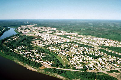
-
Article
Hayes River
The Hayes River, 483 km long, rises in Molson Lake (399 km2) northeast of Lake Winnipeg, flows northeast to Oxford Lake (401 km2) and Knee Lake, through the rock and bush of the Canadian Shield, across the clay flats of the Hudson Bay Lowlands and into the bay at YORK FACTORY.
"https://development.thecanadianencyclopedia.ca/images/tce_placeholder.jpg?v=e9dca980c9bdb3aa11e832e7ea94f5d9" // resources/views/front/categories/view.blade.php
https://development.thecanadianencyclopedia.ca/images/tce_placeholder.jpg?v=e9dca980c9bdb3aa11e832e7ea94f5d9
-
Article
Hazelton
Hazelton, British Columbia, incorporated as a village in 1956, population 270 (2011c), 293 (2006c). The Village of Hazelton is situated at the confluence of the Skeena and Bulkley rivers. The townsite was laid out by Edgar DEWDNEY in 1871 next to the GITKSAN village of Gitanmaax.
"https://development.thecanadianencyclopedia.ca/images/tce_placeholder.jpg?v=e9dca980c9bdb3aa11e832e7ea94f5d9" // resources/views/front/categories/view.blade.php
https://development.thecanadianencyclopedia.ca/images/tce_placeholder.jpg?v=e9dca980c9bdb3aa11e832e7ea94f5d9
-
Article
HBC Trading Posts in Canada
From 1670 until 1987, the Hudson’s Bay Company (HBC) operated hundreds of trading posts in various parts of Canada and the northwestern US. During the fur trade, Indigenous trappers visited trading posts to exchange furs for valued goods produced by Europeans, including metal objects, weapons and glass beads. In 1870, the HBC’s vast territory of northern wilderness (see Rupert’s Land and North-Western Territories) was transferred to the Canadian government, and the HBC gradually transitioned from a fur trading company to a retail establishment. The HBC maintained posts in Northern Canada, however, until 1987. Some settlements that remained in and around the old trading posts developed into cities, such as Winnipeg (Fort Garry), Edmonton (Fort Edmonton) and Victoria (Fort Victoria). Some First Nations that had established themselves near HBC posts also have names that reflect their fur trading history, including Fort Albany First Nation in Ontario and Fort McKay First Nation in Alberta.
"https://d2ttikhf7xbzbs.cloudfront.net/Kugluktuk-Trading-Post.jpg" // resources/views/front/categories/view.blade.php
https://d2ttikhf7xbzbs.cloudfront.net/Kugluktuk-Trading-Post.jpg
-
Article
Head-Smashed-In Buffalo Jump
Head-Smashed-In Buffalo Jump is an archaeological site located on the southern end of the Porcupine Hills in southwest Alberta.
"https://d2ttikhf7xbzbs.cloudfront.net/media/media/044efca3-4d40-4efa-b5ae-4f9f20403ea4.jpeg" // resources/views/front/categories/view.blade.php
https://d2ttikhf7xbzbs.cloudfront.net/media/media/044efca3-4d40-4efa-b5ae-4f9f20403ea4.jpeg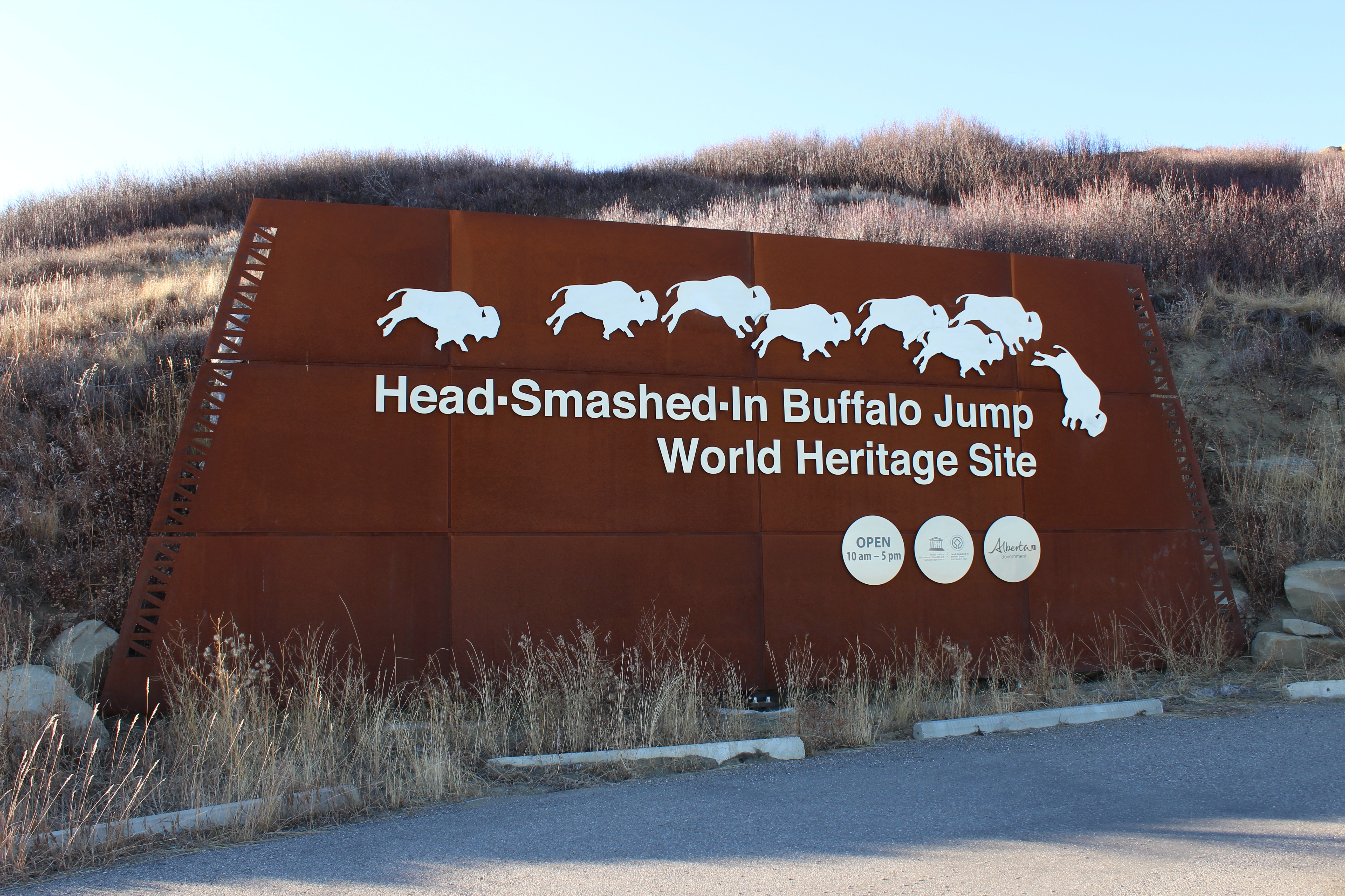
-
Article
Hearst
Hearst, Ont, incorporated as a town in 1922, population 5090 (2011c), 5620 (2006c). The Town of Hearst is situated in the Cochrane District of northeastern Ontario on the Mattawishkwia River, 260 km northwest of TIMMINS.
"https://development.thecanadianencyclopedia.ca/images/tce_placeholder.jpg?v=e9dca980c9bdb3aa11e832e7ea94f5d9" // resources/views/front/categories/view.blade.php
https://development.thecanadianencyclopedia.ca/images/tce_placeholder.jpg?v=e9dca980c9bdb3aa11e832e7ea94f5d9
-
Article
Heart's Content
Heart's Content, NL, incorporated as a town in 1967, population 418 (2011c), 418 (2006c). The Town of Heart's Content is a fishing community on a protected, urn-shaped harbour in eastern Trinity Bay.
"https://development.thecanadianencyclopedia.ca/images/tce_placeholder.jpg?v=e9dca980c9bdb3aa11e832e7ea94f5d9" // resources/views/front/categories/view.blade.php
https://development.thecanadianencyclopedia.ca/images/tce_placeholder.jpg?v=e9dca980c9bdb3aa11e832e7ea94f5d9
-
Article
Heart's Content Cable Station
Hearts Content Cable Station is a provincial HISTORIC SITE commemorating one of the most significant events in the 19th century: the laying of a trans-Atlantic TELEGRAPH cable in 1866 from Ireland to HEART'S CONTENT, NL.
"https://development.thecanadianencyclopedia.ca/images/tce_placeholder.jpg?v=e9dca980c9bdb3aa11e832e7ea94f5d9" // resources/views/front/categories/view.blade.php
https://development.thecanadianencyclopedia.ca/images/tce_placeholder.jpg?v=e9dca980c9bdb3aa11e832e7ea94f5d9
-
Article
Hebron Mission National Historic Site of Canada
For generations, Hebron, one of Nunatsiavut’s (see Labrador Inuit and Newfoundland and Labrador) most culturally important and significant sites, was an important meeting place for the Inuit, as well as a primary hunting and fishing area. In the early 1800s, Moravian missionaries chose the site to establish their fourth and northernmost mission in Labrador, officially opening the mission in 1830 (although missions were later established farther north, at Ramah in 1871 and Killinek in 1905). For more than 130 years, Hebron was a thriving community where an average of 200 to 250 Inuit lived. In 1959, without consultation with the Inuit, the community was closed, forcing all Inuit to relocate. Declared a National Historic Site in 1976 by the federal government, the Hebron Mission has been undergoing major restoration since 2004.
"https://d2ttikhf7xbzbs.cloudfront.net/media/new_article_images/HebronMissionNationalHistoricSiteofCanada/Hebron_Mission_1901_photo.png" // resources/views/front/categories/view.blade.php
https://d2ttikhf7xbzbs.cloudfront.net/media/new_article_images/HebronMissionNationalHistoricSiteofCanada/Hebron_Mission_1901_photo.png
-
Article
Hecate Strait
Hecate Strait is a body of water 48-140 km wide, underlain by a shallow basin (less than 45 m at the north end) separating Haida Gwaii from mainland British Columbia.
"https://development.thecanadianencyclopedia.ca/images/tce_placeholder.jpg?v=e9dca980c9bdb3aa11e832e7ea94f5d9" // resources/views/front/categories/view.blade.php
https://development.thecanadianencyclopedia.ca/images/tce_placeholder.jpg?v=e9dca980c9bdb3aa11e832e7ea94f5d9
-
Article
Hecla Provincial Park
Near the south end of Lake WINNIPEG some 160 km north of Winnipeg is Hecla Provincial Park (established 1969, 865.4 km2).
"https://development.thecanadianencyclopedia.ca/images/tce_placeholder.jpg?v=e9dca980c9bdb3aa11e832e7ea94f5d9" // resources/views/front/categories/view.blade.php
https://development.thecanadianencyclopedia.ca/images/tce_placeholder.jpg?v=e9dca980c9bdb3aa11e832e7ea94f5d9
-
"https://development.thecanadianencyclopedia.ca/images/tce_placeholder.jpg?v=e9dca980c9bdb3aa11e832e7ea94f5d9" // resources/views/front/categories/view.blade.php
https://development.thecanadianencyclopedia.ca/images/tce_placeholder.jpg?v=e9dca980c9bdb3aa11e832e7ea94f5d9