Browse "Places"
-
Article
Matane
In the 1950s, the closing of several paper mills resulted in widespread unemployment. A decade later, however, the recognition of Matane's port as an important regional transportation and distribution point revived interest in the town. There is now a pulp mill and a paper mill providing employment.
"https://development.thecanadianencyclopedia.ca/images/tce_placeholder.jpg?v=e9dca980c9bdb3aa11e832e7ea94f5d9" // resources/views/front/categories/view.blade.php
https://development.thecanadianencyclopedia.ca/images/tce_placeholder.jpg?v=e9dca980c9bdb3aa11e832e7ea94f5d9
-
Article
Black River-Matheson
Black River-Matheson, Ontario, incorporated as a township in 1969, population 2,572 (2021 census), 2,438 (2016 census). Black River-Matheson is located 296 km northwest of North Bay.
"https://d2ttikhf7xbzbs.cloudfront.net/blackrivermatheson/Matheson-Station.jpg" // resources/views/front/categories/view.blade.php
https://d2ttikhf7xbzbs.cloudfront.net/blackrivermatheson/Matheson-Station.jpg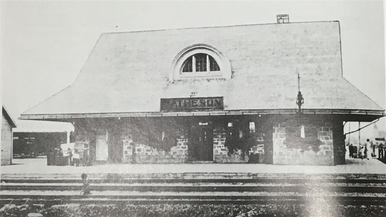
-
Article
Matsqui
Matsqui, BC, Urban Community, was a district municipality (1892-1995) until it was merged with the District Municipality of Abbotsford to form the city of ABBOTSFORD. Matsqui is located between the FRASER RIVER (opposite the district of MISSION) and the US border.
"https://development.thecanadianencyclopedia.ca/images/tce_placeholder.jpg?v=e9dca980c9bdb3aa11e832e7ea94f5d9" // resources/views/front/categories/view.blade.php
https://development.thecanadianencyclopedia.ca/images/tce_placeholder.jpg?v=e9dca980c9bdb3aa11e832e7ea94f5d9
-
Article
Mattawa River
The Mattawa River rises in Trout Lake in north-central Ontario, 198.5 m above sea level and drops to 50 m over around 65 km distance to the Ottawa River. Its watershed encompasses 1170 km2 of the Canadian Shield.
"https://development.thecanadianencyclopedia.ca/images/tce_placeholder.jpg?v=e9dca980c9bdb3aa11e832e7ea94f5d9" // resources/views/front/categories/view.blade.php
https://development.thecanadianencyclopedia.ca/images/tce_placeholder.jpg?v=e9dca980c9bdb3aa11e832e7ea94f5d9
-
Article
Maxville
Maxville, ON, former municipality, population 816 (2016 census), 811 (2011 census). Maxville is located southeast of Ottawa. It began around 1869 and expanded rapidly when the Canada Atlantic Railway established a station there in 1881. Maxville was incorporated as a village in 1891, but is now part of the township of North Glengarry (1998).
"https://development.thecanadianencyclopedia.ca/images/tce_placeholder.jpg?v=e9dca980c9bdb3aa11e832e7ea94f5d9" // resources/views/front/categories/view.blade.php
https://development.thecanadianencyclopedia.ca/images/tce_placeholder.jpg?v=e9dca980c9bdb3aa11e832e7ea94f5d9
-
Article
Mayo
In 1919 the discovery of silver-lead deposits at KENO HILL transformed Mayo into a major transshipment point for ore. In 1950 a road was built to the Klondike Highway, but as the riverboats went out of service, Mayo declined.
"https://development.thecanadianencyclopedia.ca/images/tce_placeholder.jpg?v=e9dca980c9bdb3aa11e832e7ea94f5d9" // resources/views/front/categories/view.blade.php
https://development.thecanadianencyclopedia.ca/images/tce_placeholder.jpg?v=e9dca980c9bdb3aa11e832e7ea94f5d9
-
Article
McAdam
McAdam, NB, incorporated as a village in1966, population 1284 (2011c), 1404 (2006c). The Village of McAdam is located in York County, in the Appalachian Highlands region of southwestern New Brunswick, 10 km from the Canada/US border.
"https://development.thecanadianencyclopedia.ca/images/tce_placeholder.jpg?v=e9dca980c9bdb3aa11e832e7ea94f5d9" // resources/views/front/categories/view.blade.php
https://development.thecanadianencyclopedia.ca/images/tce_placeholder.jpg?v=e9dca980c9bdb3aa11e832e7ea94f5d9
-
Article
McCord Stewart Museum
The McCord Stewart Museum is one of the few museums in Canada dedicated to the study of social history. Initially opened as the McCord National Museum in 1921, it closed to the public during the Great Depression. It reopened in McGill University’s old Student Union Building in downtown Montreal in 1971. It merged with the Stewart Museum in 2013 and absorbed the Fashion Museum in 2018. The McCord Stewart Museum was originally created to house the extensive collection of Canadiana amassed by David Ross McCord. The museum holds an estimated 2.1 million items, including objects, images and manuscripts.
"https://d2ttikhf7xbzbs.cloudfront.net/1024px-Musee_McCord_Montreal_4036379706.jpg" // resources/views/front/categories/view.blade.php
https://d2ttikhf7xbzbs.cloudfront.net/1024px-Musee_McCord_Montreal_4036379706.jpg
-
Article
McCulloch House
McCulloch House in PICTOU, NS, was built in about 1806 for Thomas MCCULLOCH, one of the Maritimes' leading educators and a theologian, writer and scholar of note. McCulloch arrived in Pictou in 1803 on his way to Prince Edward Island.
"https://development.thecanadianencyclopedia.ca/images/tce_placeholder.jpg?v=e9dca980c9bdb3aa11e832e7ea94f5d9" // resources/views/front/categories/view.blade.php
https://development.thecanadianencyclopedia.ca/images/tce_placeholder.jpg?v=e9dca980c9bdb3aa11e832e7ea94f5d9
-
Article
McDonald Archaeological Site
The McDonald site is an ancient Iroquoian village located in the backcountry of Saint-Anicet, a small town situated in southwest Québec about 70 km upstream from Montreal.
"https://d2ttikhf7xbzbs.cloudfront.net/media/media/3600d942-ab60-4538-9880-a3a8d5861733.JPG" // resources/views/front/categories/view.blade.php
https://d2ttikhf7xbzbs.cloudfront.net/media/media/3600d942-ab60-4538-9880-a3a8d5861733.JPG
-
Article
McMichael Canadian Art Collection
The McMichael Canadian Art Collection is the only public art gallery in the country that is solely devoted to Canadian art.
"https://d2ttikhf7xbzbs.cloudfront.net/media/media/18c8ebdf-0628-4594-a4e1-e1b349ae6736.jpg" // resources/views/front/categories/view.blade.php
https://d2ttikhf7xbzbs.cloudfront.net/media/media/18c8ebdf-0628-4594-a4e1-e1b349ae6736.jpg
-
Article
Meadow Lake
During the 1930s many farmers deserted land in the "dust bowl" and moved N to start again. Meadow Lake was a popular destination, and the arrival of a CPR line in 1936 provided an opportunity for further development.
"https://development.thecanadianencyclopedia.ca/images/tce_placeholder.jpg?v=e9dca980c9bdb3aa11e832e7ea94f5d9" // resources/views/front/categories/view.blade.php
https://development.thecanadianencyclopedia.ca/images/tce_placeholder.jpg?v=e9dca980c9bdb3aa11e832e7ea94f5d9
-
Article
Meaford
Meaford, Ont, incorporated as a municipality in 2001, population 11 100 (2011c) 10 948 (2006c). The Municipality of Meaford was a town (incorporated in 1874) until 2001 when it was amalgamated with St Vincent and Sydenham townships to create the Municipality of Meaford
"https://d2ttikhf7xbzbs.cloudfront.net/media/media/2fa20b37-d822-4528-b9b5-d99acf454bfc.jpg" // resources/views/front/categories/view.blade.php
https://d2ttikhf7xbzbs.cloudfront.net/media/media/2fa20b37-d822-4528-b9b5-d99acf454bfc.jpg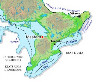
-
Article
Meares Island
Meares Island, 84.8 km2 of dramatic terrain, temperate rain forest and sheltered tidal waters, is 2 km from Tofino, BC, in Clayoquot Sound. It was named in 1862 after John Meares. Its traditional name is Wanachus-Hilthuuis, from the Nuu-chah-nulth language.
"https://development.thecanadianencyclopedia.ca/images/tce_placeholder.jpg?v=e9dca980c9bdb3aa11e832e7ea94f5d9" // resources/views/front/categories/view.blade.php
https://development.thecanadianencyclopedia.ca/images/tce_placeholder.jpg?v=e9dca980c9bdb3aa11e832e7ea94f5d9
-
Article
Mechanics' Hall (Toronto)
Mechanics’ Hall was a concert hall on the ground floor of Toronto’s Mechanics’ Institute at the corner of Church and Adelaide streets.
"https://development.thecanadianencyclopedia.ca/images/tce_placeholder.jpg?v=e9dca980c9bdb3aa11e832e7ea94f5d9" // resources/views/front/categories/view.blade.php
https://development.thecanadianencyclopedia.ca/images/tce_placeholder.jpg?v=e9dca980c9bdb3aa11e832e7ea94f5d9