Share on Facebook
 Share on X
 Share by Email
 Share on Google Classroom
The Toronto Islands, which cover 332 ha, are an archipelago of 15 islands in Lake Ontario about 1.6 km south of downtown Toronto. The islands include Algonquin Island, Centre Island (also known as Toronto Island, which includes Ward’s Island), Doughnut Island, Duckling Island, Forestry Island, Hanlan’s Island, Middle Island, Muggs Island, North Chippewa Island, Olympic Island, RCYC Island, Senator Frank Patrick O'Connor Island, South Island, South Chippewa Island and Snake Island.
History
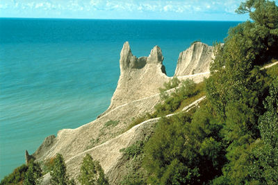
The land now known as the Toronto Islands has a long history of human activity and was known to the Mississauga as “the place of trees standing out of the water.” Originally, these islands formed a peninsula, popularly described as an island in defiance of geography. It was made up of eroded sand and gravel carried west from the Scarborough Bluffs. Separation from the mainland occurred in 1858 during a violent storm. From an area of about 145 ha in 1870, they have more than doubled in size. Winds, currents, dredging and landfill operations have shaped the islands, curving them into an 8 km hook broken on the inside into tiny lagoons and islets. The eight largest islands, with their amusement park, beaches and gardens, now attract about one million visitors a year.
Lieutenant-Governor Simcoe, who picnicked, hiked and went horseback riding on the islands in 1793, decided to make York (now part of Toronto) the naval and military centre of Upper Canada, with Gibraltar Point (now Hanlan’s Point) guarding Toronto harbour. In 1813, however, American soldiers landed and destroyed fortifications on the islands.
A residential community for over 150 years, Ward’s Island (part of Centre Island), at the eastern edge of the archipelago, was named after fisherman David Ward, who settled there with his family in 1834. The Ward’s Island community is linked by a bridge to Algonquin Island, and together, their residential population occupies 250 homes owned by islanders on land leased from Metro Toronto. In the early 1950s, 8000 people lived on Centre Island, but its summer resort hotels, theatres and stores were demolished in the late 1950s and 1960s to make room for parkland. Since 1956, the remaining residents have struggled to save their homes. In 1981, the Government of Ontario passed legislation ensuring that the community would continue to exist at least until 2005. The legislation was later updated to preserve the community until 2092.
Notable Locations
Centreville Amusement Park
Centreville Amusement Park is an amusement park located on the central portion of Centre Island of the Toronto Islands. The park was created in 1967, following the closure of its predecessor Sunnyside Amusement Park in 1955.
During the late 2010s and early 2020s, Centreville Amusement Park experienced intermitted closures due to a flood and later COVID-19. Since its re-opening in 2021, the park has featured over 30 different attractions and several food outlets and is open each summer.
Hanlan’s Point
Hanlan’s Point is a beach running along the western border of Centre Island, stretching south from the Toronto City Centre Airport. This beach has a very long cultural history as both a 2SLGBTQ+ space and a nudist beach. Hanlan’s Point is also known for its unique sand dune ecology.
Hanlan’s Point’s history as a 2SLGBTQ+ space can be traced back to at least the 1930s when it served as a meeting spot for members of the 2SLGBTQ+ community. Newspaper clippings as early as 1951 recognize Hanlan’s Point as a 2SLGBTQ+ space.
This led the beach to become the site of Canada’s first-ever Pride gathering, the Gay Day Picnic, in 1971. This event was in response to the decriminalization of homosexuality and was planned in preparation for the We Demand march.
Higher visibility led to backlash, and the 1970s and 1980s saw a police crackdown on the beach, leading to arrests. Since homosexuality had been decriminalized, it wasn’t until public nudity was criminalized that the arrests stuck.
Despite this, Hanlan’s point saw continued use as a 2SLGBTQ+ space throughout the 80s, 90s, 00s and 10s, with human rights protests, AIDS organizations, gay and lesbian sports leagues, and 2SLGBTQ+ racial justice groups hosting summer events at the beach.
Today, the space continues to be an important place for the 2SLGBTQ+ community of Toronto. The more southern portion of the beach is home to the most 2SLGBTQ+ history, whereas the central portion is a designated nudist area. However, the beach is experiencing ecological degradation. Tommy Thompson Park blocks sand from the Scarborough bluffs from reaching the Toronto Islands, leading to a net loss of sand and beach space in Hanlan’s Point. The sand dunes that line the beach, which is a unique type of freshwater sand dunes, are also slowly degrading, as beach-goers walk through them due to less sand on the beach.
Many people are currently advocating for increasing awareness about the 2SLGBTQ+ history of the beach and for measures to be taken to preserve the beach and the surrounding sand dunes.

Billy Bishop Toronto City Airport
Toronto City Centre Airport forms the northwest area of Hanlan's Point. This regional airport was first proposed in 1929. Construction was completed in 1939, and that very same year saw the first commercial passenger flight landing at what is now the Billy Bishop Toronto City Airport. Throughout the Second World War, the airport was primarily used as a military training base.
Today, the airport showcases a variety of local artists and primarily uses renewable energy for airport operations. The airport also serves as a base for an air ambulance service, helicopter tours, a variety of private planes and a flight school, among others.