Share on Facebook
 Share on X
 Share by Email
 Share on Google Classroom
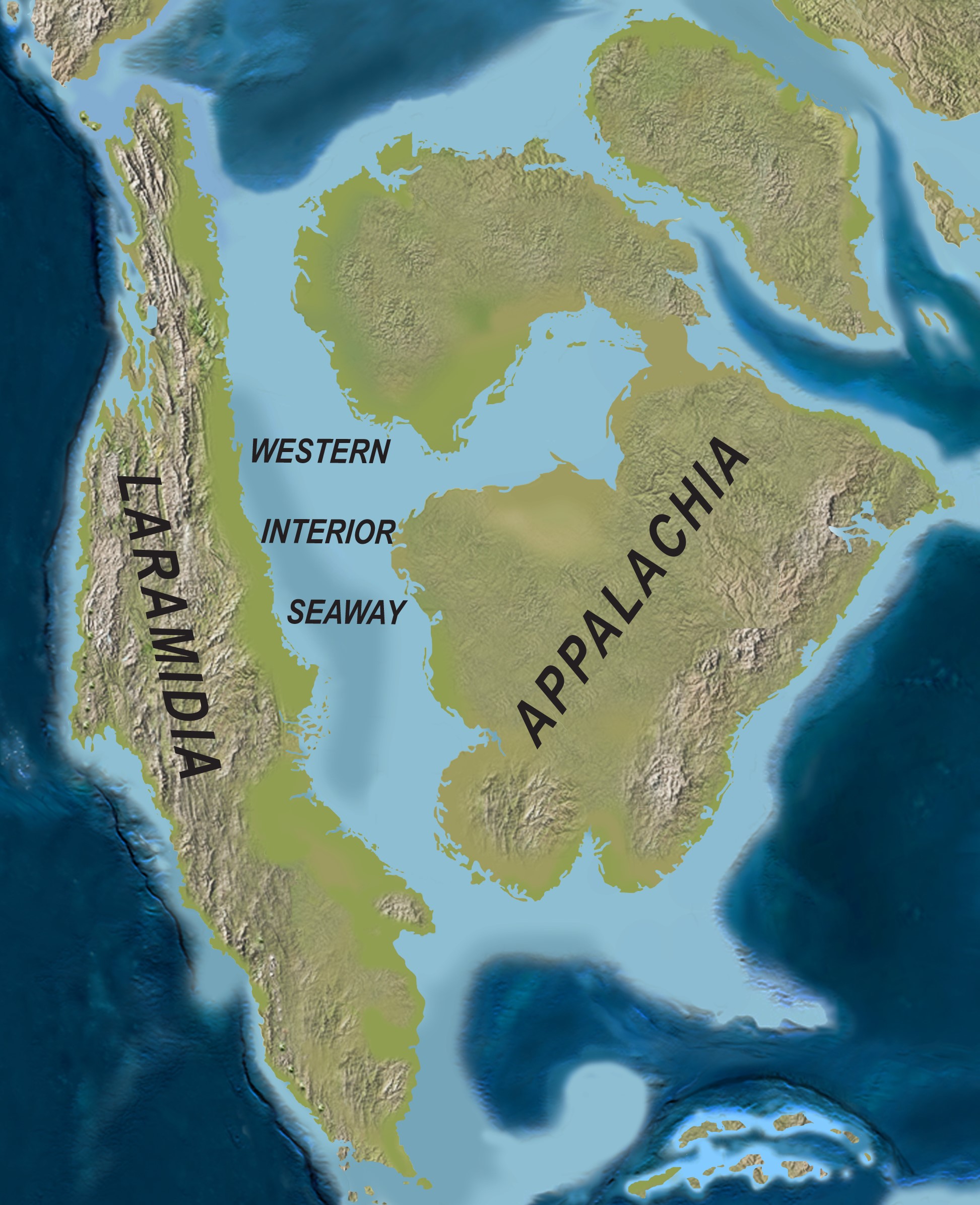
The Manitoba Escarpment is an approximately 675 km-long ridge that lies mainly within the southwest corner of Manitoba and extends into east-central Saskatchewan and northeastern North Dakota, United States (see Escarpments in Canada). The portion that extends into the United States is also known as the Pembina Escarpment. The Escarpment hosts the highest elevation points in Manitoba and divides the Canadian Prairies into the First and Second Prairie levels. Several of Manitoba’s most rare and famous fossils have been discovered along the Manitoba Escarpment from marine Cretaceous bedrock exposures between 66 and 120 million years old. Today, the varied topography, soils and microclimates of the Escarpment host a diverse community of plant and animal life, including several at-risk species.

Physical Geography
The Manitoba Escarpment is a northwest–southeast trending ridge approximately 675 km in length and is composed of five topographic highs. The majority of the Manitoba Escarpment lies within the southwestern corner of Manitoba, with its northwestern end in east-central Saskatchewan and its southeastern end in North Dakota, United States. The five topographic highs are, from southeast to northwest: Pembina Hills, Riding Mountain, Duck Mountain, Porcupine Hills and Pasquia Hills. Baldy Mountain, located in Duck Mountain Provincial Park, is the highest elevation point in Manitoba, at around 830 m above sea level.
The Canadian Prairies of Manitoba and Saskatchewan are divided by the Manitoba Escarpment into the lower elevation First Prairie Level to the east and the higher elevation Second Prairie Level to the west. River systems situated on the Second Prairie Level are part of the Assiniboine River drainage basin and drain into the Red River in Winnipeg, Manitoba. River systems of the First Prairie Level are part of the Red River drainage basin at the southern end of the Manitoba Escarpment and the Lake Manitoba sub-basin of the Lake Winnipeg drainage basin at the northern end of the Escarpment.
Geology
Surface features along the Manitoba Escarpment, such as the slope steepness of hills and valleys, are mainly an expression of the underlying Cretaceous bedrock of the Escarpment. The approximately 50 to 120 million year old Paleogene to Cretaceous bedrock is mostly made up of mudstone beds, and lesser amounts of limestone and sandstone beds. The Upper Cretaceous rock units were deposited within the Western Interior Seaway, and the Paleogene rock units were deposited within a smaller remnant of the seaway, named the Cannonball Sea. Of the rock units that are exposed at the surface, the oldest units are exposed along the northwestern end near Swan River, Manitoba, and the youngest units are exposed along the southeastern end near Boissevain, Manitoba.
Overlying the Upper Cretaceous rocks of the Manitoba Escarpment are gravels, sands, silts and clays of Quaternary age (0–2.6 million years old), related to the ice ages and the more recent glacial Lake Agassiz. Ancient beaches of Lake Agassiz are preserved in some places along the lower regions of the Manitoba Escarpment and mark the successively lower water levels of Lake Agassiz.
Did you know?
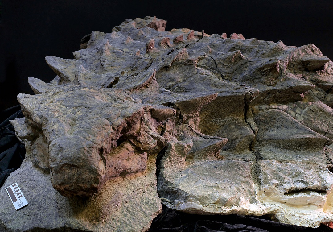
Rare fossils of marine reptiles that once swam in the Cretaceous Western Interior Seaway have been found in bedrock exposed along the Manitoba Escarpment. A few of the most notable fossil finds consist of the partial skeleton of the crocodile, Terminonaris robusta, a large skeleton of the mosasaur, Tylosaurus pembinensis, and the nearly complete front half of a large pliosaur skeleton. All three fossil finds are displayed at public museums in Manitoba and can be viewed up-close; the crocodile is at the Fort Dauphin Museum in Dauphin, the mosasaur at the Canadian Fossil Discovery Centre in Morden and the pliosaur at the Manitoba Museum in Winnipeg.
Flora and Fauna
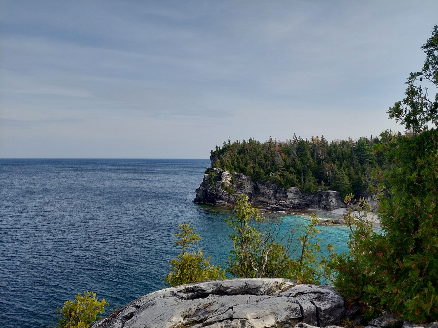
The varied topography of the Manitoba Escarpment provides a range of microclimates for diverse floral communities to flourish. In general, the Pasquia Hills, Porcupine Hills, Duck Mountain and Riding Mountain which are at the northern end of the Manitoba Escarpment host boreal forests, whereas the Pembina Hills at the southern end host aspen parkland forests and grasslands. Locally, boreal species adapted to colder and wetter environments, such as paper birch, Canada buffaloberry, bunchberry, bishop’s-cap and twin flower, grow on cool northern slopes and bogs. The warmer and drier southern slopes and highlands are host to drought-tolerant species, including long-leaved sage, broom snakeweed, scarlet globemallow, Missouri milkvetch, Nuttall’s violet, sunflower, leafy wildparsley, prairie onion and prickly pear cactus. Grasses along the Manitoba Escarpment mainly consist of fescue grasses, wheat grasses, June grass and Kentucky bluegrass.
A diverse fauna of mammals, birds, reptiles, amphibians, fish and insects dwell in the various natural habitats of the Manitoba Escarpment. Plains bison, northwestern moose, elk, black bears, cougars and grey wolves are the largest inhabitants. Other, smaller mammals include lynx, beavers, martens, fishers, red foxes, red squirrels, raccoons and river otters. Six species of bats have been recorded along the escarpment in Riding Mountain National Park, two of which are listed as endangered under the Species at Risk Act, the little brown myotis and the northern long-eared myotis. Other species at risk known to inhabit portions of the Manitoba Escarpment include the Western tiger salamander, the common snapping turtle and the barn swallow.

Human Geography
The Manitoba Escarpment is on Treaties 1, 2 and 4 territories and the traditional lands of the Anishinaabe (Ojibwe), Ininew (Cree), Oji-Cree and Dakota, and homeland of the Métis Nation. Parkland forests, grasslands and wooded valleys along the Escarpment have served as hunting and fishing grounds for Indigenous peoples and provided valuable resources for building shelter and gathering medicines for many generations. Several Indigenous communities are located along the Manitoba Escarpment including the Keeseekoowenin Ojibway and Rolling River First Nations communities on Riding Mountain and Wuskwi Sipihk Cree First Nation on the Porcupine Hills (see First Nations in Manitoba and Reserves in Manitoba).
Agriculture is the dominant form of land use in regions near the Manitoba Escarpment. Crops well adapted to the relatively short growing season of around 173 to 183 days are grown in this cryoboreal soil climate zone and mainly include spring wheat and other cereal grains, as well as oilseeds, hay and potatoes. The chernozemic black soils to the east and west of the Escarpment are among the most productive soils of Western Canada due to their relatively high organic matter and clay content, as well as their excellent water-retaining ability.