Browse "Geographical features"
-
Article
Harrison River
Harrison River, 15 km long, flows SW from Harrison Lk to join the Fraser River about 100 km upriver from Vancouver in southern BC.
"https://development.thecanadianencyclopedia.ca/images/tce_placeholder.jpg?v=e9dca980c9bdb3aa11e832e7ea94f5d9" // resources/views/front/categories/view.blade.php
https://development.thecanadianencyclopedia.ca/images/tce_placeholder.jpg?v=e9dca980c9bdb3aa11e832e7ea94f5d9
-
Article
Hayes River
The Hayes River, 483 km long, rises in Molson Lake (399 km2) northeast of Lake Winnipeg, flows northeast to Oxford Lake (401 km2) and Knee Lake, through the rock and bush of the Canadian Shield, across the clay flats of the Hudson Bay Lowlands and into the bay at YORK FACTORY.
"https://development.thecanadianencyclopedia.ca/images/tce_placeholder.jpg?v=e9dca980c9bdb3aa11e832e7ea94f5d9" // resources/views/front/categories/view.blade.php
https://development.thecanadianencyclopedia.ca/images/tce_placeholder.jpg?v=e9dca980c9bdb3aa11e832e7ea94f5d9
-
Article
Hecate Strait
Hecate Strait is a body of water 48-140 km wide, underlain by a shallow basin (less than 45 m at the north end) separating Haida Gwaii from mainland British Columbia.
"https://development.thecanadianencyclopedia.ca/images/tce_placeholder.jpg?v=e9dca980c9bdb3aa11e832e7ea94f5d9" // resources/views/front/categories/view.blade.php
https://development.thecanadianencyclopedia.ca/images/tce_placeholder.jpg?v=e9dca980c9bdb3aa11e832e7ea94f5d9
-
"https://development.thecanadianencyclopedia.ca/images/tce_placeholder.jpg?v=e9dca980c9bdb3aa11e832e7ea94f5d9" // resources/views/front/categories/view.blade.php
https://development.thecanadianencyclopedia.ca/images/tce_placeholder.jpg?v=e9dca980c9bdb3aa11e832e7ea94f5d9
-
Article
Hells Gate
Hells Gate is a narrow rocky gorge of the Fraser River Canyon south of Boston Bar, British Columbia.
"https://d2ttikhf7xbzbs.cloudfront.net/media/media/3a0bfcc6-c4db-40cb-9d96-e5db248cc7e2.jpg" // resources/views/front/categories/view.blade.php
https://d2ttikhf7xbzbs.cloudfront.net/media/media/3a0bfcc6-c4db-40cb-9d96-e5db248cc7e2.jpg
-
Article
Helmcken Falls
Helmcken Falls is located on the Murtle River at the entrance to British Columbia's Wells Gray Provincial Park, an area noted for its many waterfalls. It is the highest in the park and fifth highest in Canada. Situated in the
"https://d2ttikhf7xbzbs.cloudfront.net/media/media/7ee6d9fa-b453-42f3-8c3b-f2a71dd7943f.jpg" // resources/views/front/categories/view.blade.php
https://d2ttikhf7xbzbs.cloudfront.net/media/media/7ee6d9fa-b453-42f3-8c3b-f2a71dd7943f.jpg
-
Collection
Heritage Minutes
The Heritage Minutes collection is a bilingual series of history-focused public service announcements. Each 60-second short film depicts a significant person, event or story in Canadian history. They are produced by Historica Canada, the not-for-profit organization that also publishes this encyclopedia. First released in 1991, the Heritage Minutes have been shown on television, in cinemas and online. They have become a recognizable part of Canadian culture. The collection currently includes 100 episodes.
"https://d2ttikhf7xbzbs.cloudfront.net/media/media/1bfa3d45-2952-4f79-b7d4-4c6cb6601164.jpg" // resources/views/front/categories/view.blade.php
https://d2ttikhf7xbzbs.cloudfront.net/media/media/1bfa3d45-2952-4f79-b7d4-4c6cb6601164.jpg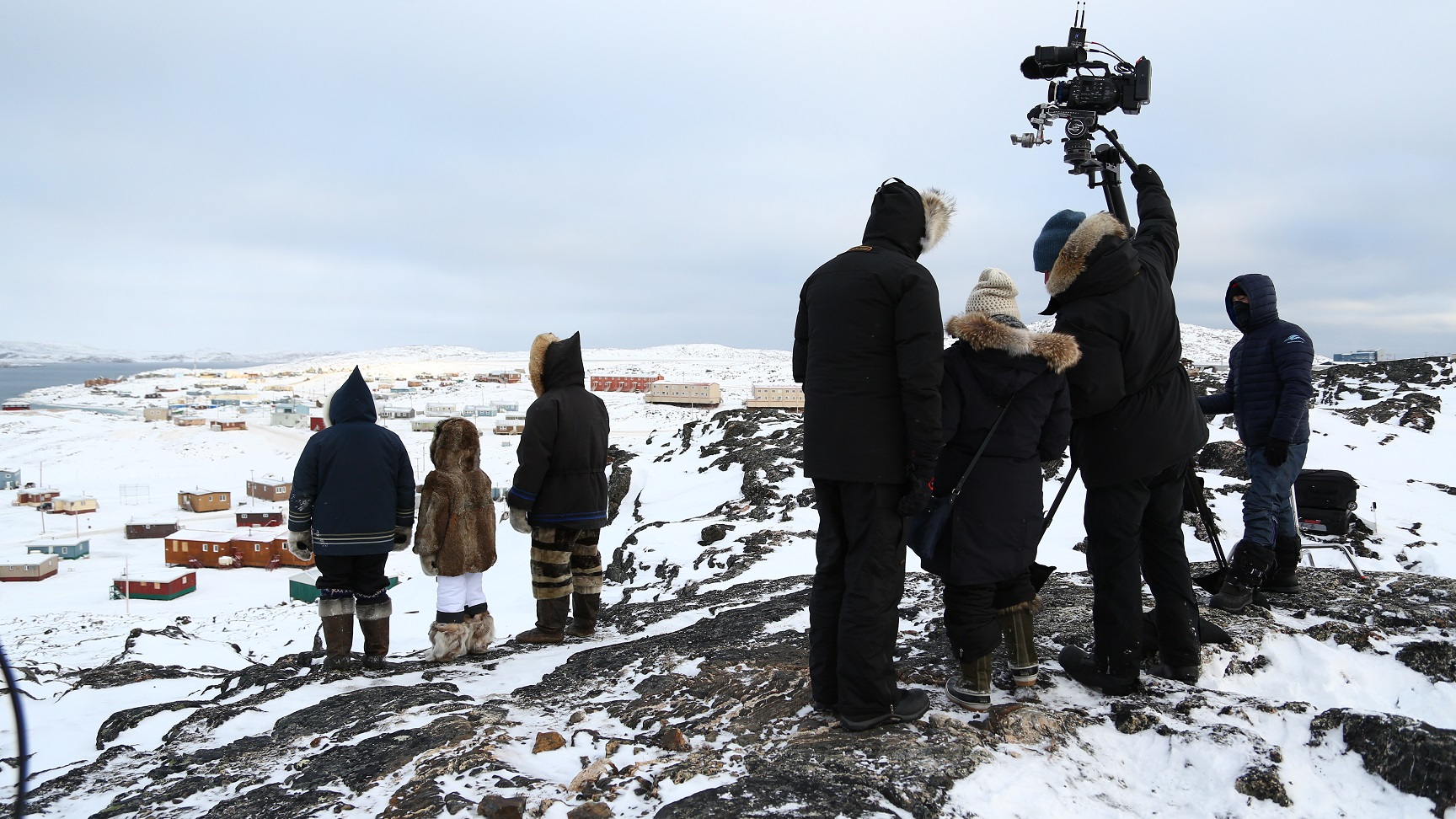
-
Article
Herschel Island
Herschel Island, 101 km 2 , lies in the Beaufort Sea off the north coast of the Yukon Territory.
"https://d2ttikhf7xbzbs.cloudfront.net/media/media/b504d03a-1419-4bf4-ab27-00b5e8cc89a0.jpg" // resources/views/front/categories/view.blade.php
https://d2ttikhf7xbzbs.cloudfront.net/media/media/b504d03a-1419-4bf4-ab27-00b5e8cc89a0.jpg
-
Article
Hillsborough River
The Hillsborough River begins near the white sand beaches of the north shore and winds 45 km through rich farm country to its mouth (Charlottetown Harbour) on the south shore of Prince Edward Island. At its mouth, the North and West rivers come together to meet the Hillsborough.
"https://development.thecanadianencyclopedia.ca/images/tce_placeholder.jpg?v=e9dca980c9bdb3aa11e832e7ea94f5d9" // resources/views/front/categories/view.blade.php
https://development.thecanadianencyclopedia.ca/images/tce_placeholder.jpg?v=e9dca980c9bdb3aa11e832e7ea94f5d9
-
Article
Holland Marsh
Holland Marsh, 2900 ha of organic (muck) soil, is located near Bradford West Gwillimbury, Ont, 50 km north of Toronto.
"https://d2ttikhf7xbzbs.cloudfront.net/media/media/01f0989f-5102-44b1-82b6-1b7a44b8ff1d.jpg" // resources/views/front/categories/view.blade.php
https://d2ttikhf7xbzbs.cloudfront.net/media/media/01f0989f-5102-44b1-82b6-1b7a44b8ff1d.jpg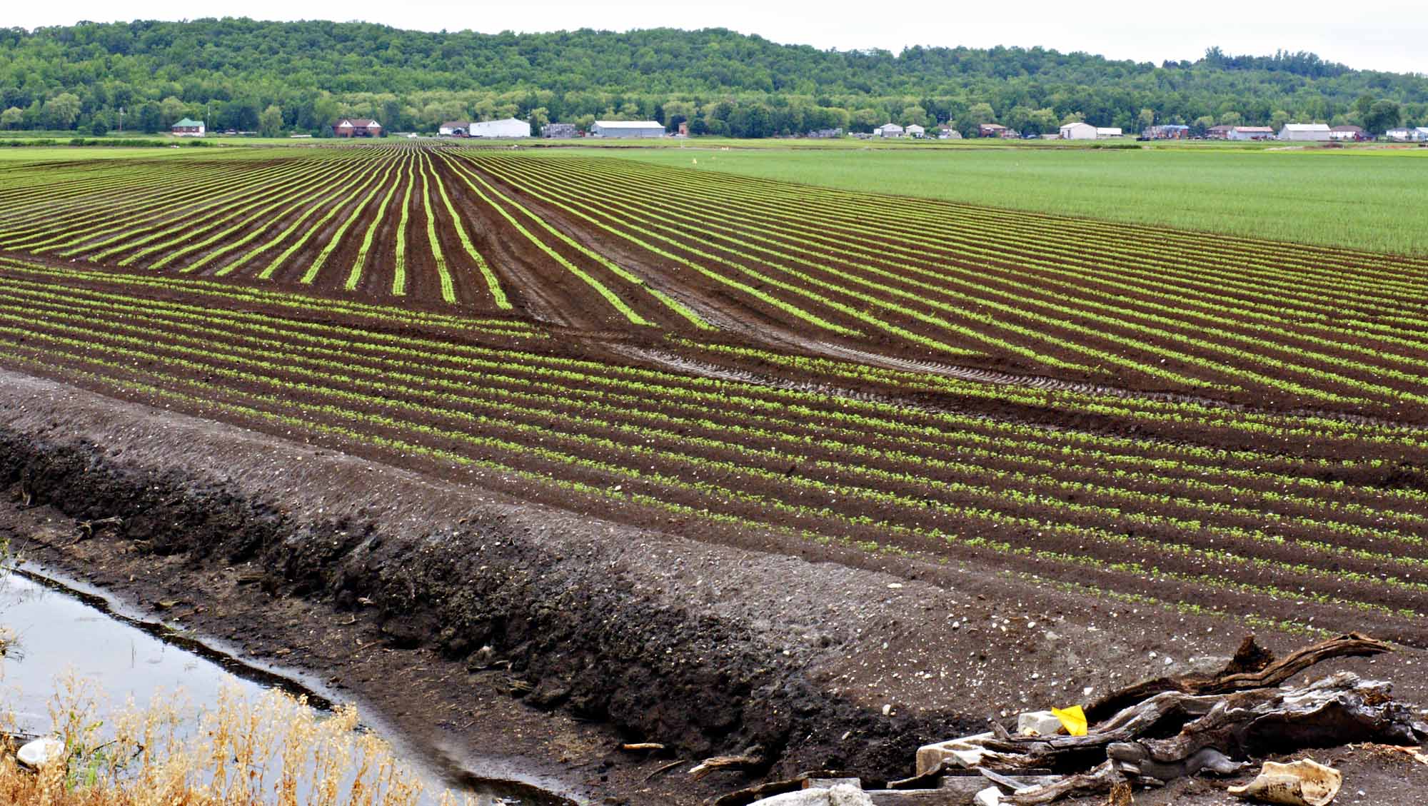
-
Article
Hoodoo Rock
Hoodoo rocks are often fantastically shaped, naturally carved rocks or earth pedestals, pillars or columns. The word hoodoo probably derives from voodoo, a West African-based religion in which magical powers can be associated with natural features. Hoodoos conjure up images of strange events.
"https://d2ttikhf7xbzbs.cloudfront.net/media/media/251b5d36-82cc-4ec1-80e8-471cfd59098a.jpg" // resources/views/front/categories/view.blade.php
https://d2ttikhf7xbzbs.cloudfront.net/media/media/251b5d36-82cc-4ec1-80e8-471cfd59098a.jpg
-
Article
Hornby Island
Hornby Island lies in the Strait of Georgia between Vancouver Island and mainland British Columbia, southeast of the island community of Courtenay . It is a wooded island with a shoreline of sandbanks and rock shelves.
"https://d2ttikhf7xbzbs.cloudfront.net/media/media/44ecf87e-919b-40ea-8039-8eefd6a41399.jpg" // resources/views/front/categories/view.blade.php
https://d2ttikhf7xbzbs.cloudfront.net/media/media/44ecf87e-919b-40ea-8039-8eefd6a41399.jpg
-
Article
Horton Plain
The vegetation is low arctic tundra in the N, dominated by dwarf shrubs and grasses, and woodland in the S, consisting of scattered, stunted spruce with a lichen carpet. The summer range and calving grounds of the large Bluenose caribou herd lie within this region.
"https://development.thecanadianencyclopedia.ca/images/tce_placeholder.jpg?v=e9dca980c9bdb3aa11e832e7ea94f5d9" // resources/views/front/categories/view.blade.php
https://development.thecanadianencyclopedia.ca/images/tce_placeholder.jpg?v=e9dca980c9bdb3aa11e832e7ea94f5d9
-
Article
Horton River
The Horton River, 618 km long, rises north of GREAT BEAR LAKE in the Northwest Territories and empties into Amundsen Gulf. Shallowly entrenched in the upper part of its course, it cuts a deep (up to 200 m) valley into the soft Cretaceous bedrock in its lower course.
"https://d2ttikhf7xbzbs.cloudfront.net/media/media/ea3f320f-29ec-47d8-a988-fda2c88fbeda.jpg" // resources/views/front/categories/view.blade.php
https://d2ttikhf7xbzbs.cloudfront.net/media/media/ea3f320f-29ec-47d8-a988-fda2c88fbeda.jpg
-
Article
Hudson Bay
It is virtually landlocked but is joined to the Arctic Ocean to the north by Foxe Channel and Fury and Hecla Strait, and to the Atlantic Ocean on the east by Hudson Strait. Baffin Island lies athwart the entrance to the bay, and Southampton, Coats and Mansel islands are lodged across the northern gap.
"https://d2ttikhf7xbzbs.cloudfront.net/media/media/dc17d99c-a66e-4177-b23e-edb98803236c.jpg" // resources/views/front/categories/view.blade.php
https://d2ttikhf7xbzbs.cloudfront.net/media/media/dc17d99c-a66e-4177-b23e-edb98803236c.jpg