Share on Facebook
 Share on X
 Share by Email
 Share on Google Classroom
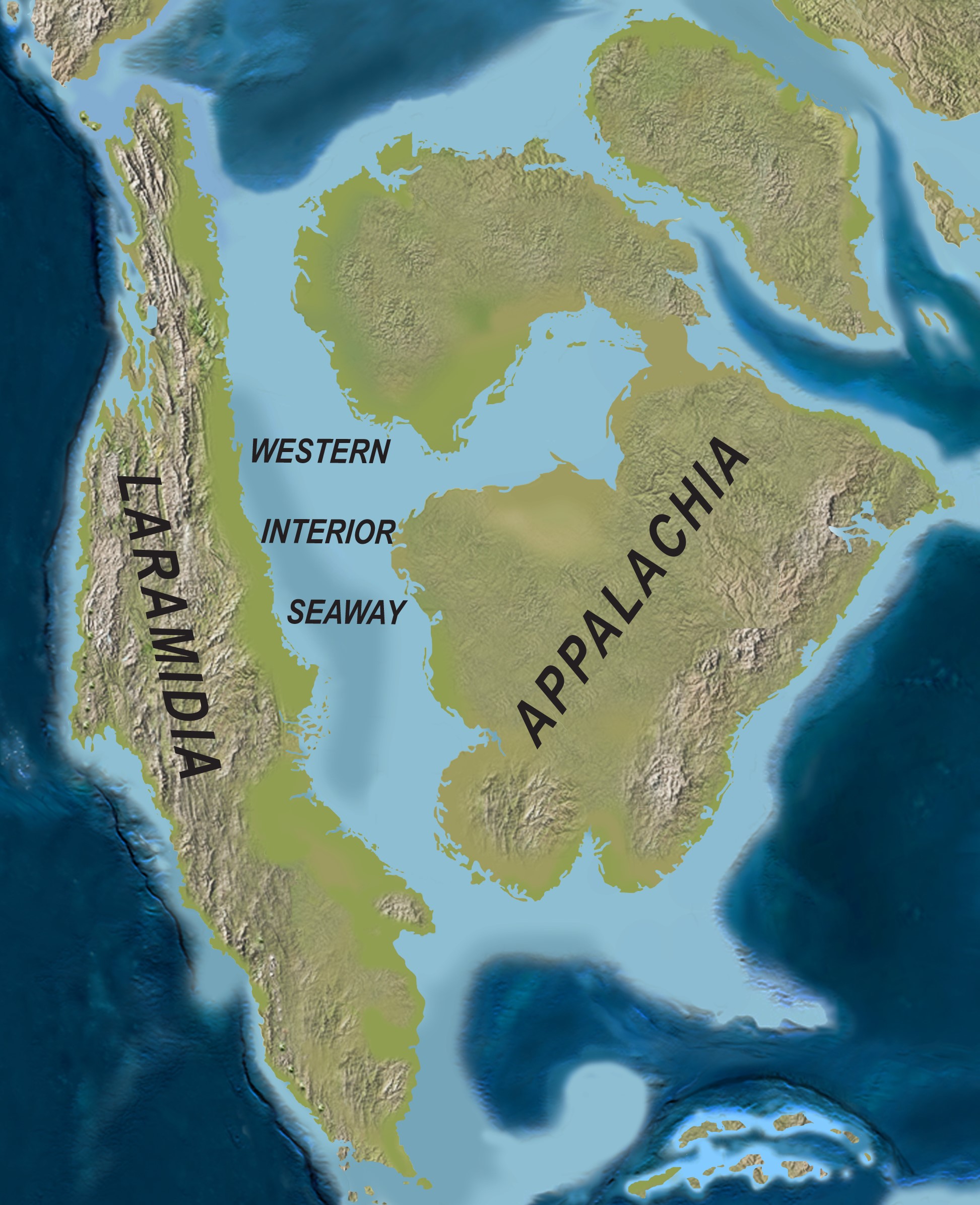
The Oak Ridges Moraine is a prominent landform in southwestern Ontario, part of the Great Lakes region's linear moraines and Ontario's Greenbelt. Situated north of Lake Ontario, the 160 km-long moraine was named for its once-abundant oak trees. As one of the region's few remaining green corridors, the moraine performs vital environmental functions, filtering drinking water and providing habitats for various species. In 2001, the Oak Ridges Moraine obtained conservation status from the provincial government of Ontario, protecting it from urban expansion.

Description
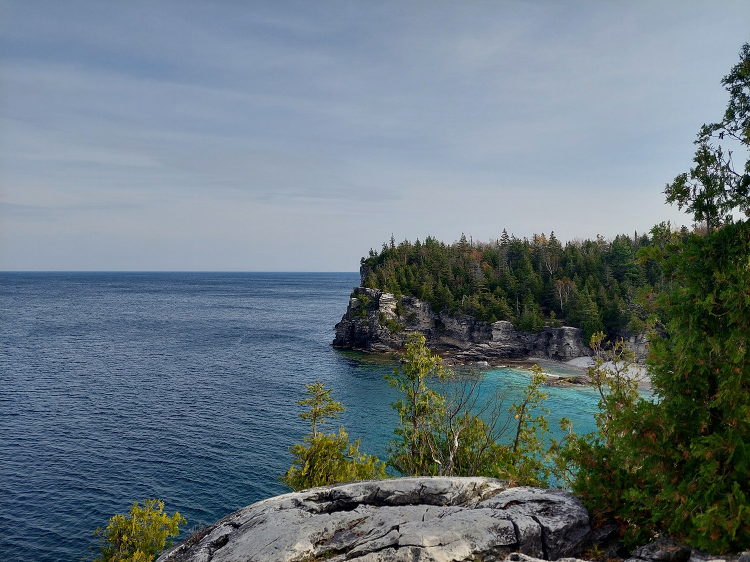
The Oak Ridges Moraine is an irregular landform with a prominent east–west ridge in southwestern Ontario. Situated parallel to and 60 km north of Lake Ontario, the moraine has a distinctive topography of knobs and kettles, where glacial push hills slope gradually from the Niagara Escarpment near Caledon to the Trent River. The moraine varies in width from 14.5 km to less than 0.5 km at Bewedley, west of Rice Lake, covering an area of 1,900 km2.
The moraine is composed of six principal wedge-shaped plateaus: Albion Hills, Mount Wolfe, Kettleby, Uxbridge, Pontypool and Rice Lake. Each formation exhibits unique characteristics and sedimentary patterns, with higher elevations reaching up to about 430 m. Its sandy composition allows groundwater to be filtered and provides a potable supply through its extensive aquifer. It also divides the watersheds draining south into Lake Ontario from those flowing north into Georgian Bay, Lake Simcoe and Trent River.
Natural History
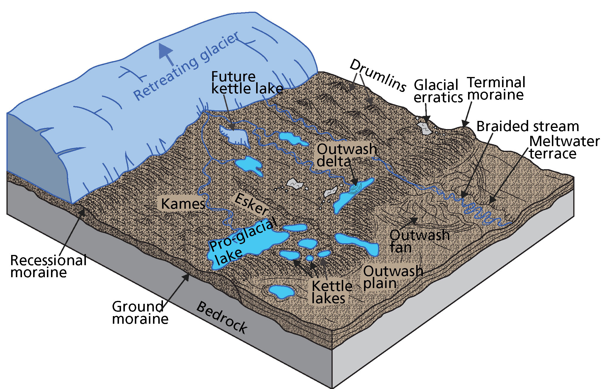
The origins of the Oak Ridges Moraine can be traced back to 13,000 years ago, during the late Wisconsin glaciation (see Geological History of Canada). Thick, glacial ice blanketed the region at the time. As the ice sheets melted and retreated, a complex ridge of sedimentary material formed underwater. Theories suggest a distinct east–west crack split the ice sheet at the western end, allowing flood channels to develop beneath the ice and deposit silt, sand and gravel. Glacial deposits eventually formed the elevated terrain of the moraine, which now divides the watersheds flowing north (e.g. Georgian Bay, Lake Simcoe) from those flowing south (e.g. Lake Ontario).
Around 9,000 years ago, as the ice sheets melted and receded northward, small tundra plants began to grow on the moraine. Over time, these plants were replaced by pine and spruce trees. Eventually, the moraine evolved into a full-grown forest dominated by oak and maple trees. This woodland provided shelter for wildlife and Indigenous peoples.
The name “Oak Ridges Moraine” is derived from the tall prairie and oak savannah ecosystem which once dominated the sections of the moraine. The village of Oak Ridges in Richmond Hill, Ontario, is similarly named.
Human Settlements
The Oak Ridges Moraine has undergone extensive human-driven changes over time. Indigenous peoples were the first inhabitants to use the natural resources of the region. In the 1300s, the Wilcox Lake site was an established Iroquoian settlement. Later, the Mississauga First Nations migrated to the region until the early 1700s. These Indigenous groups regularly burned prairies as part of their land management practices.
European influence began in the late 18th century, with United Empire Loyalists and Quakers establishing settlements. However, the sandy soils and hilly terrain hindered agricultural development. In the 19th century, the moraine's natural resources became increasingly valuable, with quarries extracting gravel and sand, and widespread deforestation occurred for farming. The Oak Ridges Moraine extends across 32 municipalities and several counties. The major economic activities in the area are agriculture, recreation and urban services for year-round and seasonal residents.

Research and Protection
The Oak Ridges Moraine was first identified and named around 1819 by John Bigsby, a British army physician, while surveying the geology of Upper Canada. His 1829 paper on the Lake Ontario basin's topography and geology described the moraine. In 1863, the Geological Survey of Canada defined the extent of the ridges between Peterborough and the Niagara Escarpment. However, the full extent of the moraine was not formally established until five decades later, when American geologist Frank Taylor wrote about the moraines of southwestern Ontario.
The sandy soils of the moraine have long faced desertification risks due to 19th-century farming practices. Calls for the moraine's protection date back to at least 1908, when Ontario's first Chief Forester, Edmund Zavitz, advocated for it in a report. Significant reforestation efforts on abandoned farmlands began soon after. In 1946, Ontario established conservation authorities to address these issues and restore the moraine. Several postwar urban plans proposed conserving the moraine area for recreation and nature protection beyond the urbanized zone. During the 1970s, various environmental groups fought to protect green spaces adjacent to the moraine as environmental issues gained greater political prominence.
In 1989, the Save the Oak Ridges Moraine (STORM) Coalition was formed by local residents concerned about the need to protect the moraine. STORM played a key role in raising awareness of the moraine at the local and provincial levels. Grassroots efforts led to planning studies and the development of a long-term strategy for moraine protection. However, the moraine became a politically contentious issue in 1999 when developers targeted Richmond Hill for large subdivisions, planning housing for over 100,000 people. Environmental groups launched a media campaign, referring to the moraine as the "rain barrel of Ontario" to heighten public awareness. This sparked widespread opposition, ultimately leading to the issue being transferred to the Ontario Municipal Board in 2000.
After a series of stakeholder and public consultation meetings, a comprehensive strategy for the Oak Ridges Moraine was made public. In 2001, the provincial government passed the Oak Ridges Moraine Protection Act, 2001 to restrict development in the area. Less than a year later, the Oak Ridges Moraine Conservation Plan (ORMCP) was established, providing guidelines for land-use and resource management to protect the moraine's ecological and hydrological features. The Oak Ridges Moraine Foundation, established in 2002 to complement the goals of the ORMCP, later joined the Greenbelt Foundation in 2020.
The Oak Ridges Moraine remains one of the last continuous green corridors in south-central Ontario, Canada's most densely populated region. According to the Oak Ridges Moraine Land Trust, this ecologically diverse area is home to 1,171 plant species, 51 mammal species and 73 fish species. Furthermore, the moraine shelters 88 provincial or national species at risk, showcasing its remarkable biodiversity. Together with the Niagara Escarpment, the Oak Ridges Moraine later became part of Ontario's Greenbelt.
In late 2022, Ontario Premier Doug Ford and his government announced plans to redesignate parts of the Oak Ridges Moraine Conservation Plan Area for new housing development. This decision was subsequently repealed a year later.