Browse "Places"
-
Article
Music at University of Regina
University of Regina. Non-denominational university growing out of Regina College, which was founded in 1911 along with the Regina Conservatory of Music (later the Conservatory of Music, University of Regina).
"https://development.thecanadianencyclopedia.ca/images/tce_placeholder.jpg?v=e9dca980c9bdb3aa11e832e7ea94f5d9" // resources/views/front/categories/view.blade.php
https://development.thecanadianencyclopedia.ca/images/tce_placeholder.jpg?v=e9dca980c9bdb3aa11e832e7ea94f5d9
-
Article
Music at University of Saskatchewan
The music program has been directed by Arthur Collingwood, dean 1931-47; J.D. Macrae, chairman 1947-51; Murray Adaskin, head 1952- 66; David L. Kaplan, head 1966-82; Dwaine Nelson, head 1982-4; Richard W.
"https://d2ttikhf7xbzbs.cloudfront.net/media/media/b77c4746-ed9c-40e2-90da-8eba5521ec77.jpg" // resources/views/front/categories/view.blade.php
https://d2ttikhf7xbzbs.cloudfront.net/media/media/b77c4746-ed9c-40e2-90da-8eba5521ec77.jpg
-
Article
Music at University of Toronto
Founded by royal charter at York (Toronto), Upper Canada, in 1827 as the Church of England (Anglican) King's College. It granted its first degree in 1844 and was secularized and renamed the University of Toronto in 1850.
"https://development.thecanadianencyclopedia.ca/images/tce_placeholder.jpg?v=e9dca980c9bdb3aa11e832e7ea94f5d9" // resources/views/front/categories/view.blade.php
https://development.thecanadianencyclopedia.ca/images/tce_placeholder.jpg?v=e9dca980c9bdb3aa11e832e7ea94f5d9
-
Article
Music at University of Trinity College
University of Trinity College. Church of England university founded in Toronto in 1851 (it received its royal charter in 1852) by the first bishop of Toronto, John Strachan, after King's College, precursor of the University of Toronto, became secular in 1850.
"https://development.thecanadianencyclopedia.ca/images/tce_placeholder.jpg?v=e9dca980c9bdb3aa11e832e7ea94f5d9" // resources/views/front/categories/view.blade.php
https://development.thecanadianencyclopedia.ca/images/tce_placeholder.jpg?v=e9dca980c9bdb3aa11e832e7ea94f5d9
-
Article
Music at University of Victoria
University of Victoria. Non-denominational university in Victoria, BC. It is the successor of Victoria College, affiliated 1903-62 first with McGill University, then with the University of British Columbia.
"https://development.thecanadianencyclopedia.ca/images/tce_placeholder.jpg?v=e9dca980c9bdb3aa11e832e7ea94f5d9" // resources/views/front/categories/view.blade.php
https://development.thecanadianencyclopedia.ca/images/tce_placeholder.jpg?v=e9dca980c9bdb3aa11e832e7ea94f5d9
-
Article
Music at University of Waterloo
University of Waterloo. Non-denominational university founded in 1957 at Waterloo, Ont, and incorporated in 1959. It came to be noted in particular for its schools of optometry and engineering.
"https://development.thecanadianencyclopedia.ca/images/tce_placeholder.jpg?v=e9dca980c9bdb3aa11e832e7ea94f5d9" // resources/views/front/categories/view.blade.php
https://development.thecanadianencyclopedia.ca/images/tce_placeholder.jpg?v=e9dca980c9bdb3aa11e832e7ea94f5d9
-
Article
Music at Western University
The Faculty of Music at Western University (known legally as the University of Western Ontario) offers a full range of undergraduate and graduate degree programs. Located in London, Ontario, it is one of the largest music schools in Canada. Music education at the university began in 1934 and evolved into an affiliated music school in 1942. The Faculty of Music was established in 1968 and was renamed the Don Wright Faculty of Music in 2002. In 2014, the faculty had more than 120 members (35 in Music Education, 63 in performance, and 32 in Research and Composition) and an enrolment of more than 600 students.
"https://development.thecanadianencyclopedia.ca/images/tce_placeholder.jpg?v=e9dca980c9bdb3aa11e832e7ea94f5d9" // resources/views/front/categories/view.blade.php
https://development.thecanadianencyclopedia.ca/images/tce_placeholder.jpg?v=e9dca980c9bdb3aa11e832e7ea94f5d9
-
Article
Music at University of Windsor
University of Windsor. Founded in 1857 at Windsor, Ont, as Assumption College (Roman Catholic). It became a university in 1953 and was granted incorporation as the non-denominational University of Windsor in 1963, affiliating at the same time with Essex College.
"https://development.thecanadianencyclopedia.ca/images/tce_placeholder.jpg?v=e9dca980c9bdb3aa11e832e7ea94f5d9" // resources/views/front/categories/view.blade.php
https://development.thecanadianencyclopedia.ca/images/tce_placeholder.jpg?v=e9dca980c9bdb3aa11e832e7ea94f5d9
-
Article
Music at Wilfrid Laurier University
Wilfrid Laurier University. Non-denominational university at Waterloo, Ont, with origins in the Evangelical Lutheran Seminary (founded 1911) and the Waterloo College of Arts (founded ca 1924 and affiliated 1925-60 with the University of Western Ontario).
"https://development.thecanadianencyclopedia.ca/images/tce_placeholder.jpg?v=e9dca980c9bdb3aa11e832e7ea94f5d9" // resources/views/front/categories/view.blade.php
https://development.thecanadianencyclopedia.ca/images/tce_placeholder.jpg?v=e9dca980c9bdb3aa11e832e7ea94f5d9
-
Article
Music at York University
York University. Non-denominational Toronto institution offering a range of part-time and full-time undergraduate and graduate degree programs and non-degree courses. It was founded in 1959 and accepted its first students in 1960. Its first campus - Glendon - opened in 1961.
"https://development.thecanadianencyclopedia.ca/images/tce_placeholder.jpg?v=e9dca980c9bdb3aa11e832e7ea94f5d9" // resources/views/front/categories/view.blade.php
https://development.thecanadianencyclopedia.ca/images/tce_placeholder.jpg?v=e9dca980c9bdb3aa11e832e7ea94f5d9
-
Article
Muskeg
Muskeg (from Cree maskek and Ojibwe mashkiig, meaning “grassy bog”) is a type of northern landscape characterized by a wet environment, vegetation and peat deposits. Chiefly used in North America, the term muskeg escapes precise scientific definition. It encompasses various types of wetlands found in the boreal zone, including bogs, fens, swamps and mires. In Canada, muskeg and other peatlands cover up to 1.2 million km2, or 12 per cent of the country’s surface.
"https://d2ttikhf7xbzbs.cloudfront.net/media/new_article_images/Muskeg/Muskeg 1.jpg" // resources/views/front/categories/view.blade.php
https://d2ttikhf7xbzbs.cloudfront.net/media/new_article_images/Muskeg/Muskeg 1.jpg
-
Article
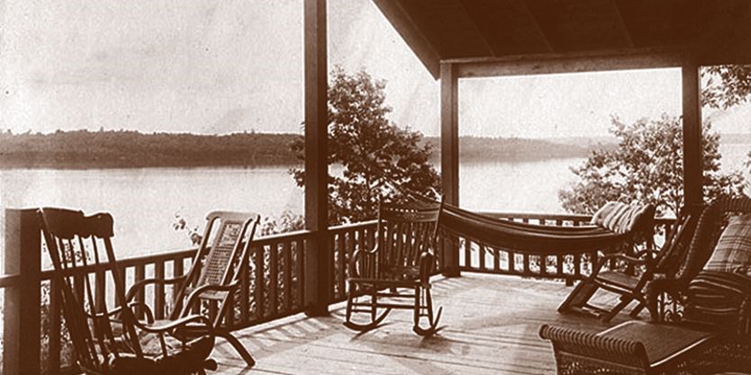
Muskoka
District Municipality of Muskoka, Ontario, incorporated in 1971, permanent population 66,674 (2021 census), 60,614 (2016 census); estimated seasonal population 85,163 (2016). Muskoka is an iconic area of Ontario’s cottage country located approximately 200 km north of Toronto. A destination for seasonal residents and tourists who have been drawn by its natural beauty since the late 1800s, the district has equally been home to generations of permanent residents.
"https://d2ttikhf7xbzbs.cloudfront.net/media/media/b38374d2-1aa9-48ab-a86b-276b8da208de.jpg" // resources/views/front/categories/view.blade.php
https://d2ttikhf7xbzbs.cloudfront.net/media/media/b38374d2-1aa9-48ab-a86b-276b8da208de.jpg
-
Article
Muttart Public Art Gallery
The Muttart Public Art Gallery, a not-for-profit institution established in 1977, is situated on the second floor of CALGARY'S Memorial Park Library occupying space that was renovated with funds provided by the Muttart Foundation.
"https://development.thecanadianencyclopedia.ca/images/tce_placeholder.jpg?v=e9dca980c9bdb3aa11e832e7ea94f5d9" // resources/views/front/categories/view.blade.php
https://development.thecanadianencyclopedia.ca/images/tce_placeholder.jpg?v=e9dca980c9bdb3aa11e832e7ea94f5d9
-
Article
Nagwichoonjik Cultural Landscape
Nagwichoonjik, meaning "river flowing through a big country," is the Gwich'in name for the Mackenzie River, the longest river in Canada and the 9th longest river in the world. The river flows through the heart of the traditional homeland of the Gwichya Gwich'in, who now largely reside in Tsiigehtchic (formerly Arctic Red River), a small community of 200 people at the confluence of the Arctic Red and Mackenzie rivers, in the northern part of the Northwest Territories. ( See also Indigenous Territory).
"https://d2ttikhf7xbzbs.cloudfront.net/media/new_article_images/Tsiigehtchic/TsiigehtchicBothRivers.jpg" // resources/views/front/categories/view.blade.php
https://d2ttikhf7xbzbs.cloudfront.net/media/new_article_images/Tsiigehtchic/TsiigehtchicBothRivers.jpg
-
Article
Nahanni Butte
Nahanni Butte, NWT, Settlement, population 102 (2011c), 115 (2006c). The settlement of Nahanni Butte is located on the north side of the SOUTH NAHANNI RIVER near its junction with the LIARD RIVER, about 125 km north of the Northwest Territories and British Columbia border.
"https://development.thecanadianencyclopedia.ca/images/tce_placeholder.jpg?v=e9dca980c9bdb3aa11e832e7ea94f5d9" // resources/views/front/categories/view.blade.php
https://development.thecanadianencyclopedia.ca/images/tce_placeholder.jpg?v=e9dca980c9bdb3aa11e832e7ea94f5d9
