Browse "Places"
-
Article
Gaspé
It is one of the oldest settlements in North America: on 24 July 1534, Jacques Cartier took possession of Canada on behalf of the king of France and placed a cross at this location, which very soon became a fishing port and supply centre for New France.
"https://d2ttikhf7xbzbs.cloudfront.net/media/media/bbc9e3a7-9a38-4b2c-848d-b51eba03f1fd.jpg" // resources/views/front/categories/view.blade.php
https://d2ttikhf7xbzbs.cloudfront.net/media/media/bbc9e3a7-9a38-4b2c-848d-b51eba03f1fd.jpg
-
Article
Gastown
Gastown is a retail and commercial district in Vancouver, British Columbia. It is bounded by Cordova Street and the waterfront between Richards Street and Main Street. The original Gastown settlement formed the nucleus for the City of Vancouver and is now a National Historic Site. Today, Gastown is a popular tourist destination and home to restaurants, gift shops, boutiques, galleries, nightclubs and bars. It is also part of the Downtown Eastside, Vancouver’s lowest-income neighbourhood, and the location of single resident occupancy hotels, social housing and social services.
"https://d2ttikhf7xbzbs.cloudfront.net/media/media/de041c94-dd8a-4af8-8def-f3bc4cc26777.jpg" // resources/views/front/categories/view.blade.php
https://d2ttikhf7xbzbs.cloudfront.net/media/media/de041c94-dd8a-4af8-8def-f3bc4cc26777.jpg
-
Article
Gatineau
Gatineau, Quebec, incorporated as a city in 2002, population 291,041 (2021 census), 276,245 (2016 census). Gatineau was formed in 2002 following the amalgamation of the municipalities of Aylmer, Buckingham, Gatineau, Hull and Masson-Angers. The city is part of Canada’s National Capital Region. Gatineau’s city council consists of a mayor and 18 councillors elected by district.
"https://d2ttikhf7xbzbs.cloudfront.net/media/media/74216004-eb52-47e1-b498-61964bbbb37a.jpg" // resources/views/front/categories/view.blade.php
https://d2ttikhf7xbzbs.cloudfront.net/media/media/74216004-eb52-47e1-b498-61964bbbb37a.jpg
-
Macleans
Gehry's Bilbao Museum Sensation (Nov97 Updates)
In architectural circles, they are calling it a masterpiece, the crowning achievement of Canadian-born, California-based Gehry's long career.This article was originally published in Maclean's Magazine on November 3, 1997
"https://d2ttikhf7xbzbs.cloudfront.net/media/media/ce03a686-a5ff-4235-ac06-c33d8f41618d.jpg" // resources/views/front/categories/view.blade.php
https://d2ttikhf7xbzbs.cloudfront.net/media/media/ce03a686-a5ff-4235-ac06-c33d8f41618d.jpg
-
Collection
Geography
Geography is the study of places, Earth’s physical features and environmental phenomena. Geographers also examine human populations and their impact on the natural world. This collection from The Canadian Encyclopedia covers a wide range of topics in both physical and human geography. These topics include geographic regions, sustainable development, and Indigenous populations.
"https://d2ttikhf7xbzbs.cloudfront.net/media/quiz_images/Geography-2.jpg" // resources/views/front/categories/view.blade.php
https://d2ttikhf7xbzbs.cloudfront.net/media/quiz_images/Geography-2.jpg
-
Article
Geography of British Columbia
British Columbia is divided by two of Canada’s seven physiographic regions. These regions are the Cordillera and the Interior Plains. The vast majority of the province is in the Cordillera region, while the northeast corner is part of the Interior Plains. Within the Cordillera region there are many mountain ranges, including the Rocky Mountains and the Coast Mountains. British Columbia’s wet, coastal climate is also home to some of the tallest coniferous trees in Canada, such as the Douglas fir.
"https://d2ttikhf7xbzbs.cloudfront.net/media/new_article_images/GeographyOfBC/CoastMountains.jpg" // resources/views/front/categories/view.blade.php
https://d2ttikhf7xbzbs.cloudfront.net/media/new_article_images/GeographyOfBC/CoastMountains.jpg
-
Article
Geography of Manitoba
Manitoba is divided by three of Canada’s seven physiographic regions. These three regions are the Hudson Bay Lowland, the Canadian Shield and the Interior Plains. Most of Manitoba’s population is concentrated in the southeastern corner of the province, in the Interior Plains physiographic region. This region is also where most of Manitoba’s arable land is located. By comparison, the Hudson Bay Lowland and the Canadian Shield are generally not suitable for agriculture. Churchill, Manitoba’s only saltwater port, is located in the Hudson Bay Lowland. Hydroelectric power, freshwater fishing, metal mines and some forestry are located in the Canadian Shield region.
"https://d2ttikhf7xbzbs.cloudfront.net/media/media/b3b5fc69-617b-4832-a4f5-34beb6238657.jpg" // resources/views/front/categories/view.blade.php
https://d2ttikhf7xbzbs.cloudfront.net/media/media/b3b5fc69-617b-4832-a4f5-34beb6238657.jpg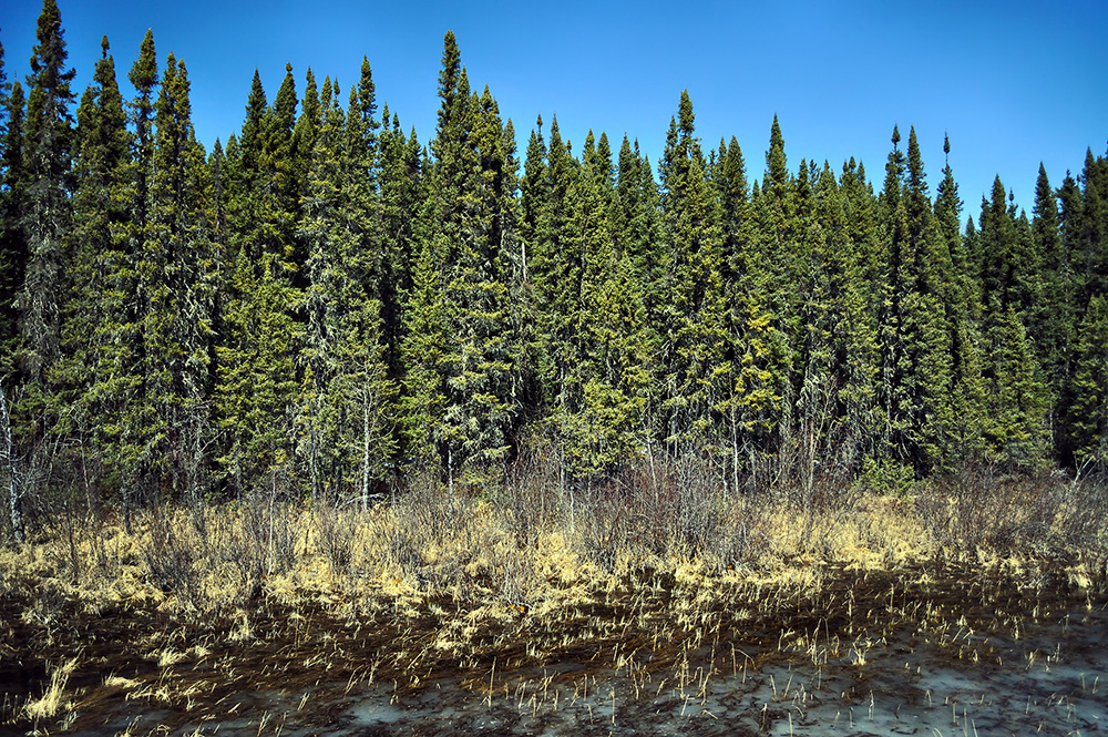
-
Article
Geography of New Brunswick
New Brunswick is part of the Appalachian region, one of Canada’s seven physiographic regions. The province’s principal geographic divisions are the watershed of the Bay of Fundy, centering on the Saint John River valley, and the north and east shores. The residents of the north and east shores live in coastal fishing villages and interior lumbering settlements along rivers. They are separated physically from the valley communities by uplands and belts of forest. They are also separated culturally by their predominantly French language and Catholic religion.
"https://d2ttikhf7xbzbs.cloudfront.net/media/media/06045521-0423-40e4-bb35-b6789d7556cf.jpg" // resources/views/front/categories/view.blade.php
https://d2ttikhf7xbzbs.cloudfront.net/media/media/06045521-0423-40e4-bb35-b6789d7556cf.jpg
-
Article
Geography of Newfoundland and Labrador
Newfoundland and Labrador is divided by three of Canada’s seven physiographic regions. These three regions are the Canadian Shield in Labrador, and the Appalachian and Eastern St. Lawrence Lowlands on the island of Newfoundland. Labrador’s northern coastal region is mountainous, deeply fjorded, and grows only ground-level, subarctic vegetation. Its southern coast has a rugged, barren foreshore and a forested hinterland. The interior of Labrador is a well-forested, dissected plateau. Most of Labrador’s most-populous towns, including Happy-Valley Goose Bay and Labrador City, are located in its interior. On the island of Newfoundland the west coast is dominated by the table-topped Long Range Mountains. The northeast coast, with its numerous bays, islands and headlands, fronts on the Atlantic Ocean from the Great Northern Peninsula to the Avalon Peninsula. Newfoundland’s southern coast has the deeply embayed characteristics of a submerged shoreline. The inland areas of the island are generally hilly and rugged. Shallow bogs and heath vegetation covers much of the land. Most of Newfoundland’s towns and cities are located in the bays and coves of the island’s west and northeast coasts.
"https://d2ttikhf7xbzbs.cloudfront.net/media/new_article_images/GeographyofNFLD/ChurchillFalls.jpg" // resources/views/front/categories/view.blade.php
https://d2ttikhf7xbzbs.cloudfront.net/media/new_article_images/GeographyofNFLD/ChurchillFalls.jpg
-
Article
Geography of Nova Scotia
Nova Scotia is part of the Appalachian region, one of Canada seven physiographic regions. The province is primarily a peninsula extending from the country’s mainland. At its northeastern end is Cape Breton Island. Surrounded by the Atlantic Ocean, Nova Scotia is separated from Prince Edward Island by the Northumberland Strait and from New Brunswick by the Bay of Fundy.
"https://d2ttikhf7xbzbs.cloudfront.net/media/media/276c48ba-ecfb-4c4a-aec6-e7bba279abf9.jpg" // resources/views/front/categories/view.blade.php
https://d2ttikhf7xbzbs.cloudfront.net/media/media/276c48ba-ecfb-4c4a-aec6-e7bba279abf9.jpg
-
Article
Geography of Nunavut
Nunavut covers 1,936,113 km2 of land and 157,077 km2 of water in Northern Canada, representing 21 per cent of the country’s total area. The territory includes part of the mainland, most of the Arctic Archipelago, and all of the islands in Hudson Bay, James Bay and Ungava Bay. Nunavut is divided by three of Canada’s seven physiographic regions. These regions are the Hudson Bay Lowlands, the Canadian Shield and the Canadian Arctic.
"https://d2ttikhf7xbzbs.cloudfront.net/media/media/49bea33f-0f3c-4b4c-b687-c347c4e03047.jpg" // resources/views/front/categories/view.blade.php
https://d2ttikhf7xbzbs.cloudfront.net/media/media/49bea33f-0f3c-4b4c-b687-c347c4e03047.jpg
-
Article
Geography of Ontario
Ontario is divided by three of Canada’s seven physiographic regions. These three regions are the Hudson Bay Lowlands, the Canadian Shield and the St. Lawrence Lowlands. Agriculture, as well as most of the population, is concentrated in the south. Despite the tendency to divide the province into three regions, there are distinct areas within these broad classifications. Geology, climate, soil and vegetation combine to create these distinct areas.
"https://d2ttikhf7xbzbs.cloudfront.net/media/media/d843f78b-9289-43dc-8791-10b06a322b23.jpg" // resources/views/front/categories/view.blade.php
https://d2ttikhf7xbzbs.cloudfront.net/media/media/d843f78b-9289-43dc-8791-10b06a322b23.jpg
-
Article
Geography of Prince Edward Island
Prince Edward Island is part of the Appalachian region, one of Canada’s seven physiographic regions. The island extends for 224 km, with a width ranging from 4 to 60 km. It is known for its reddish-brown soil, so-coloured due to high concentrations of iron oxides.
"https://d2ttikhf7xbzbs.cloudfront.net/media/new_article_images/GeographyofPEI/RedSoil.jpg" // resources/views/front/categories/view.blade.php
https://d2ttikhf7xbzbs.cloudfront.net/media/new_article_images/GeographyofPEI/RedSoil.jpg
-
Article
Geography of Quebec
The province of Quebec is composed of three of Canada’s seven physiographic regions. These regions are the St. Lawrence Lowlands, the Canadian Shield and the Appalachian region. The St. Lawrence Lowlands is the most fertile and developed region. The majority of the population of Quebec lives here, mainly between Montreal and Quebec City. The Canadian Shield covers most of Quebec from approximately 80 km north of the St. Lawrence River valley up to the Ungava region. It is a vast region composed of thousands of lakes and thousands of square kilometres of forested area. On the south bank of the St. Lawrence River, between the Richelieu River and the Gaspé Peninsula, is the Quebec part of the Appalachian mountain chain which extends from Gaspé south to Alabama.
"https://d2ttikhf7xbzbs.cloudfront.net/media/media/4ebdf498-3fb2-49b3-8f2d-8dc8efc3a7a0.jpg" // resources/views/front/categories/view.blade.php
https://d2ttikhf7xbzbs.cloudfront.net/media/media/4ebdf498-3fb2-49b3-8f2d-8dc8efc3a7a0.jpg
-
Article
Geography of Saskatchewan
Saskatchewan is divided by two of Canada’s seven physiographic regions. These two regions are the Interior Plains and the Canadian Shield. The Canadian Shield is characterized by rugged rock exposures and many lakes. It also includes a sandy region south of Lake Athabasca. South of the Canadian Shield is the area commonly called the “grain belt.” It is characterized by level or gently rolling plains and fertile soils. Saskatchewan is known as one of the world’s great wheat producers. On the western boundary and across the southwest corner is another plains region of generally higher altitudes. Its rolling and hilly terrain is distinct from that of the grain belt. The extreme southwest the province shares the Cypress Hills with Alberta. The Cypress Hills are the highest point of land in Canada between the Rocky Mountains and Labrador.
"https://d2ttikhf7xbzbs.cloudfront.net/media/new_article_images/GeographyofSaskatchewan/5459781967_6d2399bcb6_c.jpg" // resources/views/front/categories/view.blade.php
https://d2ttikhf7xbzbs.cloudfront.net/media/new_article_images/GeographyofSaskatchewan/5459781967_6d2399bcb6_c.jpg