Browse "Places"
-
Article
History of Acadia
Acadia’s history as a French-speaking colony stretches as far back as the early 17th century. The French settlers who colonized the land and coexisted alongside Indigenous peoples became called Acadians. Acadia was also the target of numerous wars between the French and the English. Ultimately, the colony fell under British rule. Many Acadians were subsequently deported away from Acadia. Over time, as a British colony and then as part of Canada, Acadians increasingly became a linguistic minority. Nonetheless, Acadians have strived to protect their language and identity throughout time.
"https://d2ttikhf7xbzbs.cloudfront.net/media/media/66c056b0-bee3-47a2-9680-5d5a50b5e7eb.jpg" // resources/views/front/categories/view.blade.php
https://d2ttikhf7xbzbs.cloudfront.net/media/media/66c056b0-bee3-47a2-9680-5d5a50b5e7eb.jpg
-
Article
HMCS Conestoga
HMCS Conestoga was a basic training establishment for the Women’s Royal Canadian Naval Service (WRCNS) during the Second World War. Located in Galt, Ontario, it operated from 1942 to 1945. Of nearly 6,800 women who served in the WRCNS, most trained at Conestoga.
"https://d2ttikhf7xbzbs.cloudfront.net/media/new_article_images/IsabelMacneill/WRCNS at Conestoga.jpg" // resources/views/front/categories/view.blade.php
https://d2ttikhf7xbzbs.cloudfront.net/media/new_article_images/IsabelMacneill/WRCNS at Conestoga.jpg
-
Article
Hochelaga
The term Hochelaga historically referred to an Indigenous village the French explorer Jacques Cartier (1491-1557) visited on Sunday, 3 October 1535, during his second voyage in what is now Quebec (1535-1536). Hochelaga is an Iroquoian term which is either a variation of the word osekare, meaning “beaver path,” or of the word osheaga, which translates as “big rapids.” Today, Hochelaga refers to islands at the confluence of the St. Lawrence and the Ottawa rivers, as well as various electoral and city districts.
"https://d2ttikhf7xbzbs.cloudfront.net/media/media/dd48df83-e33a-4d14-9707-34c0c6322d48.jpg" // resources/views/front/categories/view.blade.php
https://d2ttikhf7xbzbs.cloudfront.net/media/media/dd48df83-e33a-4d14-9707-34c0c6322d48.jpg
-
Article
Hochelaga Archipelago
The Hochelaga Archipelago, also known as the Montreal Islands, is a cluster of islands at the confluence of the Ottawa and St. Lawrence rivers in southwestern Quebec. It is estimated that the archipelago comprises about 300 islands and islets, of which the Island of Montreal is the largest. Like the Island of Montreal, the other three largest islands — Île Jésus (most of the City of Laval), Île Bizard and Île Perrot — are inhabited, while most of the smallest ones are not. Several of the islands that comprise the archipelago are protected by the Nature Conservancy of Canada. Though not originally part of the island chain, Île-Notre-Dame is a man-made island within the archipelago, and today is home to Montreal’s Parc Jean-Drapeau.
"https://development.thecanadianencyclopedia.ca/images/tce_placeholder.jpg?v=e9dca980c9bdb3aa11e832e7ea94f5d9" // resources/views/front/categories/view.blade.php
https://development.thecanadianencyclopedia.ca/images/tce_placeholder.jpg?v=e9dca980c9bdb3aa11e832e7ea94f5d9
-
Article
Hogan's Alley
Hogan’s Alley was a Vancouver, BC, neighbourhood that was home to multiple immigrant communities but was known largely for its African-Canadian population. The name “Hogan’s Alley” was not official, but was the popular term for a T-shaped intersection, including Park Lane, and the nearby residences and businesses at the southwestern edge of Strathcona. Beginning in 1967, the city of Vancouver began leveling the western half of Hogan’s Alley in order to construct freeway, spelling the end the neighbourhood.
"https://d2ttikhf7xbzbs.cloudfront.net/media/media/fec9b3fe-77d3-4cbd-a11d-96e76e7cf7b8.jpg" // resources/views/front/categories/view.blade.php
https://d2ttikhf7xbzbs.cloudfront.net/media/media/fec9b3fe-77d3-4cbd-a11d-96e76e7cf7b8.jpg
-
Article
Holland Marsh
Holland Marsh, 2900 ha of organic (muck) soil, is located near Bradford West Gwillimbury, Ont, 50 km north of Toronto.
"https://d2ttikhf7xbzbs.cloudfront.net/media/media/01f0989f-5102-44b1-82b6-1b7a44b8ff1d.jpg" // resources/views/front/categories/view.blade.php
https://d2ttikhf7xbzbs.cloudfront.net/media/media/01f0989f-5102-44b1-82b6-1b7a44b8ff1d.jpg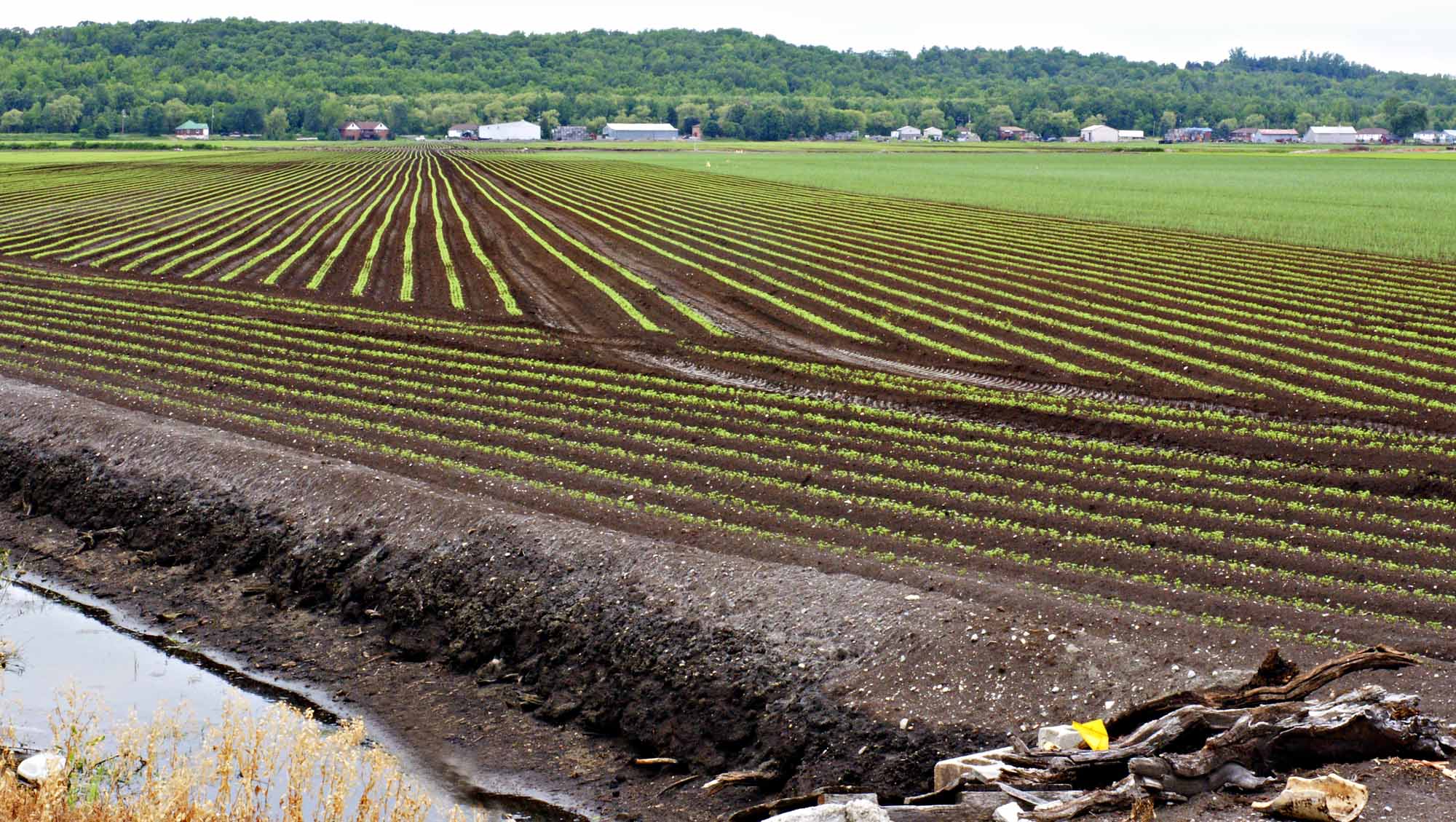
-
Article
Holyrood
Holyrood, NL, incorporated as a town in 1969, population 1995 (2011c), 2005 (2006c). The Town of Holyrood is located at the head of Conception Bay on the Avalon Peninsula about 50 km west of St John's.
"https://development.thecanadianencyclopedia.ca/images/tce_placeholder.jpg?v=e9dca980c9bdb3aa11e832e7ea94f5d9" // resources/views/front/categories/view.blade.php
https://development.thecanadianencyclopedia.ca/images/tce_placeholder.jpg?v=e9dca980c9bdb3aa11e832e7ea94f5d9
-
Article
Hoodoo Rock
Hoodoo rocks are often fantastically shaped, naturally carved rocks or earth pedestals, pillars or columns. The word hoodoo probably derives from voodoo, a West African-based religion in which magical powers can be associated with natural features. Hoodoos conjure up images of strange events.
"https://d2ttikhf7xbzbs.cloudfront.net/media/media/251b5d36-82cc-4ec1-80e8-471cfd59098a.jpg" // resources/views/front/categories/view.blade.php
https://d2ttikhf7xbzbs.cloudfront.net/media/media/251b5d36-82cc-4ec1-80e8-471cfd59098a.jpg
-
Article
Hope
Hope, BC, incorporated as a district municipality in 1992, population 5969 (2011c), 6185 (2006c). The District of Hope is located on the Trans-Canada Highway, 150 km east of VANCOUVER where it sits on the east bank of the FRASER RIVER, surrounded on three sides by mountains.
"https://development.thecanadianencyclopedia.ca/images/tce_placeholder.jpg?v=e9dca980c9bdb3aa11e832e7ea94f5d9" // resources/views/front/categories/view.blade.php
https://development.thecanadianencyclopedia.ca/images/tce_placeholder.jpg?v=e9dca980c9bdb3aa11e832e7ea94f5d9
-
Article
Hornby Island
Hornby Island lies in the Strait of Georgia between Vancouver Island and mainland British Columbia, southeast of the island community of Courtenay . It is a wooded island with a shoreline of sandbanks and rock shelves.
"https://d2ttikhf7xbzbs.cloudfront.net/media/media/44ecf87e-919b-40ea-8039-8eefd6a41399.jpg" // resources/views/front/categories/view.blade.php
https://d2ttikhf7xbzbs.cloudfront.net/media/media/44ecf87e-919b-40ea-8039-8eefd6a41399.jpg
-
Article
Horton Plain
The vegetation is low arctic tundra in the N, dominated by dwarf shrubs and grasses, and woodland in the S, consisting of scattered, stunted spruce with a lichen carpet. The summer range and calving grounds of the large Bluenose caribou herd lie within this region.
"https://development.thecanadianencyclopedia.ca/images/tce_placeholder.jpg?v=e9dca980c9bdb3aa11e832e7ea94f5d9" // resources/views/front/categories/view.blade.php
https://development.thecanadianencyclopedia.ca/images/tce_placeholder.jpg?v=e9dca980c9bdb3aa11e832e7ea94f5d9
-
Article
Horton River
The Horton River, 618 km long, rises north of GREAT BEAR LAKE in the Northwest Territories and empties into Amundsen Gulf. Shallowly entrenched in the upper part of its course, it cuts a deep (up to 200 m) valley into the soft Cretaceous bedrock in its lower course.
"https://d2ttikhf7xbzbs.cloudfront.net/media/media/ea3f320f-29ec-47d8-a988-fda2c88fbeda.jpg" // resources/views/front/categories/view.blade.php
https://d2ttikhf7xbzbs.cloudfront.net/media/media/ea3f320f-29ec-47d8-a988-fda2c88fbeda.jpg
-
Article
Hotel
Willard's Hotel (1795) and Cook's Tavern (1822), both in Williamsburg Township, Ont, and now at UPPER CANADA VILLAGE, were stopping places for commercial travellers and immigrants in coaches along the King's Highway and on bateaux on the St Lawrence River.
"https://d2ttikhf7xbzbs.cloudfront.net/media/media/c986ab61-ffd7-4ee5-9c7a-73297719034a.jpg" // resources/views/front/categories/view.blade.php
https://d2ttikhf7xbzbs.cloudfront.net/media/media/c986ab61-ffd7-4ee5-9c7a-73297719034a.jpg
-
Article
House of Commons
The House of Commons is the centre of political power in Canada. The prime minister and his or her Cabinet receive their authority through the confidence of the House. It is an institution steeped in tradition and history. In recent years, Question Period has been televised, opening the political process to Canadians. Much of what the public sees is the rancorous debate and partisan bickering among political parties but the House of Commons is also where most government legislation is introduced, and where Members of Parliament meet to debate policy, vote on key legislation, and hold the government to account.
"https://d2ttikhf7xbzbs.cloudfront.net/media/media/39b78f3a-b1bb-47ec-aa0b-d4f5de005157.jpg" // resources/views/front/categories/view.blade.php
https://d2ttikhf7xbzbs.cloudfront.net/media/media/39b78f3a-b1bb-47ec-aa0b-d4f5de005157.jpg
-
Article
Houston
Houston, BC, incorporated as a district municipality in 1969, population 3147 (2011c), 3163 (2006c). The District of Houston is situated midway between PRINCE GEORGE and PRINCE RUPERT on the Yellowhead Highway and at the confluence of the Bulkley and Morice rivers.
"https://development.thecanadianencyclopedia.ca/images/tce_placeholder.jpg?v=e9dca980c9bdb3aa11e832e7ea94f5d9" // resources/views/front/categories/view.blade.php
https://development.thecanadianencyclopedia.ca/images/tce_placeholder.jpg?v=e9dca980c9bdb3aa11e832e7ea94f5d9